Bageshwar district about 1,120 m
Baijnath Temple: Timings, Distance and Nearest Railway Station
Baijnath Temple is a temple group in Garur, in Bageshwar district, at about 1,120 m. It is 434 km by road from Delhi and 149 km from Kathgodam railway station, the nearest railway station. A 12th-century Shiva temple complex in the Garur valley, on the Gomti, at the old Katyuri capital; protected by the ASI and part of the Shiva Heritage Circuit.
Baijnath Temple at a glance
- Festival
- Pilgrims come at Shivratri and Makar Sankranti; the next are on 6 March 2027 and 15 January 2027.
- Height
- About 1,120 m
- From Delhi
- 434 km by road
- Railway station
- Kathgodam, 149 km
- Airport
- Pithoragarh airport (Naini Saini), 141 km

Visiting Baijnath Temple
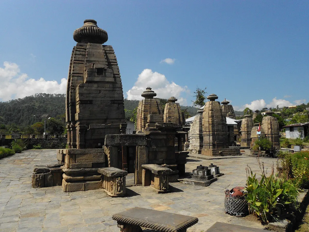
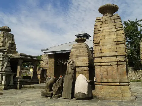
- One main Shiva temple and 17 smaller ones, among them Brahma, Ganesha, Parvati, Chandika, Kuber and Surya; Parvati's image in the main temple is of black stone. (uttarakhandtourism.gov.in, not shown)
- Baijnath was the old Kartikeyapura, where the Katyuris moved their capital from Joshimath around the 8th century; the main temple's spire is lost and its roof is a later tin shed. (asidehraduncircle.in, not shown)
Timings
- Opening hours and any ticket are not published by the ASI. (asidehraduncircle.in, not shown)
The festival
- Pilgrims come at Shivratri and Makar Sankranti; the next are on 6 March 2027 and 15 January 2027. (en.wikipedia.org, accessed 2026-10-22)
Before you go
- Nearby: Kot Bhramari Devi temple about 3 km away, Rudradhari waterfall and cave (a 2 km walk) and Pinnath temple (a 5 km walk). (uttarakhandtourism.gov.in, not shown)
Lately
- Under the Mandir Mala Mission, ₹13 crore was set aside to redevelop the complex; still a proposal. (indianmasterminds.com, 2025-08-06)
How to reach Baijnath Temple
By road, measured on OpenStreetMap.
| From | km |
|---|---|
| Delhi | 434 |
| Kathgodam railway station | 149 |
| Tanakpur railway station | 266 |
| Pantnagar airport | 187 |
| Pithoragarh airport (Naini Saini) | 141 |
- 26 km from Bageshwar and 17 to 19 km from Kausani; Kathgodam station about 180 km and Pantnagar airport about 206 km. (uttarakhandtourism.gov.in, not shown)
The weather near Baijnath Temple now
At Kausani, 7 km away, at about 1,720 m; the temple is about 600 m lower, so a little warmer.
Kausaniabout 1,720 m
12°CClear
Now, 19:03 IST · wind 4 km/h
- Mostly clear13° 9°Dry
- Mostly clear20° 9°Dry
- Mostly clear20° 8°Dry
- Partly cloudy21° 8°Dry
- Clear20° 7°Dry
- Clear20° 6°Dry
- Clear21° 7°Dry
Forecast for about 1,720 m, updated . Data from MET Norway (CC BY 4.0); the daily figures are worked out by us.
Kausani weather: the next 24 hours, 10 days and every month.
The snow peaks from Baijnath Temple
From the temple's point the elevation model finds a clear line to these summits; mornings from October to March are clearest.
- Trishul, 7,120 m: 47.7 km to the north; about 900 m of it over the nearer hills.
- Nanda Kot, 6,861 m: 60.3 km to the north-east; just the summit.
- Maiktoli, 6,803 m: 47.6 km to the north-east; just the summit.
- Nanda Ghunti, 6,309 m: 50.1 km to the north; just the summit.
Questions about Baijnath Temple
Opening hours and any ticket are not published by the ASI. (Source: asidehraduncircle.in, not shown.) Times change on festival days; ask locally or on WhatsApp before a long drive.
434 km by road, measured on OpenStreetMap; by train, Kathgodam railway station is 149 km from the temple by road, and Pithoragarh airport (Naini Saini) 141 km.
Pilgrims come at Shivratri and Makar Sankranti; the next are on 6 March 2027 and 15 January 2027.
On the elevation model, the temple's point has a clear line to Trishul (7,120 m, 47.7 km north), Nanda Kot (6,861 m, 60.3 km north-east), Maiktoli (6,803 m, 47.6 km north-east), Nanda Ghunti (6,309 m, 50.1 km north). Mornings from October to March are clearest.
How we made this page
Each fact about the temple names its source, checked 2026-10-21. The point is from OpenStreetMap way/484326259; the height and the peaks in view are worked out by us on the Copernicus DEM GLO-90; road distances come from OpenStreetMap through the OSRM router. If a timing or rule has changed, tell us on WhatsApp.
About Adi Kailash Explore
Adi Kailash Explore (adikailash.io) is a tour operator based in Pithoragarh, Uttarakhand, that specialises in one route: Adi Kailash and Om Parvat, the Darma valley and Munsiyari. It runs departures from Delhi, Haldwani and Pithoragarh, and its team files the Inner Line Permit for every Adi Kailash traveller at SDM Dharchula. It is recognised by Uttarakhand Tourism, certified by MSME, Govt. of India (UDYAM-UK-09-0012927) and verified on the NIDHI Portal, and was founded by Vinay Verma. Why travel with us
