Panchachuli Peaks: Names, Heights and Where to See Them
Panchachuli is a group of five snow peaks at the eastern end of the Kumaon Himalaya, standing over the Darma valley on one side and Munsiyari on the other. The name is told as the five hearths where the Pandavas cooked their last meal. Panchachuli II is the tallest at 6,904 m.
Panchachuli in numbers
- Peaks
- Five, Panchachuli I to V
- Tallest
- Panchachuli II, 6,904 m (about 22,650 ft)
- Heights
- 6,312 m to 6,904 m
- Where
- Pithoragarh district, Uttarakhand, between the Darma and Gori valleys
- First climbed
- Panchachuli I, 1972
- Seen from
- Munsiyari, Khaliya Top, Dantu and Dugtu, Chaukori
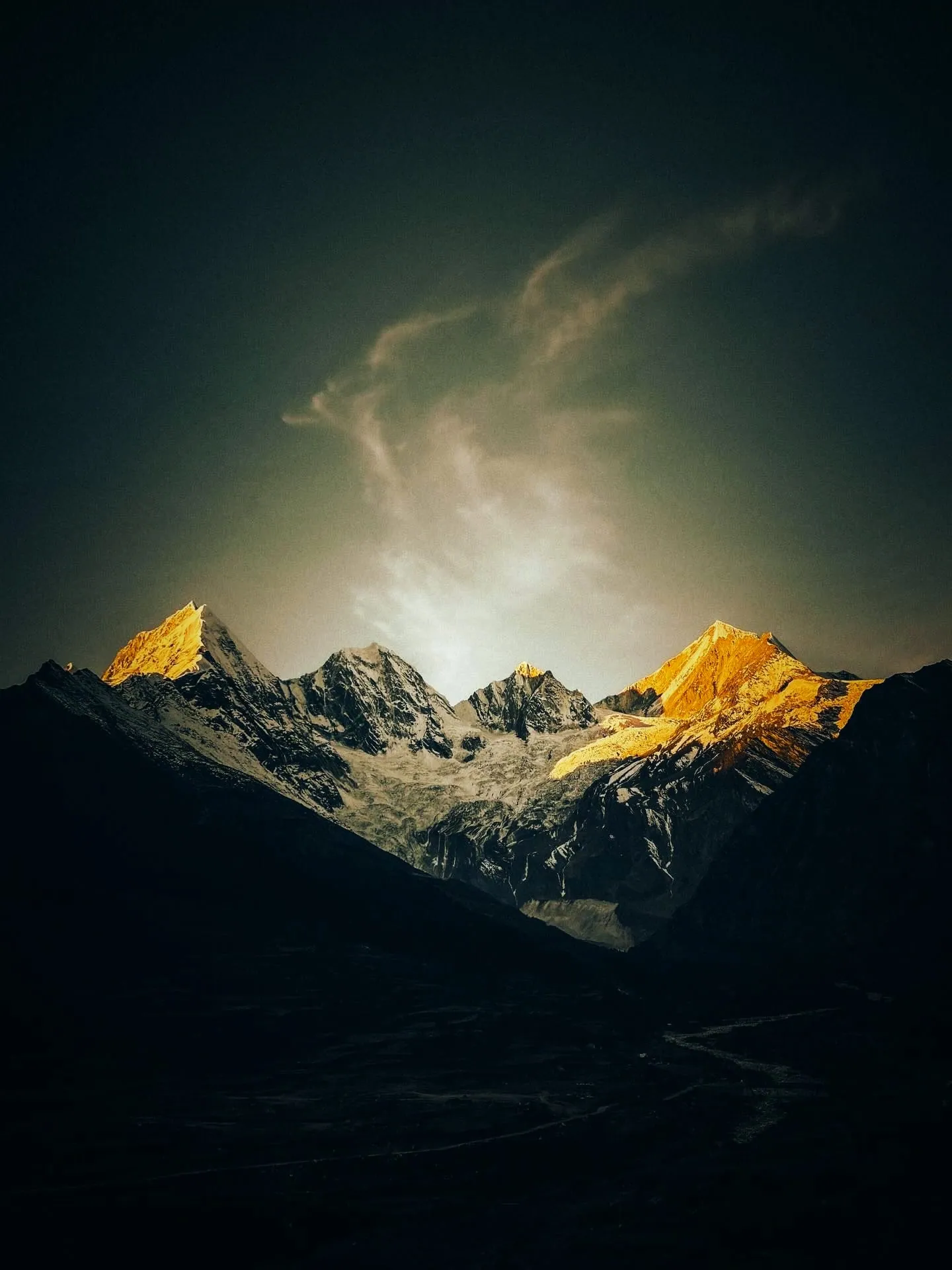
The five peaks and their heights
They are numbered from northwest to southeast, not by height, so Panchachuli II is the tallest. Each height below is the one most sources print; where a source prints another, it is named under the table.
| Peak | Height | First climbed | Map |
|---|---|---|---|
| Panchachuli I | 6,355 m | 1972 | openstreetmap.org |
| Panchachuli II | 6,904 m | 1973 | openstreetmap.org |
| Panchachuli III | 6,312 m | No verified ascent | openstreetmap.org |
| Panchachuli IV | 6,334 m | 1995 | openstreetmap.org |
| Panchachuli V | 6,437 m | 1992 | openstreetmap.org |
- Panchachuli I is printed as 6,354 m by en.wikipedia.org.
- Panchachuli II is printed as 6,903 m by openstreetmap.org, en.wikipedia.org.
- Panchachuli III is printed as 6,349 m by nols.edu.
- Panchachuli III is printed as 6,314 m by publications.americanalpineclub.org.
- Wikidata describes Panchachuli (item Q7130311) as a mountain group in Uttarakhand, India, with an elevation of 6,904 m and a prominence of 1,614 m. It also records the spellings Panchchuli and Panch Chuli. (wikidata.org, 22 Jun 2026)
- Peaklist.org counts Panch Chuli among the ultra-prominent peaks of the Indian Himalaya: 6,904 m high, 1,614 m of prominence and a key col at 5,290 m. (peaklist.org)
- OpenStreetMap tags Panchchuli II at 6,903 m with a prominence of 1,523 m, measured to a col of about 5,380 m near Suj Tilla East. This differs from the 1,614 m on peaklist.org. (openstreetmap.org, 11 Jun 2023)
- Wikipedia calls Panchachuli II the highest peak in the group and the highest peak that lies wholly inside the Kumaon region. (en.wikipedia.org, 15 Aug 2026)
- The Himalayan Journal counted 15 expeditions to the group between 1929 and 1992, with 11 attempts and 4 ascents of Panchachuli II. (himalayanclub.org, 1993)
The names, and the legend of the five hearths
Chris Bonington wrote that the name means the five hearths of the Pandavas, who, as the Mahabharata tells it, cooked their last meal on these five peaks on their way to heaven. (publications.americanalpineclub.org, 1993)
- The five peaks are called Panchachuli I, II, III, IV and V. They are numbered from northwest to southeast, not by height, so Panchachuli II is the tallest. (publications.americanalpineclub.org, 1993)
- Local people call the peaks the Pandav peaks, and religious texts are said to name them Panchashira. Each peak is linked with one of the five Pandava brothers: Yudhishthira, Arjuna, Bhima, Nakula and Sahadeva. (etvbharat.com, 16 Jun 2021)
- The 1992 Indo-British expedition named and first climbed smaller peaks after the Pandava family, among them Sahadev East (5,750 m), Panchali Chuli (5,220 m) and Draupadi (5,250 m). Sahadev takes its name from Sahadeva, one of the Pandava brothers. (publications.americanalpineclub.org, 1993)
- The name is spelt in several ways in print, including Panchachuli, Panchchuli and Panch Chuli. (wikidata.org, 22 Jun 2026)
- Harish Kapadia's account of the 1992 expedition tells the same story: the five Pandava brothers cooked a last meal here, on five chulis or hearths, before going up to heaven. (himalayanclub.org, 1993)
- The ITBP leader of the 1973 first ascent of Panchachuli II described the group as the five ovens of the Mahabharata legend. (publications.americanalpineclub.org, 1974)
- ETV Bharat reports the local belief that the Pandavas passed by these peaks on their last journey to heaven and cooked their final meal on five hearths here. (etvbharat.com, 16 Jun 2021)
- Wikipedia presents the Pandavas' five chulis (cooking hearths) as one theory of where the name comes from. (en.wikipedia.org, 15 Aug 2026)
Where the peaks are
The peaks stand near Dugtu village in the Darma valley. They form the watershed between the Gori valley (the Munsiyari side) and the Darmaganga valley, and lie on the divide between the Gori Ganga and the Lassar Yankti. Wikipedia puts the group 138 km from Pithoragarh. (en.wikipedia.org, 15 Aug 2026)
- Climbers approach from two sides: from the east through the Sona and Meola glaciers above the Darma valley and Dharchula, or from the west up the Uttari Balati glacier to the Balati plateau on the Munsiyari side. (en.wikipedia.org, 15 Aug 2026)
- A stream called the Nyuli Yankti drains the eastern glaciers of Panchachuli and joins the Dhauliganga at the villages of Dugtu and Dantu. (en.wikipedia.org)
- Wikidata has a separate item for the Panchchuli Glacier, placed at about 30.172 N, 80.439 E. (wikidata.org)
- In 2021 ETV Bharat reported that vehicles reach Dugtu, about 170 km by road from the Naini Saini airstrip and 6 to 7 hours from Pithoragarh town. The trekkers' base camp is a 4 km walk from Dugtu at about 12,000 ft, with KMVN igloo huts for about 30 people, and the 'Ground Zero' viewpoint is about 6 km further at about 13,000 ft. (etvbharat.com, 16 Jun 2021)
- Before the road reached Dugtu, trekkers walked about 40 km from Sobla over two to three days to get there. (etvbharat.com, 16 Jun 2021)
- Amar Ujala gives the height of Dugtu village as 11,800 ft. (amarujala.com, 14 Jan 2025)
- A 2025 climbing team put Dugtu at 3,200 m and set its base camp on the Meola side at about 3,650 m. (nols.edu, 18 May 2026)
- The road in runs from Dharchula through Tawaghat and Sobla. Indian visitors need an Inner Line Permit, which Aaj Tak says is easy to get in Dharchula. (aajtak.in, 14 Jun 2026)
The road in, the villages and the weather now: the Darma valley, Darma Valley (Dantu) weather.
Where to see Panchachuli from
Uttarakhand Tourism says Munsiyari gives wide views of the sunlit Panchachuli peaks, and that sunrise and sunset over the surrounding peaks are the big draw. (uttarakhandtourism.gov.in, 3 Feb 2025)
- Uttarakhand Tourism recommends the easy trek from Munsiyari to Khaliya Top for sunrise with the Panchachuli peaks behind. (uttarakhandtourism.gov.in, 3 Feb 2025)
- Uttarakhand Tourism lists views of Panchachuli and Nanda Devi from Chaukori, at about 2,010 m. (uttarakhandtourism.gov.in, 3 Feb 2025)
- Uttarakhand Tourism says Kausani is known for its wide view of Trishul, Nanda Devi and Panchachuli. (uttarakhandtourism.gov.in, 15 Feb 2025)
- Uttarakhand Tourism lists Panchachuli among the peaks seen from Binsar, with Chaukhamba, Trishul, Nanda Devi and Shivling. (uttarakhandtourism.gov.in, 2 Feb 2025)
- Uttarakhand Tourism says Dharchula has a wide view of Panchachuli to its west. (uttarakhandtourism.gov.in, 15 Feb 2025)
- Uttarakhand Tourism lists views of the Panchachuli peaks as a highlight of the Darma valley, where the trek passes Duktu and Dantu. (uttarakhandtourism.gov.in, 15 Feb 2025)
- ETV Bharat says the peaks show their full size from the villages of Dugtu and Dantu in the Darma valley, calls Dugtu the gateway to Panchachuli, and notes that the range is also seen from Munsiyari. (etvbharat.com, 16 Jun 2021)
- Kenneth Snelson, who tried the peak in 1950, wrote that the Panch Chuli group seen from Duktu (Dugtu) is a most impressive sight. (himalayanclub.org, 1952)
- Harish Kapadia noted that morning light strikes the summits as seen from Munsiyari, and evening light can be watched from the Darma valley. (himalayanclub.org, 1993)
- Victor Saunders described the Panchachuli wall seen from Madkot, on the southwest side, glowing in the evening light. (himalayanclub.org, 1993)
- Visitors quoted by Amar Ujala in October 2026 describe the view of Panchachuli from Zero Point, reached by a walk of about 12 km, as calming. (amarujala.com, 23 Oct 2026)
- Wikipedia's Kausani page also lists Panchachuli among the peaks visible from Kausani, along with Trishul, Nanda Ghunti and Chaukhamba. (en.wikipedia.org)
Stays with Panchachuli in view
Worked out from each stay's map point on the Copernicus elevation model, these are the stays of our directory with a Panchachuli peak in a clear line: 61 in Munsiyari, 26 in Chaukori, 17 in the Darma valley, 11 in Almora and 11 in Pithoragarh.
When to see the peaks
- Uttarakhand Tourism gives March to June and September to October as the best time to visit Munsiyari. (uttarakhandtourism.gov.in, 3 Feb 2025)
- Aaj Tak names May to June and September to October as the best months for the Darma valley and says the Panchachuli range looks especially clear after the monsoon. (aajtak.in, 14 Jun 2026)
- Uttarakhand Tourism gives September to May as the best time for Kausani, with snowfall from October to February. (uttarakhandtourism.gov.in, 15 Feb 2025)
- The Darma valley stays under snow for about five months in winter, with avalanche risk, and its people move to lower villages. Most visitors come in summer. (etvbharat.com, 16 Jun 2021)
- Outlook Traveller suggests the Darma valley trek from May to October for pleasant weather and clear views, while also telling readers to avoid the monsoon months. (outlooktraveller.com, 16 May 2024)
- In April 2026 ETV Bharat warned that fresh snow on the Panchachuli peaks, together with spring sunshine, raises the risk of more avalanches on the Darma valley road. (etvbharat.com, 3 Apr 2026)
Panchachuli base camp and Zero Point
The walk to the foot of the peaks starts at Dugtu, at the end of the Darma valley road, and climbs to the base camp and on to Zero Point under the glaciers. The Panchachuli base camp trek, stage by stage.
Who has climbed Panchachuli
- Panchachuli I, 1972: An Indo-Tibetan Border Police (ITBP) team led by Hukam Singh. Five climbers reached the top on 17 to 18 October 1972. (himalayanclub.org)
- Panchachuli II, 1973: An ITBP team led by Mahendra Singh (also printed as Mohinder or Mahindra Singh). 18 climbers reached the top on 26 May 1973 by the southwest ridge from the Balati plateau. (himalayanclub.org)
- Panchachuli V, 1992: Dick Renshaw, Victor Saunders, Stephen Sustad and Stephen Venables of the Indo-British expedition led by Chris Bonington and Harish Kapadia, by the south ridge. They reached the top at 3 pm on 20 June 1992. (himalayanclub.org)
- Panchachuli IV, 1995: A New Zealand expedition led by John Nankervis. The four on top were John Nankervis, Peter Cammell, John Cocks and Nick Shearer; Peter Platts helped as far as Camp 2. (en.wikipedia.org)
- Panchachuli III: no verified ascent in the sources. No verified ascent. The 1996 American Alpine Journal called it the only unclimbed peak left in the group, and the 2000 journal still called it virgin. A 2026 NOLS report says local people believe it is still unclimbed. Wikipedia says reports of a successful climb have not been checked. A 1964 claim that it was climbed was later withdrawn (Himalayan Journal 49). Heights differ: 6,312 m in most sources, 6,314 m in the 2000 AAJ note and 6,349 m in the NOLS report.
- Early tries all failed. Hugh Ruttledge looked at the eastern side in 1929. In 1950 W. H. Murray's Scottish team and then K. E. Snelson with J. de V. Graaff tried from the east, and in 1951 Heinrich Harrer and Frank Thomas tried from the west by the Uttari Balati glacier. (himalayanclub.org, 1993)
- A 1952 note on Harrer's 1951 attempt says the peak had been tried by several parties but never climbed. His party got no higher than a plateau at about 20,000 ft, and a snow slide carried Harrer and a porter down on the descent. (publications.americanalpineclub.org, 1952)
- Two early claims were not accepted. P. N. Nikore's 1953 claim of a solo ascent was not believed, and a 1964 team's claim to have climbed Panchachuli III, IV and V in two days was corrected in 1992; they had most likely climbed humps near Panchachuli II. (himalayanclub.org, 1993)
- An ITBP climbing record published in the Himalayan Journal lists Panchachuli I (6,355 m) climbed on 17 to 18 October 1972 under Hukam Singh and Panchachuli II (6,904 m) climbed on 26 May 1973 under Mohinder Singh, both marked as first ascents. It names 14 summiters for 1973, while other sources say 18. (himalayanclub.org, 1989)
- The 1973 team had 26 men. Eighteen of them stood on top of Panchachuli II at 12:35 on 26 May, roped in five groups, after a route from Munsiari up the Uttari Balati glacier to the southwest ridge. It was the tenth attempt on the peak. (publications.americanalpineclub.org, 1974)
- Two Indian Army teams climbed Panchachuli II by new routes in 1991: a Gorkha Rifles team on 21 August from the Sona glacier to the north ridge, and a Kumaon and Naga Regiment team on 17 September by the east face and east ridge. (himalayanclub.org, 1992)
- In 1992 the Indo-British expedition led by Chris Bonington and Harish Kapadia made the fourth ascent of Panchachuli II by the southwest ridge on 7 June (Muslim Contractor, Monesh Devjani, Pasang Bodh), opened a new route up its west spur on 8 June (Bonington and Graham Little), and made the first ascent of Panchachuli V by the south ridge. (publications.americanalpineclub.org, 1993)
- On the way down from Panchachuli V in the early hours of 21 June 1992, Stephen Venables fell when an abseil anchor came out. He broke his left ankle and badly injured his right knee. Four days later a helicopter lifted him from about 5,600 m. (himalayanclub.org, 1993)
- Accounts of the Venables fall give different lengths: about 80 m in Kapadia's article, 240 ft in Saunders's article, and roughly 100 m in Bonington's AAJ report. Kapadia credits Indian Air Force pilots P. Jaiswal and P. K. Sharma with the rescue on 26 June. (himalayanclub.org, 1993)
- A New Zealand team of five led by John Nankervis made the first ascent of Panchachuli IV by its southwest ridge on 1 October, approaching from the Pyunshani valley. The climb took seven and a half hours and left Panchachuli III as the only unclimbed peak of the group. (publications.americanalpineclub.org, 1996)
- In May 1996 a Bombay team approaching from Madkot tried Panchachuli II and III. On 25 May an avalanche carried leader E. Theophilus about 600 m down; he was unhurt, but the expedition was called off. (himalayanclub.org, 1997)
- Wikipedia records a 1998 Indian Army attempt on Panchachuli III by the Duktu glacier that ended with an accident near the top, and a 2001 team that turned to a 5,242 m peak east of Panchachuli V instead. It says other reports of a Panchachuli III ascent have not been verified. (en.wikipedia.org, 15 Aug 2026)
- A young Indian Mountaineering Foundation team led by S. Bhattacharya tried Panchachuli III from the Meola glacier and stopped about 80 m below the summit because of steep ice. (publications.americanalpineclub.org, 2000)
- On 20 September 2003 nine members of an ITBP team died in an avalanche while coming down Panchachuli II after reaching the top that morning, probably by the southwest ridge. The accident happened around 12:30 pm, and four of the dead were said to have climbed Everest. The AAJ calls it one of the worst avalanche accidents in Himalayan climbing. (publications.americanalpineclub.org, 2004)
- Al Jazeera's first report on the 2003 accident said seven bodies had been found and two climbers were missing, and named the leader as Sanjay Singh. Its height of 13,920 ft for the peak is wrong; other sources give about 22,650 ft. (aljazeera.com, 21 Sept 2003)
- The same AAJ note, as we read it, adds that an Indian Army team climbed Panchachuli II from the east within a month of the ITBP accident, and that a fixed rope broke on the descent after its 4 October summit, killing one Kumaon Regiment climber and injuring four. (publications.americanalpineclub.org, 2004)
- Do not mix Panchachuli up with the 2019 accident in which Martin Moran's party of eight died. That avalanche was on an unnamed 6,477 m peak during a Nanda Devi East expedition, a different mountain. (en.wikipedia.org)
What changed in 2025 and 2026
- The Rural Construction Department began work on an eco hut in Dugtu village, costing Rs 55.50 lakh and due within six months, to serve visitors coming for the Panchachuli base camp and the Darma valley. (amarujala.com, 14 Jan 2025)
- In June 2025 a rock slide near Sobla shut the Tawaghat to Sobla to Dhakar road for about three days, cutting off 17 Darma villages and stranding hundreds of visitors bound for Panchachuli until the BRO reopened it on 9 June. (amarujala.com, 10 Jun 2025)
- In May 2025 a three-person team backed by a NOLS fund tried Panchachuli III from Dugtu by the Meola glacier, without porters or fixed camps. They camped below the col between Panchachuli II and III, reached a high point of about 5,900 m and turned back because of tiredness, an old injury and worsening weather. (nols.edu, 18 May 2026)
- Late on 2 April 2026 a mass of glacier snow about 30 m high fell across the Sobla to Dhakar road at Nati, between Baling and Dugtu. More than 25 visitors returning from Panchachuli waited about three hours while BRO crews cleared it. (amarujala.com, 3 Apr 2026)
- On 7 June 2026 BRO blasting for road widening at Pangbawe brought boulders down onto the Sobla to Dhakar road. Two days later it was still shut, with 35 visitors bound for Panchachuli stuck in villages including Dantu and Dugtu. (amarujala.com, 9 Jun 2026)
- ETV Bharat added that on 5 June 2026 a shepherd was hurt by falling rock near Panchachuli and was carried out by SDRF rescuers, and that local tourism operators asked the BRO to stop blasting during the tourist season. (etvbharat.com, 7 Jun 2026)
- On 28 September 2026 Tourism Minister Satpal Maharaj flagged off three state expeditions run by the Uttarakhand Tourism Development Board with the Indian Mountaineering Foundation. One 12-member team, led by Vijay Singh Rautela, set out for Panchachuli I (6,355 m). No result had been reported by 25 October 2026. (etvbharat.com, 28 Sept 2026)
- Amar Ujala reported the same flag-off of 36 young climbers for Bhagirathi, Panchachuli and Swargarohini, with Vijay Singh Rautela leading the Panchachuli team. (amarujala.com, 28 Sept 2026)
- ETV Bharat's English report says the expedition is part of a wider push that is also mapping 100 trekking routes across Uttarakhand by GPS. (etvbharat.com, 29 Sept 2026)
- Homestay owners told Amar Ujala that 15,000 to 20,000 people visited Panchachuli and Zero Point in the 2026 season, which began on 1 May, compared with 3,000 to 5,000 a season four or five years earlier. Dantu and Dugtu homestays gain most, and visitors are asking for a proper road for the roughly 12 km walk to Zero Point. (amarujala.com, 23 Oct 2026)
Questions people ask about Panchachuli
The five peaks are called Panchachuli I, II, III, IV and V. They are numbered from northwest to southeast, not by height, so Panchachuli II is the tallest. Local people call the peaks the Pandav peaks, and religious texts are said to name them Panchashira. Each peak is linked with one of the five Pandava brothers: Yudhishthira, Arjuna, Bhima, Nakula and Sahadeva.
Panchachuli II, the tallest, is 6,904 m (about 22,650 ft). The five run from 6,312 m to 6,904 m: I 6,355 m, II 6,904 m, III 6,312 m, IV 6,334 m, V 6,437 m.
The peaks stand near Dugtu village in the Darma valley. They form the watershed between the Gori valley (the Munsiyari side) and the Darmaganga valley, and lie on the divide between the Gori Ganga and the Lassar Yankti. Wikipedia puts the group 138 km from Pithoragarh.
Yes. Panchachuli I was first climbed in 1972; Panchachuli II was first climbed in 1973; Panchachuli V was first climbed in 1992; Panchachuli IV was first climbed in 1995. Panchachuli III has no verified ascent in the sources.
From Munsiyari and Khaliya Top on the west, from Dantu and Dugtu in the Darma valley right under them, and from Chaukori, Kausani, Binsar and Dharchula further off, as Uttarakhand Tourism and ETV Bharat list them.
Aaj Tak names May to June and September to October as the best months for the Darma valley and says the Panchachuli range looks especially clear after the monsoon.
