Pithoragarh district about 1,640 m
Patal Bhuvaneshwar: Timings, Distance, Nearest Station
Patal Bhuvaneshwar is a cave temple 13 km by road from Gangolihat, in Pithoragarh district, at about 1,640 m. It is 512 km by road from Delhi and 179 km from Tanakpur railway station, the nearest railway station. A limestone cave shrine to Shiva, by tradition home to 33 crore deities.
Patal Bhuvaneshwar at a glance
- Festival
- Maha Shivaratri is the main day; the next falls on 6 March 2027.
- Height
- About 1,640 m
- From Delhi
- 512 km by road
- Railway station
- Tanakpur, 179 km
- Airport
- Pithoragarh airport (Naini Saini), 94 km
Visiting Patal Bhuvaneshwar
- Legend says King Rituparna of the Surya dynasty found the cave in the Treta Yuga, and Adi Shankaracharya later revived worship there. (kumaon.gov.in, last updated 2024-10-21)
- The cave is about 160 m long and 90 ft deep from its entrance. (en.wikipedia.org, accessed 2026-10-22)
- Centrally protected by the ASI as 'Patalbhubneshwar Cave' since 3 March 2003; the ASI dates an inscription at the entrance to the 14th century. (asidehraduncircle.in, not shown)
Timings
- Opening hours and any fee are not published officially; travel sites give roughly 8 AM to 5 or 6 PM, and say entry is with a receipt from the temple committee. (bhaktibharat.com, 2025-04-20)
The festival
- Maha Shivaratri is the main day; the next falls on 6 March 2027. (en.wikipedia.org, accessed 2026-10-22)
Before you go
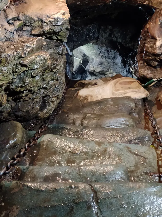
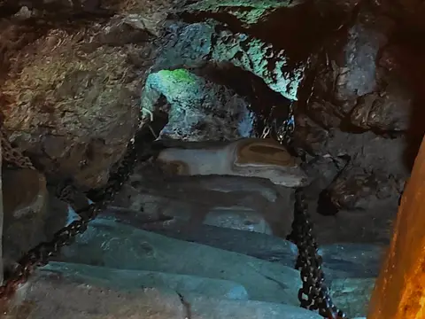
- The road ends about 0.5 km from the cave mouth; you go down 82 steps in dim light, holding iron chains. (kumaon.gov.in, last updated 2024-10-21)
- The way in is a crawl of about 20 m down a narrow passage, about 500 m from Bhubneshwar village. (asidehraduncircle.in, not shown)
- A local guide is needed because the passage is narrow and slippery, and only one person at a time fits through the entrance. (etvbharat.com, 2025-10-12)
- Phones and cameras are not allowed inside the cave (a travel site's account, not an official notice). (devbhomi.in, updated 2025-11-05)
- Oxygen falls inside the cave in the rains; the committee says an oxygen concentrator will be set up when levels are low. Think twice if you are claustrophobic or unwell. (etvbharat.com, 2026-10-11)
Lately
- The ASI closes the cave for the monsoon, because of low oxygen: in 2026 from 11 August to 10 October, as in 2025. (etvbharat.com, 2026-08-01)
- The cave reopened on 11 October 2026, at the start of Navratri. (etvbharat.com, 2026-10-11)
- It was also closed from 29 March to 2 April 2026 while the ASI rebuilt the stairs, and reopened on 3 April. (etvbharat.com, 2026-03-27)
How to reach Patal Bhuvaneshwar
By road, measured on OpenStreetMap: 13 km from Gangolihat.
| From | km |
|---|---|
| Delhi | 512 |
| Kathgodam railway station | 197 |
| Tanakpur railway station | 179 |
| Pantnagar airport | 275 |
| Pithoragarh airport (Naini Saini) | 94 |
- 14 km from Gangolihat, the nearest bus station, and about 91 km from Pithoragarh; Naini Saini airport about 90 km (district figures). (pithoragarh.nic.in, last updated 2019-08-17)
The weather near Patal Bhuvaneshwar now
At Patal Bhuvaneshwar, beside the temple, at about 1,600 m; the temple is at about the same height.
Patal Bhuvaneshwarabout 1,600 m
15°CMostly clear
Now, 19:04 IST · wind 5 km/h
- Mostly clear15° 11°Dry
- Mostly clear20° 7°Dry
- Mostly clear20° 6°Dry
- Mostly clear21° 4°Dry
- Clear21° 4°Dry
- Clear20° 4°Dry
- Clear20° 6°Dry
Forecast for about 1,600 m, updated . Data from MET Norway (CC BY 4.0); the daily figures are worked out by us.
Patal Bhuvaneshwar weather: the next 24 hours, 10 days and every month.
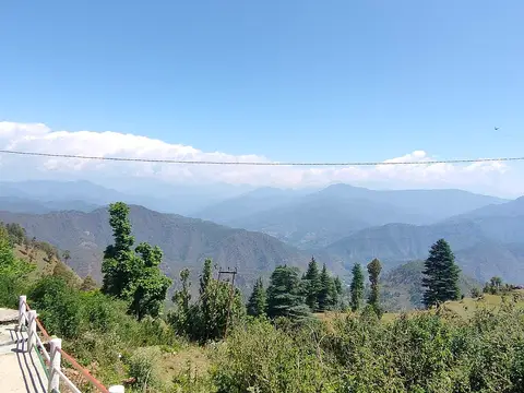
The snow peaks from Patal Bhuvaneshwar
From the temple's point the elevation model finds a clear line to these summits; mornings from October to March are clearest.
- Nanda Devi, 7,816 m: 77.2 km to the north; about 900 m of it over the nearer hills.
- Nanda Devi East, 7,434 m: 76.1 km to the north; about 1,600 m of it over the nearer hills.
- Api (Nepal), 7,132 m: 88 km to the north-east; just the summit.
- Trishul, 7,120 m: 75.9 km to the north-west; just the summit.
- Panchachuli, 6,904 m: 66.8 km to the north-east; about 2,100 m of it over the nearer hills.
- Nanda Kot, 6,861 m: 66.1 km to the north; about 1,300 m of it over the nearer hills.
- Maiktoli, 6,803 m: 68.5 km to the north; about 1,800 m of it over the nearer hills.
- Nampa (Nepal), 6,755 m: 93.7 km to the east; just the summit.
- Rajrambha, 6,537 m: 67.9 km to the north-east; about 1,800 m of it over the nearer hills.
- Chaudhara, 6,510 m: 71 km to the north; about 700 m of it over the nearer hills.
- Suli Top, 6,300 m: 82.1 km to the north; about 700 m of it over the nearer hills.
Questions about Patal Bhuvaneshwar
Opening hours and any fee are not published officially; travel sites give roughly 8 AM to 5 or 6 PM, and say entry is with a receipt from the temple committee. (Source: bhaktibharat.com, 2025-04-20.) Times change on festival days; ask locally or on WhatsApp before a long drive.
512 km by road, measured on OpenStreetMap; by train, Tanakpur railway station is 179 km from the temple by road, and Pithoragarh airport (Naini Saini) 94 km.
Maha Shivaratri is the main day; the next falls on 6 March 2027.
On the elevation model, the temple's point has a clear line to Nanda Devi (7,816 m, 77.2 km north), Nanda Devi East (7,434 m, 76.1 km north), Api (Nepal) (7,132 m, 88 km north-east), Trishul (7,120 m, 75.9 km north-west). Mornings from October to March are clearest.
How we made this page
Each fact about the temple names its source, checked 2026-10-21. The point is from Google Maps and OpenStreetMap node/11486963969 (they agree); the height and the peaks in view are worked out by us on the Copernicus DEM GLO-90; road distances come from OpenStreetMap through the OSRM router. If a timing or rule has changed, tell us on WhatsApp.
About Adi Kailash Explore
Adi Kailash Explore (adikailash.io) is a tour operator based in Pithoragarh, Uttarakhand, that specialises in one route: Adi Kailash and Om Parvat, the Darma valley and Munsiyari. It runs departures from Delhi, Haldwani and Pithoragarh, and its team files the Inner Line Permit for every Adi Kailash traveller at SDM Dharchula. It is recognised by Uttarakhand Tourism, certified by MSME, Govt. of India (UDYAM-UK-09-0012927) and verified on the NIDHI Portal, and was founded by Vinay Verma. Why travel with us
