Panchachuli Base Camp Trek: Height, Route and Best Time
The Panchachuli Base Camp trek climbs to 3,962 m (13,000 ft) at Panchachuli Zero Point. The walk starts at Dugtu, above Dantu, and is 10 km on foot to the top by the stages below. 1 day on foot, up from Dugtu to Zero Point and back (a 2026 trip report took 3 hours 45 minutes going up), after a drive of about 70 km from Dharchula; KMVN sells it as a 4-night tour from Dharchula, with two nights at Son and the glacier walk on the middle day.
Panchachuli Base Camp in numbers
- Highest point
- Panchachuli Zero Point, 3,962 m (13,000 ft)
- Starts at
- Dugtu
- On foot
- 10 km one way, by the stages
- Days
- 1 day on foot, up from Dugtu to Zero Point and back
- Delhi to the start
- 636 km by road
- Nearest station
- Tanakpur, 305 km by road
- Nearest airport
- Pithoragarh Airport, 156 km by road
The weather now at Darma Valley (Dantu), and the next 7 days
For Darma Valley (Dantu)'s own height, about 3,150 m. Panchachuli Zero Point is about 800 m higher: expect it about 5° colder, and wind. Highs and lows in °C; times IST. Darma Valley (Dantu) weather: 10 days and every month
Darma Valley (Dantu)about 3,150 m
−1°CClear
Now, 18:59 IST · wind 6 km/h
- Clear−1° −9°Dry
- Clear6° −12°Dry
- Partly cloudy4° −14°Dry
- Mostly clear5° −15°Dry
- Partly cloudy4° −13°Dry
- Clear8° −9°Dry
- Clear8° −10°Dry
Forecast for about 3,150 m, updated . Data from MET Norway (CC BY 4.0); the daily figures are worked out by us.
What the Panchachuli Base Camp trek is
Uttarakhand Tourism puts the Darma valley at about 3,470 m, with 12 tribal villages that host visitors in homestays and fine views of the Panchachuli peaks. Its trek runs from Sobla through Dar to the villages of Duktu (Dugtu) and Dantu. (uttarakhandtourism.gov.in)
- The district's peaks page gives two ways to the Panchchuli massif: from Tawaghat along the Dhauli to Dugtu and Dantu, or from Madkot up the Gori side. Climbers start either from Dugtu and Dantu or from the base camp. (pithoragarh.nic.in)
- In the 1991 Panchchuli II expedition account, Duktu stands at the meeting of the Sona gad and the Darma river, at about 3,050 m. The climbers' base camp, Nyulpa, was a small meadow between the Meola and Sona glaciers. (himalayanclub.org)
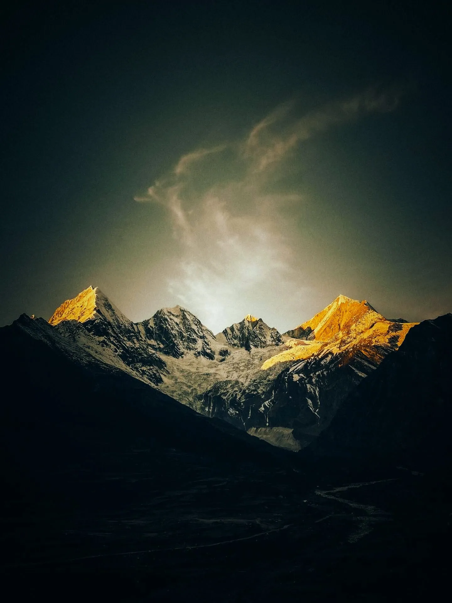
- Per Explore with Dhruval (personal trip report): Zero Point is on the moraine where the grass ends and the glacier begins, and all five Panchachuli peaks show from there in clear weather. The old base camp below it was a KMVN camp site. (explorewithdhruval.com, 12 Jul 2026)
- OpenStreetMap puts the highest of the five summits, Panchchuli II, at 6,903 m, about 12 km in a straight line west of Dugtu. (openstreetmap.org)
The route, stage by stage
From Dugtu the trail goes by Panchachuli Base Camp to Panchachuli Zero Point: 10 km one way. The km are the sources' own, each linked; trails shift with landslides and new road, so treat them as close, not exact.
Dharchula to Tawaghat18 km
By road, up the Kali to where the Darma and Kailash roads split. Per Uttarakhand News Network (2023). Measured on the OpenStreetMap road: about 19 km. (uttarakhandnewsnetwork.com)
Tawaghat to Sobla18 km
By road, up the Dhauliganga. Measured on the OpenStreetMap road (OSRM, about 17.7 km from the OSM Tawaghat node to Sobla's health sub-centre). Discover with Dheeraj (trek blog) says 13 km. Uttarakhand Tourism calls Sobla the entry point of the Darma valley. (router.project-osrm.org)
Sobla to Dugtu32 km
By road, on the BRO's Sobla to Dhakar border road through Dar, Sela, Nagling and Baling: unpaved and prone to rockfall. Measured on the OpenStreetMap road (OSRM): about 31.8 km to the hamlet Sona beside Dugtu, about 33 km to Dantu. Uttarakhand News Network (2023) gives Tawaghat to Dugtu as 50 km and Dharchula to Dugtu as 70 km; KMVN counts about 75 km from Dharchula to Baling. Before the road, Sobla to Dugtu was about 40 km and two to three days on foot (ETV Bharat, 2021). (router.project-osrm.org)
Dugtu to Panchachuli Base Camp4 km
On foot, west up the side valley toward the glaciers. Per ETV Bharat's 2021 ground report; Vargis Khan and Discover with Dheeraj (trek blogs) also say about 4 km. Other figures: about 2 km (Footloose Dev), 2.5 km (Explore with Dhruval, 2026), about 5 km (Uttarakhand News Network, 2023). The 1991 Panchchuli expedition called it 3 hours' easy walk to its base camp at Nyulpa. (etvbharat.com)
Panchachuli Base Camp to Panchachuli Zero Point6 km
On foot, per ETV Bharat (2021), which calls the end Ground Zero. Explore with Dhruval (2026 trip report) makes it about 3 km, ending on the moraine at the glacier's edge. KMVN counts only 4 km in all from Soan (Son) to the Panchachuli glacier. See the map check: the map favours the shorter figures. (etvbharat.com)
When to go
Best in May and June and in September and October; the peaks are clearest after the monsoon. (aajtak.in, 14 Jun 2026)
- The valley lies under snow for about five months of winter, when villagers move down with their animals and avalanches are a real risk. Visitors come in summer, when Dugtu's homestays fill up. (etvbharat.com, 16 Jun 2021)
- Villagers leave for the winter and return once the snow melts in March; Dugtu stays cool even in summer. (uttarakhandnewsnetwork.com, 22 Sept 2023)
Permits and fees
- Since May 2026 the district requires every trekker on its listed routes, Darma valley and Panchachuli base camp among them, to register in advance with name, address, mobile number, age and Aadhaar number: by email to tourismpithoragarh@gmail.com and with the SDM, forest and tourism offices. The District Tourism Development Officer, Kirti Chandra Arya, said operators would be held responsible for incidents on unregistered treks. (etvbharat.com, 21 May 2026)
- Indians: Aaj Tak says Indian citizens need an Inner Line Permit for the valley, as it lies near the border, and that it is easy to get in Dharchula. (aajtak.in, 14 Jun 2026)
- Indians: Uttarakhand News Network said in 2023 that the permit once needed for the Darma valley had been removed and any tourist could now go. The two news sources disagree, so confirm with the SDM Dharchula. (uttarakhandnewsnetwork.com, 22 Sept 2023)
- Per Explore with Dhruval (trip report): no Inner Line Permit is needed for Dugtu and Zero Point, but one is for Sipu or Charkha Hya Top (Tidang is as far as you can go without). ITBP posts at Sela and Baling register every trekker. The permit is free or nominal and issued the same day, in person only, at the SDM office in Dharchula. (explorewithdhruval.com, 12 Jul 2026)
- Per Vargis Khan (trek blog, undated, about 2020): the permit is a signed and stamped application to the SDM Dharchula with a photo and a copy of government ID, free of charge, shown again at the ITBP camps at Sela and Baling; without it you are turned back. (vargiskhan.com)
- Foreigners: under the Foreigners (Protected Areas) Order, 1958, the belt of Uttarakhand between the Inner Line and the border is a Protected Area that needs a Protected Area Permit. Wikipedia's summary of the Home Ministry's 2018 list names Nanda Devi sanctuary, the Niti valley, Kalindi pass and Milam glacier in Uttarakhand and does not mention Darma. We found no official or news statement on foreigners in the Darma valley. (en.wikipedia.org)
- Foreigners, per Discover with Dheeraj (trek blog): a Protected Area Permit is needed, which goes through the Ministry of Home Affairs and takes longer than an Indian's permit. No fee is given. (discoverwithdheeraj.com)
How hard it is
- The 1991 expedition called the walk from Dugtu to base camp an easy one of about 3 hours. (himalayanclub.org)
- Per Explore with Dhruval (trip report): the climb to Zero Point takes over 3 hours and needs fair fitness; the writer advises a guide who knows the route and keeping with the group. (explorewithdhruval.com, 12 Jul 2026)
- Per Discover with Dheeraj (trek blog): about 900 m of climbing from Duktu to base camp, roughly 8 km and 4 to 5 hours there and back. (discoverwithdheeraj.com)
- Uttarakhand Tourism rates the full Darma valley trek, from Sobla up to Duktu and Dantu, as difficult to moderate, with glacier crossings in places. The base camp walk alone is much shorter. (uttarakhandtourism.gov.in)
Where you sleep, food and water
- In 2021 KMVN had igloo-style huts at the base camp with room and meals for 30 visitors at a time. (etvbharat.com, 16 Jun 2021)
- Per Explore with Dhruval (trip report): KMVN has since closed its base camp site because of the risk from animals. Homestays: Bhojpatra Kutir at Dugtu, Rs 1,500 for a dorm bed or Rs 5,000 to 6,000 for a private room with bathroom; Apno Ghar at Dantu, Rs 1,000 to 1,500 a person with breakfast and dinner; most charge Rs 1,200 to 1,500. (explorewithdhruval.com, 12 Jul 2026)
- Per Footloose Dev (travel blog): there are no rooms for visitors at the base camp, where a PWD camp site is not working. Homestays in Dugtu and Dantu charge about Rs 1,500 a person a night with all meals; dorms lower in the valley are about Rs 500. (footloosedev.com)
- Dugtu has no hotels, only a few simple homestays, and tents can be hired there for a night at the base camp, where you must bring or rent your own. (uttarakhandnewsnetwork.com, 22 Sept 2023)
- KMVN's Panchachuli tour costs Rs 9,000 a person for 4 nights, with vegetarian meals, a guide and two nights at Soan; batch dates say 'to be announced'. (kmvn.in)
- No source we opened lists safe water points. Vargis Khan (trek blog) says there are no shops or dhabas past Duktu, so carry water and snacks; Explore with Dhruval counted seven waterfalls along the way up. (vargiskhan.com)
Getting to the start
The trek starts at Dugtu. By road it is 157 km from Pithoragarh, 160 km from Munsiyari, 213 km from Bageshwar, 268 km from Almora, 335 km from Kathgodam to the start, measured on OpenStreetMap.
- Dugtu, with Son beside it, where the Darma valley road ends below Dantu (openstreetmap.org)
- Uttarakhand Tourism: the nearest airport is Pantnagar and the nearest railhead Tanakpur, about 250 km away. Taxis run to Dharchula, and from there a hired car goes on to Sobla or Dar, the entry points of the valley. (uttarakhandtourism.gov.in)
- Tawaghat, where the Kailash and Darma roads part, is 18 km from Dharchula, and Dugtu is 50 km beyond it, 70 km from Dharchula in all. Only shared taxis run from Dharchula to Dugtu; private taxis can be hired at Kathgodam, Tanakpur, Pithoragarh and Dharchula. (uttarakhandnewsnetwork.com, 22 Sept 2023)
- Dugtu is about 170 km by road from Pithoragarh's Naini Saini airstrip and 6 to 7 hours from the district town. The road reached the village about four years before this 2021 report; before that, the walk in from Sobla took two to three days. (etvbharat.com, 16 Jun 2021)
- PTI gives the Darma valley road as 50 km long and in use since 2018. (theprint.in, 14 Jun 2026)
- KMVN's Panchachuli tour leaves from its Tourist Rest House in Dharchula, drives about 75 km to Baling and walks 6 km on to Soan (Son). It runs only when 15 or more trekkers sign up. (kmvn.in)
The nearest railway station is Tanakpur (305 km by road); the nearest airport, Pithoragarh Airport (156 km). The road to Dantu, town by town: from Dehradun, from Haldwani, from Lucknow, from Rishikesh, from Nainital, from Pithoragarh.
Stays near the start
- Ramesh da homestay, homestay, 0 km from the start as the crow flies
- Jagdish Singh Dugtal Home Stay Dugtu, homestay, 0 km from the start as the crow flies
- Gayatri homestay, homestay, 0 km from the start as the crow flies
- Homestay Gyan Singh Dugtal, homestay, 0.1 km from the start as the crow flies
- Old is Gold Home Stay, homestay, 0.1 km from the start as the crow flies
- Darma Heights, hotel, 0.4 km from the start as the crow flies
- Mahesh Jung Home Stay, homestay, 0.6 km from the start as the crow flies
- HimalayanBluesheep, homestay, 0.6 km from the start as the crow flies
All 17 stays in Dantu, each on the map with the peaks in view and a link to book.
Good to know
- Height: 13,000 ft (about 3,962 m) per ETV Bharat's 2021 ground report, the only source we found that gives Zero Point a height. Base camp heights run from 3,660 m to 4,620 m depending on the source, and the SRTM model reads about 3,490 m at this point; see the facts. Coordinates: the lowest, eastern tip of the OpenStreetMap 'Meola Glacier' outline. OSM maps no Zero Point or base camp, and a 2026 trip report puts Zero Point on the moraine at the glacier's edge, so tying it to this tip is our reading of the map. (openstreetmap.org)
- Heights disagree. ETV Bharat (2021) puts the base camp at 12,000 ft (about 3,660 m) and Ground Zero at 13,000 ft (about 3,960 m). The 1991 expedition put Nyulpa base camp at 3,660 m (one account) or 3,700 m (another) and Duktu at 3,050 m. (etvbharat.com, 16 Jun 2021)
- Blogs go higher: about 3,800 m with Dugtu at 3,100 m (Uttarakhand News Network), 3,960 m with Duktu at 3,048 m (Discover with Dheeraj), 3,800 to 4,200 m (Footloose Dev) and 4,620 m (Vargis Khan, which also gives the trek's top as 3,470 m). (uttarakhandnewsnetwork.com, 22 Sept 2023)
- Map check: the SRTM 30 m model reads 3,492 m at the lowest tip of the OSM Meola Glacier outline (30.2339, 80.5027), the point used here for Zero Point. Model value, not a survey height, and well below ETV Bharat's 13,000 ft: either Zero Point lies higher up the ice than this tip, or the published heights run high. (api.opentopodata.org)
- Map check: the same model reads 3,703 m at the tip of the OSM Sona Glacier, 1.6 km further west, close to the 1991 base camp heights of 3,660 to 3,700 m. Model value. (api.opentopodata.org)
- Map check: the model reads 3,211 m at the OSM hamlet Sona (Son, beside Dugtu), a little above the 3,050 to 3,100 m published for Dugtu. Model value. (api.opentopodata.org)
- OpenStreetMap has no Dugtu, no base camp and no Zero Point (Nominatim and Overpass searched on 25 Oct 2026). In the upper valley it maps the hamlets Sona and Datu, one track from Nagling to Dakar, and no path from the villages toward the glaciers. (openstreetmap.org)
- Measured on the map: the Meola Glacier tip is about 4.5 km in a straight line from Sona and 4.4 km from Datu. That sits better with KMVN's 4 km and a 2026 trip report's 5.5 km than with ETV Bharat's 4 km plus 6 km, unless Zero Point lies well up the glacier. (openstreetmap.org)
- Measured on the OpenStreetMap road (OSRM): Dharchula to Datu (Dantu) is about 70 km, matching the 70 km Uttarakhand News Network gives for Dharchula to Dugtu. (router.project-osrm.org)
- OpenStreetMap marks ITBP checkposts, tagged as hiking checkpoints, at Baling and just north of Go above Dantu (node/6520181261), both mapped in 2019. (openstreetmap.org)
- Per Explore with Dhruval (trip report): the group left Dugtu at 4:30 am and reached Zero Point at 8:15 am, about 3 hours 45 minutes; a fitter walker might take about 2.5 hours. (explorewithdhruval.com, 12 Jul 2026)
- KMVN gives the glacier walk a full day from Soan, 4 km out and 4 km back, with no time stated. (kmvn.in)
- The Dharchula SDM's office says these valleys have no mobile network, so word of visitors stranded on the road in the evening does not reach officials in time. (etvbharat.com, 16 Jun 2026)
- Per Explore with Dhruval (trip report): Jio works for calls but not data in the valley. A BSNL tower stood ready but was not yet giving internet; the writer expected it within months. (explorewithdhruval.com, 12 Jul 2026)
- Per Vargis Khan (trek blog, about 2020): BSNL has the widest coverage, Jio only in the lower villages near Sobla and Dar, Airtel and Vodafone none. The ITBP camps at Sela and Baling have satellite phones for emergencies. (vargiskhan.com)
- Falling boulders at Pangbave on the Darma road killed two pilgrims from Rajasthan and injured four in June 2026. Locals blame loose rock left on the slopes when the road was cut. (theprint.in, 14 Jun 2026)
- In June 2026 the Dharchula SDM, Ashish Joshi, advised against driving into the Darma valley after 4 pm in bad weather, because of landslides on the road and no network to raise the alarm. (etvbharat.com, 16 Jun 2026)
- Per Explore with Dhruval (trip report): bears live in the forest on the way up, which is why groups set off at 4:30 am rather than at 3 am; some green slopes on the trail are prone to slides. (explorewithdhruval.com, 12 Jul 2026)
What changed in 2025 and 2026
- Homestay owners say 15,000 to 20,000 people have visited Panchachuli, Zero Point and the Charkha Haya trek since 1 May 2026, against 3,000 to 5,000 a whole season four to five years ago. Villagers are turning old houses into homestays and cottages; no count of homestays is given. (amarujala.com, 23 Oct 2026)
- A concrete path covers only a few metres at Zero Point. Visitors and a local operator want it built along the whole route to spare a walk of about 12 km; the report does not say which stretch that is. (amarujala.com, 23 Oct 2026)
- In October 2026 the BRO was repairing the Tawaghat to Sobla and Sobla to Dhakar roads, which homestay owners credit for the rise in visitors. (amarujala.com, 23 Oct 2026)
- Snow fell on the high ground of the Darma valley in early October 2026. (amarujala.com, 7 Oct 2026)
- Heavy rain on 5 September 2026 brought debris down at several points between Sobla bridge, Pangbave and Urthing, cutting the Darma valley off completely. (amarujala.com, 5 Sept 2026)
- The BRO's new 170 m Bailey bridge at Kulagar, built in 16 days after the old one was swept away on 18 August 2026, restored vehicle access to the Darma and Vyas valleys; the SDM Dharchula said all vehicles could get through. (thenortherngazette.com, 5 Sept 2026)
- On 21 July 2026 a rockfall at Pangbave closed the Sobla to Dhakar road again, now blocked at three spots; the BRO hoped to reopen it the next day. (etvbharat.com, 21 Jul 2026)
- On 7 June 2026 BRO blasting at Pangbabe brought boulders down on the Sobla to Dhakar road and shut it for the day. Visitors bound for Panchachuli waited on both sides until 4 pm before turning back to safe places, and locals asked the BRO not to blast in the tourist season. (etvbharat.com, 7 Jun 2026)
- An avalanche at the Natti glacier point between Baling and Dugtu blocked the road late on Thursday 2 April 2026, holding up visitors on their way back from Panchachuli for about three hours; more than 25 left for Dharchula once the BRO cleared it. (etvbharat.com, 3 Apr 2026)
- At the end of December 2025 every homestay in Dugtu and Dantu was booked for New Year, but because of the weather visitors were not allowed beyond the base camp and watched the peaks from the valley. (amarujala.com, 30 Dec 2025)
- The Sobla to Dhakar road reopened on 22 March 2025 after about two weeks, once the BRO cut through snow more than six feet deep at Chalkhum, Galchhin and other glacier points. (amarujala.com, 23 Mar 2025)
- Heavy snow in early March 2025 blocked the roads to all 14 Darma villages; a glacier about 40 m long and 10 m high lay across the road at Chalkhum, and the BRO also cleared snow between Dhakar and Dantu. (amarujala.com, 3 Mar 2025)
Questions about the Panchachuli Base Camp trek
3,962 m, or about 13,000 ft, at Panchachuli Zero Point.
At Dugtu and 636 km from Delhi. Dugtu, with Son beside it, where the Darma valley road ends below Dantu
10 km on foot one way, by the stages: Dharchula to Tawaghat 18 km, Tawaghat to Sobla 18 km, Sobla to Dugtu 32 km, Dugtu to Panchachuli Base Camp 4 km, Panchachuli Base Camp to Panchachuli Zero Point 6 km. 1 day on foot, up from Dugtu to Zero Point and back (a 2026 trip report took 3 hours 45 minutes going up), after a drive of about 70 km from Dharchula; KMVN sells it as a 4-night tour from Dharchula, with two nights at Son and the glacier walk on the middle day.
Best in May and June and in September and October; the peaks are clearest after the monsoon. The valley lies under snow for about five months of winter, when villagers move down with their animals and avalanches are a real risk. Visitors come in summer, when Dugtu's homestays fill up.
Since May 2026 the district requires every trekker on its listed routes, Darma valley and Panchachuli base camp among them, to register in advance with name, address, mobile number, age and Aadhaar number: by email to tourismpithoragarh@gmail.com and with the SDM, forest and tourism offices. The District Tourism Development Officer, Kirti Chandra Arya, said operators would be held responsible for incidents on unregistered treks. Indians: Aaj Tak says Indian citizens need an Inner Line Permit for the valley, as it lies near the border, and that it is easy to get in Dharchula.
The 1991 expedition called the walk from Dugtu to base camp an easy one of about 3 hours. Per Explore with Dhruval (trip report): the climb to Zero Point takes over 3 hours and needs fair fitness; the writer advises a guide who knows the route and keeping with the group.
In 2021 KMVN had igloo-style huts at the base camp with room and meals for 30 visitors at a time. Per Explore with Dhruval (trip report): KMVN has since closed its base camp site because of the risk from animals. Homestays: Bhojpatra Kutir at Dugtu, Rs 1,500 for a dorm bed or Rs 5,000 to 6,000 for a private room with bathroom; Apno Ghar at Dantu, Rs 1,000 to 1,500 a person with breakfast and dinner; most charge Rs 1,200 to 1,500.
More treks on this side of Kumaon
- Khaliya Top3,500 m · from Khaliya Dwar
- Pindari Glacier3,700 m · from Kharkiya
- Nanda Devi East Base Camp4,000 m · from Dhapa
- Milam Glacier4,250 m · from Munsiyari
- Namik Glacier3,600 m · from Munsiyari
- Kafni Glacier3,860 m · from Kharkiya
- Thamri Kund2,800 m · from Betulidhar
- Sunderdhunga3,849 m · from Kharkiya
- Ralam Glacier3,900 m · from Lilam
How we made this page
The heights, stages, seasons, permits and news are from their sources, each linked beside it (checked 25 Oct 2026); where sources disagree we say so. Road km are OpenStreetMap's, the shorter of two public routers. We leave out what no source states. If anything here is out of date, tell us on WhatsApp.
About Adi Kailash Explore
Adi Kailash Explore (adikailash.io) is a tour operator based in Pithoragarh, Uttarakhand, that specialises in one route: Adi Kailash and Om Parvat, the Darma valley and Munsiyari. It runs departures from Delhi, Haldwani and Pithoragarh, and its team files the Inner Line Permit for every Adi Kailash traveller at SDM Dharchula. It is recognised by Uttarakhand Tourism, certified by MSME, Govt. of India (UDYAM-UK-09-0012927) and verified on the NIDHI Portal, and was founded by Vinay Verma. Why travel with us
