Munsiyari18 min read
The 13 places worth your time in Munsiyari, in the order the road gives them
Munsiyari has 13 places worth your time, and three of them are behind you before you check in: Birthi Falls, Kalamuni Top with its Kali temple, and the Betulidhar and Balanti viewpoints on the ridge. Five sit in and around the town, two are walks, two are villages down in the valley. Read them in that order and a two night stay plans itself.
By Nivedita Verma, of the Adi Kailash Explore team Checked by Deepak YadavAsk us on WhatsApp
TL;DRThe post in 5 lines
- Munsiyari has 13 places worth a stop: three on the drive in, the Panchachuli View Point on arrival evening, five around town, two walks, two villages below.
- Birthi Falls stands on the road in, below the Kalamuni climb, and July and August bring Munsiyari's heaviest rain, 837 mm and 825 mm in the normals.
- Khaliya Top, commonly quoted at about 3,500 m, is the one full walking day; Thamri Kund is the shorter walk of the two.
- October and November read 53 mm and 49 mm of rain in Munsiyari's normals, the driest months and the clearest for the Panchachuli wall.
- Adi Kailash Explore runs Munsiyari in 4 days from Haldwani and 5 days from Delhi, with Khaliya Top, the town sights and Birthi Falls in the plan.
Key facts
- Location
- Above the Gori Ganga, eastern Kumaon, Uttarakhand
- Places in this guide
- 13: three on the drive in, the view point on arrival evening, five around town, two walks, two below
- Distance from Delhi
- About 623 km
- From Kathgodam
- About 282 km
- From Pithoragarh
- About 125 km
- Highest point here
- Khaliya Top, about 3,500 m as commonly quoted
- Driest months
- October 53 mm, November 49 mm
- Trip length
- 4 days from Haldwani, 5 days from Delhi
What is Munsiyari famous for?
Munsiyari is known for the front view of the Panchachuli peaks, the old Johar valley trail towards Milam, and its place inside the Kailash Sacred Landscape.
The town sits on a shelf high above the Gori Ganga, and the Panchachuli wall stands across the gorge. Behind the town lies the Johar valley, the trailhead for the walk towards Milam. That is the pull: a full snow skyline from a place a car reaches.
Munsiyari lies about 125 km from Pithoragarh, about 282 km from Kathgodam, about 623 km from Delhi by road and about 261 km from Nainital. It is also about 94 km short of Dharchula. Want the drive broken into days? How to reach Munsiyari takes it leg by leg.
Where Munsiyari is, and how high it sits
Munsiyari stands on a shelf above the Gori Ganga in eastern Kumaon, at a height travel pages quote anywhere between 2,200 m and about 2,300 m.
Published listings do not agree on the town's elevation. Our own climate table for Munsiyari is modelled at 2,155 m, which is a model elevation for the weather data and not the town's official height. Treat the two as different things and do not swap one for the other.
A study prepared for the Kailash Sacred Landscape Conservation and Development Initiative by the Uttarakhand Biodiversity Board places this part of Pithoragarh district inside that landscape, and lists six sacred lakes of the region, Thamri Kund and Maheshwari Kund among them. Two of the places in this guide are on that list.
How the sights split: on the drive in, in town, and the two walks
- On the drive in, before you check in: Birthi Falls, Kalamuni Top and its Kali temple, and the Betulidhar and Balanti farm viewpoints.
- Arrival evening, above the town: the Panchachuli View Point.
- In and around the town: Nanda Devi temple, the market, the Tribal Heritage Museum, Maheshwari Kund and the small parks above town.
- The two walks: Khaliya Top and Thamri Kund.
- Below the town: Darkot for weaving, Madkot for the hot springs.
- Farther out: Milam Glacier, Ralam, Namik, Chaukori, Narayan Ashram.
Places to visit on the drive in, in the order you pass them
Three stops come before the town on the Thal to Munsiyari road: Birthi Falls, Kalamuni Top, and the Betulidhar and Balanti viewpoints on the ridge.
On the ground the road decides. Coming up from Thal you reach Birthi Falls first, which has its own section below, then climb to the Kalamuni pass, then run along the ridge past Betulidhar and the Balanti fields, and only then drop towards the town.
Doing them in that order saves doubling back. Published road distances between these stops vary so widely from page to page that they are not worth planning against, so they are left out here. Our drivers run this road through the season and know how the stops sit on the day.
Send us your route on WhatsApp and the team will tell you how these stops fall on your drive in.
Kalamuni Top and the Kali temple on the pass
Kalamuni is the pass the road crosses before it drops to the town, with a Kali temple at the roadside.
Betulidhar and the Balanti potato farm viewpoints
Betulidhar is rhododendron country, and the flowering is a narrow few weeks in spring rather than a season, so it is luck as much as planning. Balanti, also written Bolanti, is the potato farm on the open slope, where the fields fall away and the peaks come back into view. Ask for the place, not the spelling.
The fourth stop of that first day, the Panchachuli View Point, sits above the town rather than before it, so it waits until you have checked in and dropped your bags.
Birthi Falls: how high it is, and what makes it worth the stop
Birthi Falls is the waterfall on the Thal to Munsiyari road, commonly quoted at 126 m, and it runs heaviest in the monsoon months.
Which waterfall is on the way to Munsiyari?
Birthi Falls is the one, below the climb to the Kalamuni pass. Both our Munsiyari itineraries take it on the way out rather than the way in. Some accounts say it can also be approached from the Kalamuni side.
Is Birthi Falls 126 m or 400 ft?
126 m is the figure most travel listings give for Birthi Falls, and the 400 ft quoted elsewhere is the same drop converted, with no official survey height found.
The pages that print the number do not say who measured it. One listing gives the height in kilometres rather than metres.
Entry, parking and how long to allow
The fall is in view from near the road head, and any ticket charged at Birthi Falls is a thing to check on the day.
Walking in towards the base takes longer, and how much longer depends on where your driver can stop and how much water is coming over. Reports of a small ticket circulate online with no date on any of them, so no figure is repeated here.
Which month the falls are fullest
July and August bring Munsiyari's heaviest rain in the 1991 to 2020 normals, so that is when Birthi Falls carries the most water, easing through September.
The normals put July at 837 mm and August at 825 mm, far above any other month. September, at 288 mm, is the compromise: still plenty of water, the sky opening up. By November, at 49 mm, there is far less rain behind it. What the monsoon does to this road, landslides included, is covered in the Munsiyari weather guide.
In and around Munsiyari town: what you can reach on foot or in a short hop
The sights sit in the town and just outside it: Nanda Devi temple, the market, the Tribal Heritage Museum, Maheshwari Kund, the small parks and the Panchachuli View Point.
The Panchachuli View Point above the town
Check in, leave the bags, and go straight up. The view point gives the whole five peak line across the valley, and on both the Munsiyari trips we run this is the arrival evening: the view point, then the market as the light goes. It asks nothing of you after a long drive. If the cloud is down, you try again in the morning.
Nanda Devi temple
Nanda Devi temple stands above Munsiyari town and is reached on foot, on a path published descriptions put at around 3 km.
Those descriptions say almost nothing about the gradient or how long the walk takes. Both our Munsiyari trips put the temple on the sightseeing day, with the museum and Darkot after it.
Munsiyari market: pashmina, sheep wool and local produce
The market sells wool: pashmina and sheep wool shawls, with local produce alongside. The weaving itself happens down at Darkot, in the houses below the town.
Tribal Heritage Museum
The Tribal Heritage Museum at Munsiyari is a private house collection of objects of the Rung and Shauka community of the Johar valley.
The collection belongs to that community rather than to a gallery. Because it is a private house, its hours, any fee and whether it takes walk-in visitors are not things anyone can confirm from a desk in Pithoragarh.
Maheshwari Kund and the legend told about it
Maheshwari Kund, called Mehsar Kund locally, is a small lake the pages describing it place about 3.5 km from Munsiyari, with a drought story attached to it.
As AllSeasonsz and Char Dham Tours tell it, a yaksha, a nature spirit, lived in the lake and fell for the village headman's daughter. The villagers drained the lake to keep them apart, and the spirit cursed Munsiyari with a long drought, lifted only when the villagers came and apologised. A ritual of apology is said to continue. Some tellings make the spirit a yakshi.
Nearly every version online repeats the same wording, and no older or community account was found. The Uttarakhand Biodiversity Board study lists Maheshwari Kund among the region's six sacred lakes and tells no story at all. Take it as something said in Munsiyari, and if you want the local telling, ask an elder there rather than a website.
Lichen Park, the eco park and the tulip plot
Munsiyari has a small tulip plot, an eco park and a lichen park near the town.
The lichen interest is real: these forests carry the mosses, lichens and bird life the Biodiversity Board study records for the landscape. The tulip plot is a narrow few weeks in the year, and which weeks those are, what the gate charges and whether it is open at all are not things to publish from a desk.
Is Nanda Devi the peak you see from Munsiyari, or a temple?
Nanda Devi at Munsiyari is a temple above the town, while the peaks filling the view across the valley are the Panchachuli five, a different massif.
Several travel pages fold the two together, one listing Nanda Devi and Nandakot among the Panchachuli peaks. They belong to a different massif altogether. What stands across the gorge from the town and from the view point is the Panchachuli wall, five summits in a line, in view on a clear day with no walking or climbing asked of you.
Which summit a guide names on a clear morning is a question for someone standing beside you there. The identity of the wall itself is settled in what the five Panchachuli peaks are, and which one is highest.
The two walks: Khaliya Top and Thamri Kund
Khaliya Top takes a whole day and is commonly quoted at about 3,500 m; Thamri Kund is a shorter forest walk to a small pond.
Khaliya Top: distance, height and time
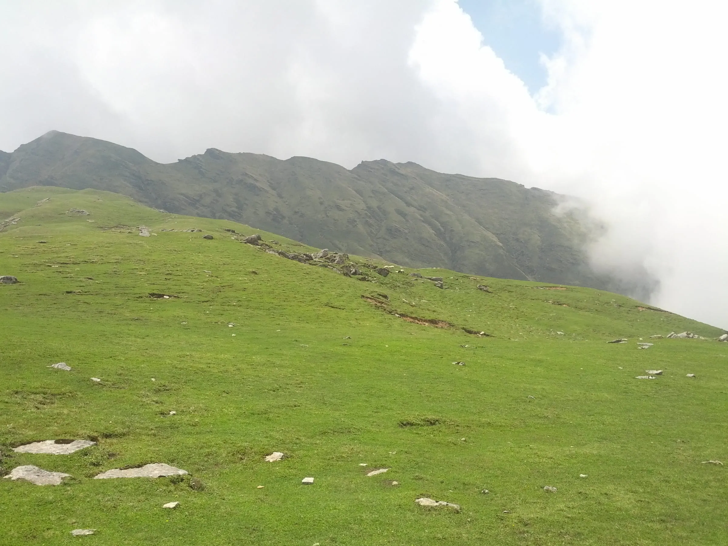
Khaliya Top is the full day out above Munsiyari, commonly quoted at about 3,500 m, with a meadow first and the open top above it.
The figures floating about, ten kilometres of trek, ten kilometres from Munsiyari, mix the drive and the walk into one number. The walk to the meadow and the top starts above the town, with Zero Point beyond the summit. How far a vehicle gets and how much is left on foot changes with the month, which is something we check for your dates rather than guess at here.
Tell us your dates and we will check how much of the Khaliya walk is on foot then.
Thamri Kund: the forest trail and what lives there
Thamri Kund is a small forest pond near Munsiyari, where local people are said to pray when the rains fail.
Where the walk starts is genuinely disputed. Some pages put the pond eight or nine kilometres before the town; others describe a forest trail of about 3 km above it. Until our own team has measured the road head, settle the start with someone local on the morning rather than with a website.
Char Dham Tours records that people come here to pray for rain in a drought, and the Biodiversity Board study lists Thamri Kund among the region's six sacred lakes, with Maheshwari Kund and Parvati Sarovar. Musk deer and a long bird list are reported for these forests by tourism pages and by the landscape study. Neither of them promises anyone a sighting.
How fit you need to be, and when snow changes the walk
Khaliya Top asks for a day of steady uphill walking rather than any technical skill, and from December to March snow and frost change it completely.
Munsiyari records 8 snow days in January and 28 frost nights; March still has 16 frost nights in the town. That is a different walk, with different shoes, and not one to start on a whim.
Our own trips treat it as a walk a family in reasonable shape can manage, and that is as far as any of us can judge it from here. Altitude is personal. A heart or lung condition, blood pressure you're treating, a recent surgery: talk to your own doctor first. The full FAQ sets out how these trips handle height.
Villages and hot springs below the town: Darkot and Madkot
Darkot is the weaving village near Munsiyari, with carved wooden houses; Madkot lies lower in the Gori Ganga valley and has the hot springs.
Darkot: weaving and what to buy
Carved wooden facades on the old houses. Darkot, below the town, is where Munsiyari's woollens are made: pashmina and sheep wool shawls.
Madkot: the hot springs and the drive down
The road below Munsiyari drops to the valley floor beside the Gori Ganga. Madkot is down there, with its hot springs.
Farther out: Milam Glacier, Chaukori, Narayan Ashram and Dharchula
Milam, Ralam and Namik are multi day treks, while Dharchula lies about 94 km on, with Narayan Ashram on the road above it.
Milam Glacier is sometimes listed beside a temple and a waterfall, as though it could be seen in a day. You cannot. Milam, Ralam and Namik are long walks with nights on the trail, and whether any registration or permit applies today is for the local administration to say. Chaukori is another name that comes up when people plan a Kumaon trip, and it sits back towards the plains rather than deeper in.
Dharchula lies about 94 km on from Munsiyari, where the roads up to the Darma valley and the Vyas valley for Adi Kailash begin. Narayan Ashram stands above Dharchula on the Tawaghat side, high enough to be its own day rather than a stop on the way through: what Narayan Ashram is, and how to reach it has the legs, the hours and how travellers are expected to behave there.
The same Panchachuli from Munsiyari and from Darma
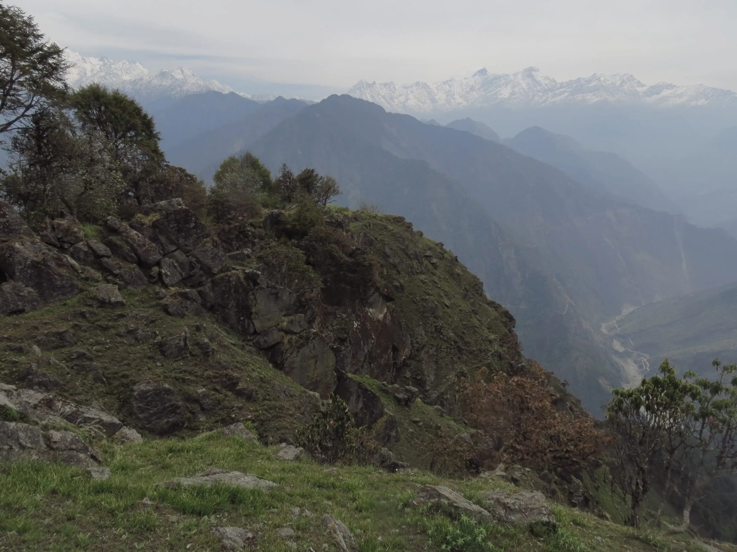
Munsiyari lines up all five peaks across the valley, while the Darma road reaches Dantu and the base camp walk, which puts the same peaks close overhead.
From Munsiyari it is the front face, the entire line at once, seen at distance from a town with hotels and a market. From Darma it is the other way round: the road carries on through Dharchula, about 94 km from the town, then climbs past Sobla, about 1,870 m, to Dantu at about 3,150 m. Less panorama, more mountain.
Either way it is one wall, looked at rather than climbed. For the drive itself, leg by leg, see how far Darma Valley is from Munsiyari and where the Darma road turns off.
Which month suits which sight
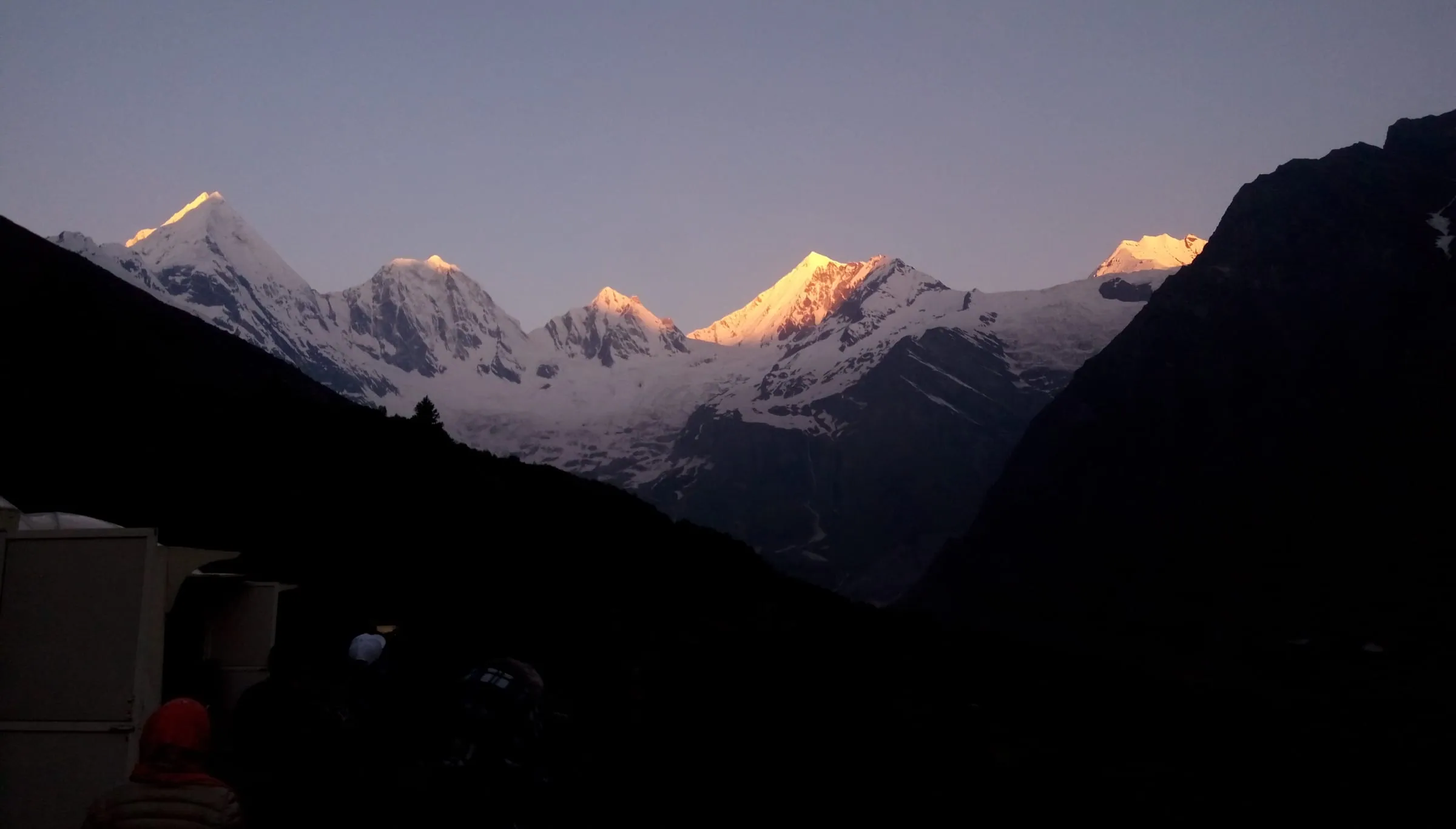
October and November give the clearest peaks, July and August the heaviest water at Birthi Falls, and December to March the snow that changes the Khaliya walk.
Munsiyari is often given one best month for the whole town. The sights do not work that way. The month that fills Birthi Falls is the month that hides the Panchachuli line, and the month that turns Khaliya into a snow walk is the one that empties the fall.
| Month | Day / night | Rain | Snow days | Frost nights | What it suits |
|---|---|---|---|---|---|
| April | 15°C / 4°C | 72 mm | 0 | 2 | Rhododendron on the ridge, walks opening up |
| May | 19°C / 7°C | 101 mm | 0 | 0 | Khaliya Top, the town sights, warm days |
| June | 21°C / 12°C | 315 mm | 0 | 0 | Green valley, rain building, peaks in and out |
| July | 21°C / 16°C | 837 mm | 0 | 0 | Heaviest rain of the year, Birthi Falls at full flow |
| August | 21°C / 15°C | 825 mm | 0 | 0 | Rain barely eases, the falls still heavy |
| September | 20°C / 12°C | 288 mm | 0 | 0 | Rain easing, the sky beginning to clear |
| October | 17°C / 5°C | 53 mm | 0 | 2 | Among the driest in the normals, the month for the viewpoints |
| November | 13°C / 1°C | 49 mm | 0 | 11 | Cold, dry, sharp views, frost at night |
Clear peaks
October and November are the driest months in Munsiyari's normals, 53 mm and 49 mm.
If the Panchachuli wall is the reason you are going, those two months are the ones with the least rain in the normals. November nights bite: 1°C in the town and 11 frost nights in the month. Carry a proper jacket for the view point in those months.
Full waterfall
July and August put the most water over Birthi Falls, and they are also the months that ask the most of your plan. If you travel then, keep the itinerary loose, keep a spare day, and expect the peaks to stay behind cloud for much of the trip.
Snow on Khaliya
Snow lies on Khaliya Top through winter, with Munsiyari itself recording 8 snow days in January and 28 frost nights.
December and February hold snow in the normals too. Walking up there in those months is a winter outing, planned as one, not a morning stroll with a flask.
How many days do you need, and a two night plan
Two nights cover the drive-in stops and one full day on Khaliya Top, with Birthi Falls on the road out; the 4-day trip from Haldwani adds a town day.
Start with the drive, because the drive decides it. Munsiyari is about 282 km from Kathgodam and about 623 km from Delhi, so a full day goes each way before you have seen anything at all.
Two nights: what fits
Two nights fit the drive-in stops, one full day on Khaliya Top, and Birthi Falls on the way out.
- Arrival day: Kalamuni Top and the ridge viewpoints on the road in, check in, then the Panchachuli View Point and a walk through the market.
- Full day: Khaliya Top and Zero Point, back in the town by evening.
- Departure morning: leave early and stop at Birthi Falls on the road down.
Three nights: what you can add
Spend a third night and you get the town day: Nanda Devi temple, the Tribal Heritage Museum, then Darkot. Take it instead for Thamri Kund, Maheshwari Kund or the drive down to the Madkot hot springs, and either way the Khaliya day stays whole. It is also the version that survives bad weather: if cloud takes the Khaliya morning you still have a day in hand.
How to get around between the sights
Whether shared jeeps or local taxis run between the sights is a question for the Adi Kailash Explore team, so ask before you plan a day without a vehicle. On our trips the vehicle and driver stay with you for the whole route, so your day is not decided by who else is going where.
Adi Kailash Explore runs Munsiyari two ways: 4 days from Haldwani at ₹14,400 a person, on the Khaliya Top trip page, and 5 days from Delhi at ₹20,400 a person, on the Delhi trip page. Both include the drive in each direction, stays, breakfast and dinner.
Munsiyari or Auli, Munsiyari or Nainital?
Auli is in Garhwal and Nainital is a lake town, while Munsiyari is a hill town under a snow wall.
Auli and Munsiyari are not really competing for the same trip. Munsiyari gives you the mountain from your window and a meadow to walk up to. Both questions are taken further in the Munsiyari trip guide.
Nainital is the easier question. Munsiyari lies about 261 km beyond Nainital on the same journey. If your family wants a comfortable lake break, stop at Nainital. If they want a Himalayan skyline and a morning of walking, keep driving.
Questions travellers ask
Small tickets are reported at some of them, and none of the figures circulating online carries a date, so treat every one as unconfirmed. Birthi Falls, the tulip plot and eco park, and the Tribal Heritage Museum are the three where a fee or a timing comes up. The museum is in a private house, so its hours and walk-in access are not something to assume. Message the Adi Kailash Explore team before you build a morning around any of them.
Kainchi Dham sits on the Nainital side of Kumaon, well before Munsiyari on the drive up: the Nainital to Munsiyari road alone runs about 261 km. Send your route and dates to the Adi Kailash Explore team and they will tell you what the detour adds to that day.
Khaliya Top is a day out above the town with no technical ground, and Zero Point lies beyond the top. Fitness matters more than skill, and the month decides how much snow is lying on the meadow. The fitness and altitude note in the walks section above says plainly who should speak to a doctor before booking.
For families with children, Adi Kailash Explore points to Munsiyari: lower than the border valleys, mostly driven, with one morning of walking. The temple walk and the Khaliya morning are the parts to judge, and the fitness note above covers the health questions to settle first.
Munsiyari has no railway station and no airport, so the last stretch is always road: about 282 km from Kathgodam, the railhead beside Haldwani, and about 285 km from Haldwani itself. Tanakpur is the nearest railhead for the Pithoragarh side of the district, not for Munsiyari. Travellers also fly into Pantnagar, on the plains near Haldwani. Naini Saini at Pithoragarh is the nearest airport to Pithoragarh, Dharchula and the border valleys. Its scheduled flights come and go. A Delhi flight landed there in November 2024. A Dehradun service restarted in March 2026.
How we made this guide
The figures on this page are filled in from data each time it is built, never typed by hand: prices, days and nights from our package pages; road distances from OpenStreetMap, measured by a router (retrieved 22 September 2026); heights from the Copernicus 90 m elevation model; temperatures from 30-year ERA5-Land climate normals, modelled rather than measured at a weather station. Checked by Deepak Yadav. If anything here is out of date, tell us on WhatsApp and we will correct it.
- Munsiyari & Khaliya Top: itinerary and price
- Munsiyari from Delhi: itinerary and price
- OpenStreetMap contributors, routed with OSRM: road distances · retrieved 22 September 2026
- Copernicus GLO-90 elevation model, via Open-Meteo (heights given as about) · retrieved 24 September 2026
- ERA5-Land climate normals 1991–2020, ECMWF, via Open-Meteo · retrieved 22 September 2026
- Kailash Sacred Landscape Conservation and Development Initiative: Study on Science-Policy Interface focussing on Access and Benefit Sharing and Trans-boundary Issues, Uttarakhand Biodiversity Board, Dehradun
- Maheshwari Kund, Munsiyari, allseasonsz.com
- Maheshwari Kund in Munsiyari, chardhamtours.in
- Thamri Kund in Munsiyari, chardhamtours.in
About Adi Kailash Explore
Adi Kailash Explore (adikailash.io) is a tour operator based in Pithoragarh, Uttarakhand, that specialises in one route: Adi Kailash and Om Parvat, the Darma valley and Munsiyari. It runs departures from Delhi, Haldwani and Pithoragarh, and its team files the Inner Line Permit for every Adi Kailash traveller at SDM Dharchula. It is recognised by Uttarakhand Tourism, certified by MSME, Govt. of India (UDYAM-UK-09-0012927) and verified on the NIDHI Portal, and was founded by Vinay Verma. Why travel with us
Keep reading
All postsMunsiyari18 min readMunsiyari Weather Month by Month, and When Does It Snow?
Munsiyari temperature runs from 7°C days and -4°C nights in January to 21°C in June. Adi Kailash Explore chart every month, with snow days for each.Munsiyari11 min readMunsiyari, Uttarakhand: The Range You See Is Panchachuli
A Munsiyari trip runs 4 days from Haldwani at ₹14,400 a person, or 5 days from Delhi. Adi Kailash Explore include the Khaliya Top morning.Munsiyari18 min readHow to Reach Munsiyari from Delhi, Leg by Leg
No airport and no railway station, so how to reach Munsiyari is a road question: about 261 km from Nainital. Adi Kailash Explore name the hours per leg.The day-by-day plan
Get the Munsiyari itinerary for free.
4 days and 3 nights from Haldwani, day by day on WhatsApp.Munsiyari from Haldwani: 4 days and 3 nights, day by day, sent on WhatsApp. Share it with your family, then ask us anything.
One WhatsApp message. Free, in Hindi or English.Or call +91 76688 58311 · Hindi or English
Munsiyari from Haldwani
4 days, 3 nights · day by day
- Haldwanistart
- Munsiyari
- Khaliya Top
- Tribal Museum
- Darkot
- Birthi Falls
- Back to Haldwani
