Munsiyari18 min read
The drive to Munsiyari from Delhi, leg by leg, with the kind of road each one is
Munsiyari has no airport and no railway station, so every traveller arrives by road: about 623 km from Delhi, about 282 km from Kathgodam and about 261 km from Nainital, all measured on OpenStreetMap. The road in runs through Almora, Bageshwar and Thal, then climbs Kalamuni Top and drops into town. The last stretch is the one that eats the day.
By Nivedita Verma, of the Adi Kailash Explore teamAsk us on WhatsApp
TL;DRThe post in 5 lines
- The town has no runway and no railway line of its own, so the figures that matter are road ones: about 623 km from Delhi and about 282 km from Kathgodam station.
- Kathgodam station, beside Haldwani, and Pantnagar airport, on the plains near Haldwani, are the arrival points for a Munsiyari trip, leaving one full driven day up through Almora, Bageshwar and Thal.
- Nainital to Munsiyari is about 261 km by road. From Pithoragarh it's about 125 km.
- Adi Kailash Explore drives this road in 4 days from Haldwani and 5 days from Delhi, so the day split here is a working plan.
- Rain and snow decide the drive: on the 1991 to 2020 normals Munsiyari runs 837 mm of rain in July and 8 snow days in January, when Kalamuni Top can block.
Key facts
- Location
- Gori valley, Pithoragarh district, Uttarakhand
- Distance from Delhi
- About 623 km by road
- Distance from Kathgodam
- About 282 km
- Distance from Haldwani
- About 285 km
- Distance from Nainital
- About 261 km
- Distance from Pithoragarh
- About 125 km
- Railheads
- Kathgodam, beside Haldwani, about 282 km from Munsiyari by road; Tanakpur, the other railhead, is nearer Pithoragarh (about 147 km) and Dharchula (about 238 km) than Kathgodam is (about 183 km and about 273 km)
- Nearest airport
- Pantnagar, on the plains near Haldwani
- Trips we run
- 4 days from Haldwani, 5 days from Delhi
How do you reach Munsiyari?
Munsiyari is reached only by road: rail to Kathgodam or Tanakpur, or a flight to Pantnagar, then one driven day by way of Almora, Bageshwar, Thal and Kalamuni Top.
No railway line comes anywhere near Munsiyari, and there is no airstrip. Everyone arrives in a vehicle, on a road that leaves the Kumaon plains and keeps climbing for most of a day. From Delhi that is about 623 km. Start at Kathgodam station, next door to Haldwani, and it is about 282 km.
The total is not what decides your plan. Where the road slows is. The plains and the lower hills are ordinary driving, and then the road above Thal narrows, turns and stays that way to the end.
Where is Munsiyari, and which road reaches it?
High above the Gori in Uttarakhand's Pithoragarh district, Munsiyari is reached by road: Almora and Bageshwar first, then Thal, Birthi and the climb over Kalamuni Top.
The town runs along a ridge, with the Panchachuli peaks in view and the Khaliya meadow on the slope above. Our climate normals for Munsiyari are modelled at an elevation of 2,155 m. That is hill-town height: cold after dark for much of the year, and not an altitude that poses a problem for most people.
Why does the last stretch take so long?
The final leg above Thal and Birthi is narrow mountain road, and that is what makes it the slow part of the journey.
Look at the climb rather than the kilometres. Delhi stands at 221 m, Haldwani at 424 m and Almora at 1,642 m, and Munsiyari is higher again on the modelled figure. All of that height is gained on narrow hill road.
Delhi to Munsiyari: distance, route and how long it really takes
Delhi to Munsiyari runs about 623 km by road, through Kathgodam, Almora and Bageshwar, then Thal, Birthi and Kalamuni Top.
How far is Munsiyari from Delhi by road?
Munsiyari is about 623 km from Delhi by road, one measured figure for the route through Kathgodam and Almora.
You will see other numbers for this pair, and they are not all wrong. Ours is one measured road distance for one route, retrieved 22 September 2026, with the method stated beside it.
Can you drive Delhi to Munsiyari in one day?
Day 1 of the Munsiyari trip Adi Kailash Explore runs from Delhi does it in one go: an early start out of Delhi, the town by evening, with no hours per leg published here.
It is a long day, and local drivers on this road plan to be through the last stretch in daylight rather than after dark. If you are taking your own car up from the plains for the first time, break it.
Where to break the journey: Kathgodam, Almora, Bageshwar or Chaukori
Travellers splitting the drive spend the first night around Almora, Bageshwar or Chaukori, then finish the climb to Munsiyari the next morning.
Almora, Bageshwar and Chaukori are the halts on this line, though we hold no measured road distance from any of them to Munsiyari. Kathgodam and Haldwani suit you if you are coming up by train rather than driving from Delhi.
Which route is best from Delhi?
The line runs Delhi, Haldwani and Kathgodam, then Almora and Bageshwar, Thal and Birthi, and the Kalamuni climb into town.
There is a second way in, through Tanakpur and Pithoragarh, which comes at Munsiyari from the east. It is a genuinely different road, lower and warmer for most of its length, and it suits travellers combining Munsiyari with Pithoragarh or the border valleys. For a straight Delhi to Munsiyari run, the Almora line is the one this post follows.
The drive leg by leg, and what kind of road each one is
The drive breaks into four honest parts: plains to Kathgodam, hills to Almora, the ridge road to Bageshwar and Thal, then the narrow climb over Kalamuni Top.
Delhi to Kathgodam: the plains stretch
Delhi to Kathgodam is about 292 km on highway and plains road, the plains stretch of the journey before any hill driving begins.
Nothing about this leg is mountain driving. Leave Delhi early enough to be through the plains before the day thickens, and treat Kathgodam or Haldwani as the point where the trip actually begins.
Kathgodam to Almora: where the hills start
Above Kathgodam the road begins climbing at once, past Bhimtal and Kainchi Dham towards Almora.
Watch the heights climb as you go.
| Place on the drive | Height |
|---|---|
| Delhi | 221 m |
| Haldwani | 424 m |
| Bhimtal | About 1,350 m |
| Kainchi | 1,400 m |
| Almora | 1,642 m |
Almora to Bageshwar to Thal
Beyond Almora the road runs along ridges and drops into river valleys through Bageshwar to Thal.
Thal is the hinge of the whole journey. After Thal you are on the last stretch, and that is a different kind of driving.
Thal to Birthi to Kalamuni Top: the last and slowest stretch
From Thal the road climbs through Birthi and over Kalamuni Top to Munsiyari on narrow mountain road, the slowest leg of the drive.
Birthi Falls comes in on this leg, which is why it appears on the way out of our itineraries as well. Above Birthi the road works up to Kalamuni Top, the high point of the approach, then drops towards the town with the Panchachuli range in view. Plan to be through here in daylight.
We publish the distances we have measured and no others, so the intermediate legs above are described without figures rather than estimated. The same holds for driving hours: they depend on the month, the traffic and the state of the road.
How far is Munsiyari from Kathgodam, Haldwani, Nainital and Pithoragarh?
Kathgodam is about 282 km from Munsiyari, Haldwani about 285 km, Nainital about 261 km and Pithoragarh about 125 km, each figure a road distance.
| From | km (OpenStreetMap) | The road it uses |
|---|---|---|
| Delhi | 623 | Kathgodam, Almora, Bageshwar, Thal, Kalamuni Top |
| Kathgodam | 282 | the railhead leg of the same road |
| Haldwani | 285 | joins the Kathgodam road immediately |
| Nainital | 261 | |
| Pithoragarh | 125 | the eastern approach, with no Almora leg |
| Dharchula | 94 | for travellers coming from the Vyas or Darma valley |
Kathgodam and Haldwani to Munsiyari
Station and town sit right next to one another, so the drive works out much the same either way: about 282 km from Kathgodam, about 285 km from Haldwani.
If you arrive by train or flight, this is your real distance, and it is one driven day. Our Haldwani trip is built on it: day 1 goes straight up, with the check-in, the Panchachuli view point and the market at the end of it.
Nainital and Almora to Munsiyari
Nainital to Munsiyari is about 261 km by road.
Nainital is a start people ask about often, which is why the measured road distance from it is given here.
Pithoragarh and Tanakpur to Munsiyari: the eastern approach
Pithoragarh to Munsiyari is about 125 km by road, the shortest of the measured figures here, used by travellers coming up through Tanakpur or down from the border valleys.
By road Tanakpur is the nearest railhead to Pithoragarh, about 147 km, against about 183 km from Kathgodam. That approach stays low and warm for a long time: Pithoragarh, at 1,645 m, sees May days around 26°C against 19°C at Munsiyari, so the climb comes late on it.
Dehradun to Munsiyari: why this one is longer than it looks
Dehradun to Munsiyari means crossing Uttarakhand from west to east, and it is a drive we have not measured.
Munsiyari sits at the far eastern end of the state and Dehradun at the western end.
How to reach Munsiyari by train
Kathgodam, beside Haldwani, is one of two railheads for Munsiyari, about 282 km from the town by road; Tanakpur is the other and sits nearer Pithoragarh and Dharchula.
Which railway station is closest to Munsiyari?
Trains for Munsiyari run to Kathgodam, the station next door to Haldwani, leaving about 282 km of road into the town, with Tanakpur the other railhead on the eastern side.
Neither is close in hill terms. From Kathgodam a full driven day still lies ahead, so the train is the way to take the plains out of your trip, not the way to arrive.
How to reach Munsiyari by train from Delhi
Trains run from Delhi to Kathgodam, and the road leg up to Munsiyari fills the day after arrival.
Check which trains run on your own dates before you plan around one. What matters for planning is the shape: reach Kathgodam in the morning, go straight into a vehicle, and Munsiyari comes that evening.
Kathgodam or Tanakpur: which railhead suits your start
Kathgodam suits the Almora route to Munsiyari; Tanakpur suits travellers heading for Pithoragarh and Dharchula, being nearer both by road.
Tanakpur is about 147 km from Pithoragarh and about 238 km from Dharchula, so a traveller pairing Munsiyari with the border valleys may come or go that way. For Munsiyari alone, the road distance given here is measured from Kathgodam.
Getting from the station to Munsiyari
From Kathgodam the options are a booked vehicle or the bus and shared jeep chain in stages.
Our Haldwani trip starts in this area and goes up the same morning, so the road day is planned rather than assembled at the stand. If you are travelling independently, book a car the night before.
How to reach Munsiyari by air, and is there a helicopter?
For a Munsiyari trip you fly into Pantnagar, out on the plains near Haldwani. Naini Saini at Pithoragarh has had scheduled flights come and go.
What is the nearest airport to Munsiyari?
Pantnagar is the working airport for Munsiyari, sitting on the plains near Haldwani, so the road leg is the Haldwani one, about 285 km, plus the run in from the airport, which is not measured here.
Naini Saini serves Pithoragarh town, which is about 125 km from Munsiyari by road; we hold no measured distance for the stretch from the airfield into the town. A first Delhi flight landed there on 7 November 2024. A Dehradun link followed on 26 March 2026. It flew a 42-seat aircraft, three days a week. The scheduled service has come and gone. Check what is actually flying on your dates before you build a plan on it.
How to reach Munsiyari from Mumbai, Bangalore or Kolkata
Travellers from other cities fly to Delhi or Pantnagar and then cover the road leg by car, since no flight reaches Munsiyari itself.
- Fly into Delhi, take a train to Kathgodam, and drive up the next day.
- Fly into Pantnagar, on the plains near Haldwani, and check what is actually flying on your dates before you plan the road leg.
- Fly into Delhi and join a road trip from there, the way our 5-day Delhi itinerary is built.
Is there a helicopter to Munsiyari?
No scheduled helicopter service to Munsiyari can be confirmed: seasonal and charter flights are mentioned by operators and news pages, but not as a seat a traveller can book like a flight.
We will not sell you a seat on something we cannot verify. As of 27 September 2026 we hold no confirmation that a Haldwani or Pithoragarh to Munsiyari helicopter is flying on a published schedule, and the honest advice is to treat any such offer as a charter enquiry and to check with the state civil aviation authority before money changes hands. Plan the road. Treat a helicopter as a bonus if one exists on your dates.
Munsiyari by bus and shared jeep
Munsiyari is reached by bus and shared jeep in stages through Haldwani, Almora or Bageshwar, or from Pithoragarh, with no direct Delhi to Munsiyari service confirmed.
Is there a direct bus from Delhi to Munsiyari?
No direct Delhi to Munsiyari bus can be confirmed; travellers reach Haldwani or Kathgodam first and continue from there in stages.
Travellers reach Haldwani or Kathgodam first, and we do not publish services or timings on the plains leg that we have not checked ourselves. Beyond that, the hill legs move with the season and the road.
The bus and jeep chain, hub by hub
The public transport chain runs Delhi to Haldwani, Haldwani to Almora, Bageshwar or Pithoragarh, then a shared jeep over Thal and Kalamuni Top into Munsiyari.
- Delhi to Haldwani or Kathgodam, the plains leg.
- Haldwani to Almora, Bageshwar or Pithoragarh by bus.
- The hill town to Munsiyari by shared jeep, the last and slowest leg.
What a shared jeep day is like
Shared jeep times on this road are not published here, so plan on the whole day belonging to the journey.
It is a fine way to travel if you are on your own, unhurried and happy to change vehicles twice. It is a hard way to travel with elderly parents, small children or a lot of luggage, and a booked vehicle for the hill legs answers that.
When the road is hard: monsoon, snow and the way round
Two things change this drive: monsoon rain, which brings landslide risk below Thal from June to September, and winter snow, which can block the Kalamuni Top stretch, January carrying the most snow days at Munsiyari on the normals.
| Month | Rain | Snow days | Frost nights |
|---|---|---|---|
| January | 146 mm | 8 | 28 |
| March | 118 mm | 0 | 16 |
| May | 101 mm | 0 | 0 |
| July | 837 mm | 0 | 0 |
| September | 288 mm | 0 | 0 |
| October | 53 mm | 0 | 2 |
| December | 64 mm | 2 | 23 |
Monsoon: landslides and what to check before you start
Munsiyari's normals put the heaviest rainfall in July, 837 mm, and August, 825 mm, and rain of that weight is what shuts the road below Thal; checked on 27 September 2026.
The risk is being on that narrow stretch at dusk. The rain is not confined to the top either, with Pithoragarh recording 716 mm in July, so the lower approaches take their share.
Before you start the hill day, ask at your hotel, ask a driver who came down that morning, and message us.
Snow at Kalamuni Top, and the way round
Kalamuni Top sits above the town, so snow lies there when Munsiyari itself is clear: December to February carry the snow days, January the most at 8.
After heavy snowfall the Kalamuni stretch can stay shut until it is cleared, and we publish no alternate approach, because we have not verified one we would put a guest car on. We check before we commit a vehicle, and we name no route as blocked or open in advance.
Is night driving on this road a bad idea?
Driving the Thal to Kalamuni stretch after dark is avoided by local drivers: the road is narrow and unlit, and rain leaves debris that headlights find late.
Plan every hill day to finish before sunset, and if you are running late, stop at Bageshwar instead of pushing on. Month by month temperatures and the rain pattern are set out in our Munsiyari temperature and best time guide.
What is the easiest way to get to Munsiyari?
The easiest way is a train or flight into the Kathgodam and Haldwani area, then one driven day up with a driver who knows the Thal to Kalamuni stretch.
The easiest plan if you drive yourself
Self-drivers do best leaving Delhi before first light, sleeping at Almora, Bageshwar or Chaukori, and taking the Thal to Kalamuni climb fresh the next morning.
Two drivers, and no ambition to arrive the same night. On the way back the same split works in reverse, and it leaves room for Birthi Falls without a rush.
The easiest plan if you come by train or flight
A train to Kathgodam or a flight to Pantnagar, then a pre-booked vehicle the same morning, puts a traveller in Munsiyari by evening with one road day.
That is the shape of Munsiyari & Khaliya Top, our 4-day trip from Haldwani at ₹14,400 a person: up on day 1, Khaliya Top and Zero Point on day 2, then the Nanda Devi temple, the tribal museum and Darkot on day 3, with Birthi Falls on the way down. Prefer to begin in the city? The 5-day Munsiyari from Delhi trip drives up from Delhi and keeps the return night for Pithoragarh.
With elderly parents or small children
Munsiyari is a hill town, so the drive itself poses no altitude problem for most travellers, but the long road day and the cold nights need planning for.
Split the drive, take a private vehicle instead of shared jeeps, and keep the arrival day light. The climb to Khaliya Top the next morning is a real trek on a meadow trail, and a family in ordinary walking shape can do it in a morning. For anything personal, a heart or lung condition, recent surgery, a pregnancy, ask your own doctor before you book, and tell us so we can shape the days around it.
Fitting Munsiyari into a longer Kumaon trip
Munsiyari sits about 94 km from Dharchula, so the border valleys can come before or after it, with Kausani, Chaukori and Jageshwar the halts on the way in.
Dharchula lies about 94 km from Munsiyari and Pithoragarh about 125 km, which puts Adi Kailash, Om Parvat and the Darma valley on one long eastern loop with Pithoragarh as the joint between them. From Delhi, Dharchula is about 570 km and Gunji about 648 km, so the loop wants days rather than a weekend, and east of Dharchula it wants an Inner Line Permit as well. For how the combination runs, night by night, and what the shortest honest version costs you, read Adi Kailash and Darma Valley in one trip, night by night.
On the way in from Kathgodam, Kausani, Chaukori and Jageshwar are the halts travellers add, Jageshwar standing at 1,870 m and Kainchi Dham at 1,400 m.
Questions people ask before they book
Munsiyari reads best on the figures in April, May and again in October, and is known for the Panchachuli view and the Khaliya meadow.
Which month is best for Munsiyari?
April to June and October read best on the normals: no snow days, and Munsiyari days near 19°C in May and 17°C in October.
March is lovely and still cold at night, with 16 frost nights on the normals. July and August are for people who like rain and cloud, and who do not mind losing a view for a day. The full month by month picture is in our Munsiyari weather guide.
Which is better, Auli or Munsiyari?
Auli and Munsiyari are on different roads, so the choice follows the route you are already taking rather than any ranking of the two.
Munsiyari belongs to Kumaon: a working hill town with the Panchachuli peaks in front of it, a meadow walk above, and Darkot on its sightseeing day. If you are already coming towards Nainital, Almora or Pithoragarh, Munsiyari is the one on your road.
What is Munsiyari famous for?
Munsiyari draws travellers for its Panchachuli view, the Khaliya Top walk, the shawls woven at Darkot, Birthi Falls and the museum of Rung and Shauka life.
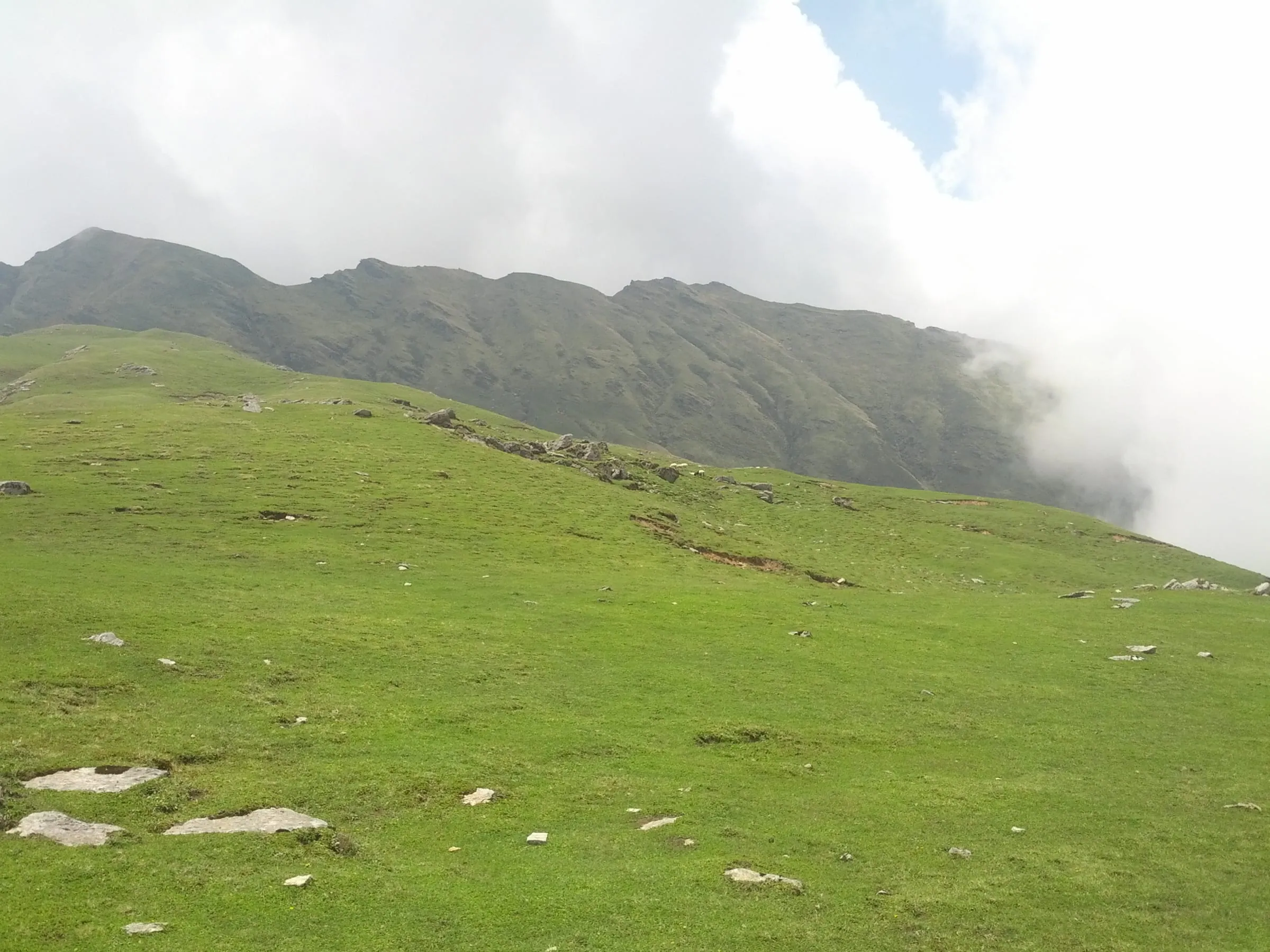
The town works as a base rather than a viewpoint, with Darkot, the museum and Khaliya Top all reached from it. More about the place itself, its stays and its days is in our Munsiyari town guide.
Do you need a permit for Munsiyari?
The Inner Line Permit's scope is the Vyas and Darma valleys east of Dharchula, and it does not extend to Munsiyari itself.
Carry a government photo ID for hotel check-in. Carrying on into the border valleys? Then you'll need the permit, and the Inner Line Permit guide walks through every paper it asks for.
Questions travellers ask
Four days from Haldwani or five from Delhi, counting the drive in both directions. That is how the two Munsiyari trips we run are built, which leaves two clear days in the town. Fewer days and the road eats the trip.
Transport for the full route is included from the city each package names, Haldwani or Delhi, and you are dropped back at the same point. Whether the meeting point on those dates is the railway station, the airport or the hotel comes in writing alongside the seat confirmation, so share the train or flight details and the pickup will be set around them.
Yes, and it's the trip Adi Kailash Explore suggests for families with children. The town sits at hill-town height, and the walk to Khaliya Top is a genuine trek rather than a hard one. The long road day is the part to plan for, so break it, keep food in the car, and pack warm layers for the evenings whatever the month. As things stand today, no child rate is listed separately.
The town is lived in all year, but the drive changes in those months. January carries 8 snow days and 28 frost nights on the normals, and the Kalamuni Top stretch sits higher than the town. If snow is what you have come for, come knowing the road may not run to plan. Ask us before you book winter dates.
How we made this guide
The figures on this page are filled in from data each time it is built, never typed by hand: prices, days and nights from our package pages; road distances from OpenStreetMap, measured by a router (retrieved 22 September 2026); heights from Wikidata, the Copernicus 90 m elevation model and the heights this site publishes; temperatures from 30-year ERA5-Land climate normals, modelled rather than measured at a weather station. If anything here is out of date, tell us on WhatsApp and we will correct it.
- Munsiyari & Khaliya Top: itinerary and price
- Munsiyari from Delhi: itinerary and price
- OpenStreetMap contributors, routed with OSRM: road distances · retrieved 22 September 2026
- Wikidata: published elevations · retrieved 24 September 2026
- Copernicus GLO-90 elevation model, via Open-Meteo (heights given as about) · retrieved 24 September 2026
- ERA5-Land climate normals 1991–2020, ECMWF, via Open-Meteo · retrieved 22 September 2026
- The Hindu: first commercial flight lands at Naini Saini airport (7 November 2024)
- ThePrint: Dehradun to Pithoragarh flight service flagged off (26 March 2026)
About Adi Kailash Explore
Adi Kailash Explore (adikailash.io) is a tour operator based in Pithoragarh, Uttarakhand, that specialises in one route: Adi Kailash and Om Parvat, the Darma valley and Munsiyari. It runs departures from Delhi, Haldwani and Pithoragarh, and its team files the Inner Line Permit for every Adi Kailash traveller at SDM Dharchula. It is recognised by Uttarakhand Tourism, certified by MSME, Govt. of India (UDYAM-UK-09-0012927) and verified on the NIDHI Portal, and was founded by Vinay Verma. Why travel with us
Keep reading
All postsMunsiyari18 min readMunsiyari Weather Month by Month, and When Does It Snow?
Munsiyari temperature runs from 7°C days and -4°C nights in January to 21°C in June. Adi Kailash Explore chart every month, with snow days for each.Munsiyari11 min readMunsiyari, Uttarakhand: The Range You See Is Panchachuli
A Munsiyari trip runs 4 days from Haldwani at ₹14,400 a person, or 5 days from Delhi. Adi Kailash Explore include the Khaliya Top morning. Adi Kailash12 min read
Adi Kailash Route: Delhi to Jolingkong, Leg by Leg
How to reach Adi Kailash means driving, not trekking: the road runs to Jolingkong at about 4,500 m. Adi Kailash Explore note where the short walks begin.The day-by-day plan
Get the Munsiyari itinerary for free.
4 days and 3 nights from Haldwani, day by day on WhatsApp.Munsiyari from Haldwani: 4 days and 3 nights, day by day, sent on WhatsApp. Share it with your family, then ask us anything.
One WhatsApp message. Free, in Hindi or English.Or call +91 76688 58311 · Hindi or English
Munsiyari from Haldwani
4 days, 3 nights · day by day
- Haldwanistart
- Munsiyari
- Khaliya Top
- Tribal Museum
- Darkot
- Birthi Falls
- Back to Haldwani