Darma Valley13 min read
Panchachuli, the five peaks of Kumaon: a mountain you look at rather than climb
Panchachuli is one massif with five summits in Pithoragarh district, the highest of them 6,904 m. You look at this mountain, not climb it. Two valleys watch it from opposite sides: Munsiyari from the west, Dugtu and Dantu in Darma from the east. The name means five hearths, and the story behind it was already in print by 1886.
By Deepak Yadav, of the Adi Kailash Explore teamAsk us on WhatsApp
TL;DRThe post in 5 lines
- Panchachuli has two faces: Munsiyari looks at the western side, and Dugtu and Dantu in the Darma valley stand under the eastern one.
- Panchachuli II is the highest of the five summits at 6,904 m, and Panchachuli III is still unclimbed, on the record Wikipedia carries.
- The name Panchachuli reads as pancha and chuli, five hearths: in the valley they tell of the Pandavas' last meal before the climb towards heaven.
- Adi Kailash Explore drives the Darma side, 6 days from Haldwani and 6 days from Delhi, with two nights at Dantu, about 3,150 m.
- Munsiyari's normals give 837 mm of rain in July against 53 mm in October, so the months after the monsoon are the dry ones.
Key facts
- Location
- Pithoragarh district, Uttarakhand, on the Gori Ganga and Darma Ganga divide
- Peaks
- Five summits on one massif, numbered Panchachuli I to V
- Highest peak
- Panchachuli II, 6,904 m
- Still unclimbed
- Panchachuli III
- Seen from
- Munsiyari on the western side; Dugtu and Dantu in Darma on the eastern side
- Darma road
- Dharchula to Sobla, about 37 km, with Dantu at about 3,150 m
What is Panchachuli, and where is it?
Panchachuli is one massif carrying five summits, at the eastern end of Kumaon between the Gori Ganga and the Darma Ganga.
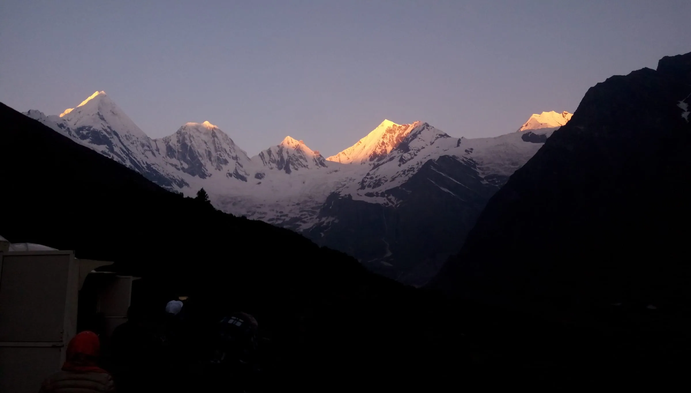
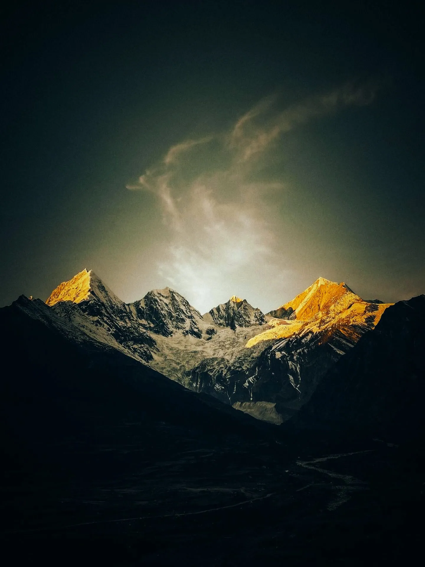
From Munsiyari on a clear morning, the eastern skyline belongs to one mountain: Panchachuli. It stands at the eastern end of Kumaon, in Pithoragarh district. The divide it sits on separates the Gori Ganga from the Darma Ganga. Five summits, one massif.
So the mountain has two front rows. Munsiyari's ridge watches the western side, and the road from Munsiyari down to Dharchula runs about 94 km. From Dharchula the other side begins: up the Darma valley, past Sobla, to Dugtu and Dantu under the eastern face.
This is border country, which is why the permit question comes up at all.
Is Panchachuli one mountain or five?
One massif, five summits, numbered I to V.
Climbers count five, because each summit counts on its own. A traveller sees one wall with five high points on it. Both readings are right, and the numbering keeps them straight.
Is Darma Valley and Panchachuli the same thing?
No: Darma is the valley of Rung villages below the massif, and Panchachuli is the mountain at its head.
The names blur because the trip to the mountain gets sold under the valley's name, and the valley under the mountain's. Darma is the inhabited part: the road up the Dhauli Ganga, the fields, the homestays at Dugtu and Dantu. Panchachuli is the skyline over all of it. The valley has its own guide.
How high is Panchachuli, and which peak is the highest?
Panchachuli II is the highest of the five at 6,904 m, on the heights Wikipedia's article lists.
Panchachuli II is the high one, at 6,904 m. The other four stand between 6,312 m and 6,437 m, close enough that from a distance the group reads as a single wall. Wikipedia's article runs through them summit by summit, each height with its own citations. That list is as close to an agreed record as the massif has.
| Peak | Height | First ascent |
|---|---|---|
| Panchachuli I | 6,355 m | ITBP, 1972 |
| Panchachuli II | 6,904 m | ITBP, 26 May 1973 |
| Panchachuli III | 6,312 m | Unclimbed |
| Panchachuli IV | 6,334 m | New Zealand team, 1995 |
| Panchachuli V | 6,437 m | Indo-British expedition, 1992 |
Panchachuli peaks names: why they are numbers
The published record numbers them I to V and gives no individual names.
Five summits, five numerals, and not one agreed name between them. Some tellings online hand the peaks the names of the five Pandava brothers. The Rung families of Darma may have their own words for the tops they live under, and that's a question for your hosts at Dugtu and Dantu.
Which of the five fills your camera comes down to where you stand, so ask the guide beside you.
Why the base camp height is quoted three different ways
Trek listings put the base camp at 3,960 m, at 4,100 m and at 4,260 m, so no single figure deserves your trust.
Same walk, three heights. What helps more is the ground under it. Sobla, where the Darma road climbs away from the river, sits at about 1,870 m. Dantu, where you sleep, is at about 3,150 m. The walk above the village adds to that, and how much it adds depends on whose listing you're reading.
Why is it called Panchachuli?
Panchachuli reads as pancha and chuli, five hearths, and the valley tells of the Pandavas' last meal.
The story, as it is told in these valleys, is about a meal. The Pandava brothers stopped here on their last journey, before the climb towards heaven. They built five hearths to cook on. The five summits are those hearths.
Dainik Jagran carried that telling in 2022, in a report by O. P. Awasthi: the brothers ate here before going on, and the name followed. The report credits the Manas Khand for the story. That attribution we cannot confirm.
What does Panchachuli mean?
Pancha is five and chuli is a hearth: five hearths.
Sherring, writing in 1906, glossed it more plainly: the Five Peak range, with no legend attached. Atkinson's 1884 volume summarises a mountain called Panchasira, the five-headed one, from the Manas Khand, and identifies it with Panch-chuli. So the name has been read both ways for well over a century.
What the oldest printed accounts say
The traveller Madden described the view from Naini Tal, and the gazetteer reprinted his description in 1886. In it he names the Panch-chula, the five cooking places used by the Pandavas. That is the oldest written trace of the belief we can put a date on. Madden was writing down what people already said about the group: read it as a record of the story, not a proof of it.
Harish Kapadia, walking these valleys in 1983, wrote of a Panch Chuli temple near Duktu, one of the two villages under the eastern face. Ask your hosts about it when you're there.
Other tellings go further, into households and rituals on the mountain. Nobody we can cite stands behind those.
Five hearths, not five Kailash
Panchachuli is not one of the Panch Kailash peaks, which stand in Tibet, Uttarakhand and Himachal Pradesh.
The two fives get mixed up often, and it's an easy mistake: both are groups of five in the same Himalaya. Different sets, different meanings, different roads. The Kailash five have their own guide.
Why is Panchachuli famous?
Panchachuli is known for the skyline it gives Munsiyari, for the hearths legend, and for one unclimbed summit.
The view comes first. Munsiyari looks straight at the group, and it is why the town's mornings start early. The hearths story does the rest of the work.
Climbers added the last part. A 1992 Indo-British expedition to Panchachuli V put two well-known Himalayan names on the group, and a New Zealand team climbed Panchachuli IV in 1995. The third summit stayed untouched. A mountain nobody has stood on advertises itself.
Where can you see the Panchachuli peaks from?
Munsiyari looks at the western face of Panchachuli, and Dugtu and Dantu in Darma face the eastern side.
Both sides give you the same mountain and a very different day. One is a town you drive into and look out from. The other is a village at the end of a valley road, with homestays and thin air. Sunrise is the hour on both.
From Munsiyari: the western face
Munsiyari shows the western side from the town, with no inner line permit and no high night to sleep through.
At Munsiyari the peaks sit on the town's horizon. That's the appeal: you arrive, you sleep in the town, and the mountain is there in the morning. The drive in runs about 282 km from Kathgodam, or about 623 km from Delhi.
Which of the viewpoints need a walk, and which don't, is set out in places to visit in Munsiyari.
From Dugtu and Dantu in Darma: the eastern face
Dugtu and Dantu stand under the eastern side, and Dantu sits at about 3,150 m.
The Darma side asks more of you. You leave the river at Sobla, about 1,870 m, and sleep at Dantu, about 3,150 m, the same day. Nights are homestay nights with Rung families. The peaks are close on this side. Where your host sends you to stand for sunrise is a question for the evening you arrive.
Munsiyari or Darma: which side for which traveller
Munsiyari suits travellers who want the view with the least altitude and paperwork; Darma suits those who want to walk towards it.
Darma's honest drawback is the road above Sobla: its condition changes through the season. And the stays in the villages are homestays. Even so, it's the side where the mountain stands in front of you rather than on the horizon.
If you're bringing elderly parents, Munsiyari is the side to take. If reaching the foot of the massif is the point of the trip, take Darma.
Is the peak you see from Munsiyari Nanda Devi or Panchachuli?
The snow wall on Munsiyari's skyline is Panchachuli; at Munsiyari, Nanda Devi is the name of a temple in town.
People ask because both names attach to Munsiyari, and the Munsiyari trip from Delhi visits the Nanda Devi temple. The snow wall you photograph from the town is Panchachuli.
Which months show the peaks clear?
Munsiyari's climate normals show the rain dropping away after the monsoon, before the snow days start.
July and August are the months the mountain goes missing. Munsiyari's normals give 837 mm of rain in July. August is barely drier at 825 mm.
October is the turn. Rain drops to 53 mm for the whole month, against July's figure, and nights cool to 5°C.
| Month | Day high | Night low | Rain |
|---|---|---|---|
| May | 19°C | 7°C | 101 mm |
| June | 21°C | 12°C | 315 mm |
| July | 21°C | 16°C | 837 mm |
| August | 21°C | 15°C | 825 mm |
| September | 20°C | 12°C | 288 mm |
| October | 17°C | 5°C | 53 mm |
May is the other dry window, 101 mm of rain, before June starts the build-up. Winter is the coldest of it, and the snow starts: January alone has 8 snow days at Munsiyari. Our own departures run 1 May to 20 November. Month by month temperatures sit in Munsiyari weather by month.
How to reach Panchachuli, and how far it is from Pithoragarh
Panchachuli is reached from Pithoragarh two ways: about 91 km to Dharchula for the Darma side, or about 125 km to Munsiyari.
For the Darma side the chain is a short one. Pithoragarh to Dharchula is about 91 km. At Tawaghat the Dhauli Ganga comes into the Kali, and the Darma road turns up it. Sobla is about 37 km from Dharchula. Above Sobla the road climbs to Dugtu and Dantu, and that leg isn't in our measured data yet.
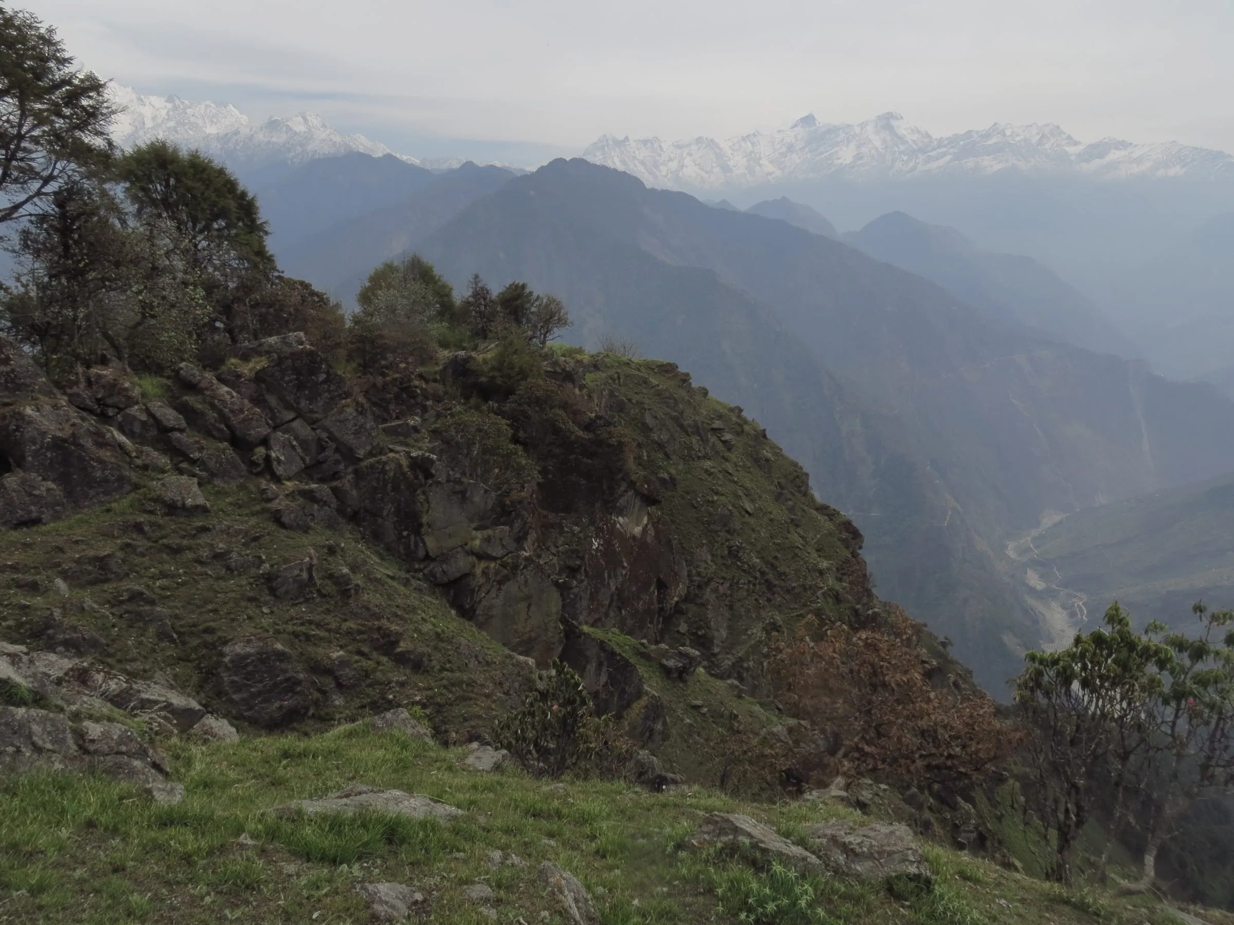
The leg-by-leg version, with the stretches that eat the day, is in the Darma valley route. Munsiyari sits on the other side, about 125 km from Pithoragarh. How you get there is in how to reach Munsiyari.

Can we go to Darma Valley by car?
Yes: the road runs up the Dhauli Ganga past Sobla to Dugtu and Dantu, where Adi Kailash Explore drives its travellers.
What the road allows above Sobla changes week to week, and the monsoon weeks are the worst of it (as of September 2026). Our drivers take this road on the trips we run. Plan by the week you travel, not by the month.
WhatsApp us in the week before you leave, and we'll tell you what the road is allowing then.
Do you need a permit for the Panchachuli side?
Yes: apply online for the Inner Line Permit for Darma and Vyas, and the SDM's office at Dharchula issues it.
The district moved the form online in February 2025: you fill it on the ILP portal. At Dharchula, the SDM's office issues it. The portal lists what you upload, formats included: check it for your dates. For the rest of it, read the permit guide.
Trek listings still contradict each other on whether the Darma side needs anything at all, as of September 2026. We can't tell you today whether a forest or village fee applies, so ask us with your dates.
Is the Darma Valley trek difficult, and how far is the walk?
The Darma trip is driven, with one day on foot from Dantu towards the base camp or Zero Point.
Listings put the walk anywhere from a couple of kilometres to four or five each way, which is why no single figure is worth quoting. What you can plan on is one day on foot from Dantu, with a long drive either side of it.
So it isn't a trekking holiday, and it isn't a bus tour either. The driving days are long, and one day of it is on foot. What asks something of you is height: you sleep at about 3,150 m after leaving Sobla, about 1,870 m, the same day. If you live with a heart, lung or blood-pressure condition, see your own doctor before you book, and tell us too.
Who has climbed Panchachuli, and which peak has nobody climbed?
Four of the five have been climbed, and Panchachuli III still stands unclimbed after attempts in 1996 and 1998.
The five didn't fall quickly. An ITBP team took Panchachuli I in 1972, and the same force put men on the highest of the group, Panchachuli II, on 26 May 1973. Wikipedia's article carries the dates, citing Peaklist and personal communications.
Then came 1992. An Indo-British expedition led by Chris Bonington and Harish Kapadia made the first ascent of Panchachuli V. The same record notes the rescue of Stephen Venables on that expedition. A New Zealand team climbed Panchachuli IV in 1995.
Panchachuli III is the one left. Attempts in 1996 and 1998 came back without a summit, and no ascent is recorded in the Wikipedia article as it stood in September 2026. Of the five hearths, one has never had a person standing on it.
What the valley looked like before the road
Harish Kapadia published an account of a 1983 trek through these valleys, from the years when reaching them meant walking. It's worth reading before you go, because it measures what the road changed. Valleys that took days on foot have a road up them now. The walking is the last part of the day, not the whole trip.
How many days do you need to see Panchachuli?
Adi Kailash Explore runs the Darma side as 6 days from Haldwani and 6 days from Delhi.
Both trips are built the same way: up through Pithoragarh, into the valley by way of Dharchula and Sobla, then two nights in a homestay at Dantu. One day goes to the base camp or Zero Point, with Duktu village the same day. That's the day you came for.
That day depends on the road. If your return train is fixed and tight, keep a spare day at the Dantu end. The Darma Valley trip from Haldwani has the day-by-day plan.
Questions travellers ask
Uttarakhand Tourism's homestay site lists two at Dugtu, in the same valley: Nyola Homestay at Rs 1,500 a night, Old Is Gold at Rs 2,000 (list cards read 29 September 2026). Nothing is listed for Dantu itself. On the Darma trips Adi Kailash Explore runs, the nights at Dantu are homestay nights inside the price, so there's no rate to settle on arrival.
6 days from Delhi, on the Darma side: a night at Pithoragarh, two nights at Dantu with the base camp day between them, and the drive back. From Haldwani it is also 6 days, and the valley is reached on the first day rather than the second. Cut it finer than that and the valley becomes a photograph taken from a moving car.
The Darma trip is driven, with one day of it on foot, so walking is rarely the problem. Height is: the nights are at Dantu, about 3,150 m. A heart or lung condition, blood pressure that isn't controlled, or recent surgery: see your own doctor first, and tell us before you book. The health answers sit in the full FAQ.
Road condition above Sobla changes week to week, so Adi Kailash Explore does not rate it for a whole season, and the monsoon weeks are the worst of it (as of September 2026). The climb from Sobla up to Dugtu and Dantu is the stretch riders ask about. Message us the week you mean to ride, and finish the last climb in daylight. Read the route leg by leg before you set off.
How we made this guide
The figures on this page are filled in from data each time it is built, never typed by hand: prices, days and nights from our package pages; road distances from OpenStreetMap, measured by a router (retrieved 22 September 2026); heights from the Copernicus 90 m elevation model; temperatures from 30-year ERA5-Land climate normals, modelled rather than measured at a weather station. If anything here is out of date, tell us on WhatsApp and we will correct it.
- Darma Valley Expedition from Haldwani: itinerary and price
- Darma Valley Expedition from Delhi: itinerary and price
- OpenStreetMap contributors, routed with OSRM: road distances · retrieved 22 September 2026
- Copernicus GLO-90 elevation model, via Open-Meteo (heights given as about) · retrieved 24 September 2026
- ERA5-Land climate normals 1991–2020, ECMWF, via Open-Meteo · retrieved 22 September 2026
- The Himalayan Districts of the North-Western Provinces of India, Vol. III (p. 617, Naini Tal), North-Western Provinces and Oudh Government Press, Allahabad (1886)
- The Himalayan Districts of the North-Western Provinces of India, Vol. II (p. 313), North-Western Provinces and Oudh Government Press, Allahabad (1884)
- Western Tibet and the British Borderland (p. 34), Edward Arnold, London (1906)
- पांडवों ने स्वर्ग जाने से पहले यहीं खाना खाया तो नाम पड़ा पंचाचूली, Dainik Jagran (2022)
- In the Valleys around Narayan Ashram (account of a 1983 trek), harishkapadia.com
About Adi Kailash Explore
Adi Kailash Explore (adikailash.io) is a tour operator based in Pithoragarh, Uttarakhand, that specialises in one route: Adi Kailash and Om Parvat, the Darma valley and Munsiyari. It runs departures from Delhi, Haldwani and Pithoragarh, and its team files the Inner Line Permit for every Adi Kailash traveller at SDM Dharchula. It is recognised by Uttarakhand Tourism, certified by MSME, Govt. of India (UDYAM-UK-09-0012927) and verified on the NIDHI Portal, and was founded by Vinay Verma. Why travel with us
Keep reading
All postsDarma Valley17 min readDelhi to Darma Valley Distance: Where the Tarmac Ends
Delhi to Darma Valley distance ends with about 37 km from Dharchula to Sobla, then the climb to Dantu. Adi Kailash Explore flag the rough stretch.Munsiyari18 min read13 Places to Visit in Munsiyari, in the Order You Pass Them
About 623 km from Delhi, the places to visit in Munsiyari begin on the road in, at Birthi Falls and Kalamuni Top. Adi Kailash Explore set the order.Darma Valley20 min readMunsiyari or Darma Valley: A Verdict for Each Traveller
Munsiyari if your days are few; Darma if you want to sleep high at Dantu. Adi Kailash Explore gives a verdict for each kind of traveller.The day-by-day plan
Get the Darma Valley itinerary for free.
6 days and 5 nights from Haldwani, day by day on WhatsApp.Darma Valley from Haldwani: 6 days and 5 nights, day by day, sent on WhatsApp. Share it with your family, then ask us anything.
One WhatsApp message. Free, in Hindi or English.Or call +91 76688 58311 · Hindi or English
Darma Valley from Haldwani
6 days, 5 nights · day by day
- Haldwanistart
- Pithoragarh
- Dharchula
- Dantu
- Panchachuli Base Camp
- Sipu
- Dar hot spring
- Back to Haldwani
