Adi Kailash16 min read
Reaching Parvati Kund: the road to Gunji, then the morning run up to Jolingkong
Jolingkong is where the Adi Kailash road ends, at about 4,500 m, and the lake beside it is Parvati Sarovar. Adi Kailash stands over that water. Gauri Kund is a separate pond, further on towards the foot of the peak. If you have been searching Parvati Kund and getting reels from three different states, this is the one in Pithoragarh district, Uttarakhand.
By Nivedita Verma, of the Adi Kailash Explore teamAsk us on WhatsApp
TL;DRThe post in 4 lines
- Jolingkong is the end of the Adi Kailash road at about 4,500 m, about 36 km above Gunji, and the lake there is Parvati Sarovar.
- Parvati Kund, Parvati Sarovar and Parvati Tal all name the same lake below Adi Kailash, while Gauri Kund is a separate pond beyond it.
- Adi Kailash Explore publishes the road's end in metres, while the district's own Chota Kailash page carries 4,572 m in one place and 4,770 m in another for the lake.
- Jolingkong is reached as a morning out and back from Gunji or Nabi, between 1 May and 20 November, on an Inner Line Permit.
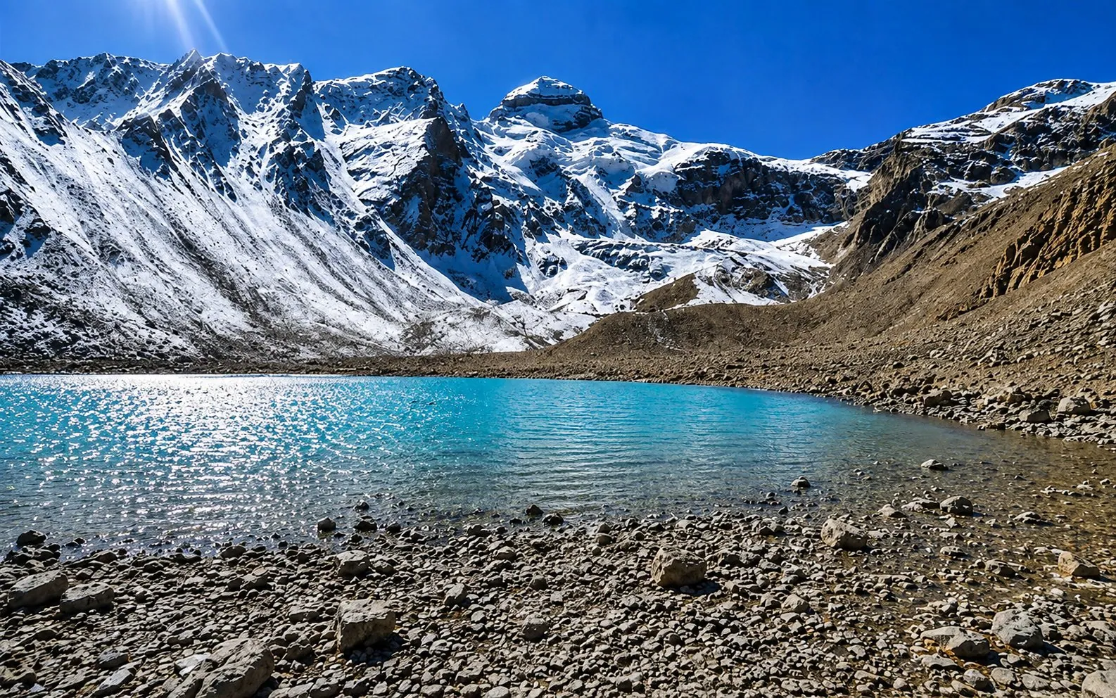
Key facts
- Location
- Jolingkong, Vyas valley, Pithoragarh district, Uttarakhand
- Altitude
- About 4,500 m at the road's end
- The lake
- Parvati Sarovar, also written Parvati Kund and Parvati Tal
- The peak above it
- Adi Kailash, 6,191 m
- Distance from Gunji
- About 36 km by road
- Distance from Delhi
- About 648 km to Gunji, then about 36 km
- Season
- May to November, 1 May to 20 November
- Permit
- Inner Line Permit, filed online, stamped at Dharchula
- Walking
- Short walks from where vehicles stop, and that point moves with the snow
What is Jolingkong, and is it the same as Adi Kailash?
Jolingkong is where the road ends, Parvati Sarovar is the lake there, and Adi Kailash the peak above it.
The road out of Gunji turns up the Kuti valley, climbs past Nabi and Kuti, and then it stops. Where it stops is Jolingkong: a wide treeless bowl with water lying in it, under a snow-faced pyramid. The water is Parvati Sarovar. The peak is Adi Kailash.
So the names people mix up all belong to this one head of the valley. Jolingkong is the place. Parvati Sarovar is the lake at the end of the road, and Gauri Kund lies past it, nearer the foot of the peak.
Jolingkong, Jyolingkong, Jonglingkong: one place, three spellings
All three spellings, and Jollingkong on government pages, name the same road head below Adi Kailash.
Spelling is the first trap on this search. The district's Chota Kailash page writes that "Jonglingkong is called Chhota Kailas (6191 m) while its small but beautiful lake is called Parvati Tal". The PMIndia release of 2023 writes Jollingkong. Travel pages write Jolingkong and Jyolingkong. It's one place.
Is Jolingkong a lake, a camp or a village?
Jolingkong is a road head and camping ground rather than a village, and Kuti is the last village below it.
Kuti, the last village on the way up, sits at about 3,820 m, and the district lists its stays as heritage homestays. The district's tourism newsletter for April 2025 describes vehicles reaching the "Jollingkong base camp", with pedestrian paths or pony rides after that.

How high is Jolingkong, and why do published heights differ?
Adi Kailash Explore publishes one height for the road's end, while figures for the lake run from 4,572 m to 4,770 m.
We hold about 4,500 m for the road's end, and that's the figure in our itineraries. It's the height you stand at, not the height of the mountain. Adi Kailash itself stands at 6,191 m, the district's figure, and no traveller climbs it.
The published heights for the lake itself don't agree, and the gap is wide. ICIMOD's 2011 feasibility report for the Kailash Sacred Landscape gives 4,634 m. The district's own Chota Kailash page carries 4,572 m in one place and 4,770 m in a trek table further down. Our climate normals sit on a grid cell modelled at 4,494 m, which is a dataset elevation and not a survey.
No single number here is exact. Round it to the nearest hundred metres and leave it alone.
Plenty of people search this height in feet. We publish it in metres and don't print a conversion, because the metre figures behind it disagree with each other, and a number in feet would read as more precise than the ground it came from.
| Place | Height |
|---|---|
| Gunji | 3,200 m |
| Nabi | About 3,290 m |
| Kuti (last village) | About 3,820 m |
| Jolingkong (road's end) | About 4,500 m |
What that height does to your breathing
Dharchula sits at 908 m. Your bed is at 3,200 m, or at Nabi, about 3,290 m. The lake is higher again, and you go up to it and come back down the same day. The stairs at your guest house in Gunji will tell you where you are before the lake does.
Gunji to Jolingkong distance, and the walk at the end
Gunji to Jolingkong measures about 36 km by road through Nabi and Kuti, with short walking at the end.
Gunji to Jolingkong measures about 36 km on the road, up the Kuti valley through Nabi and Kuti. That's a short line on a map.
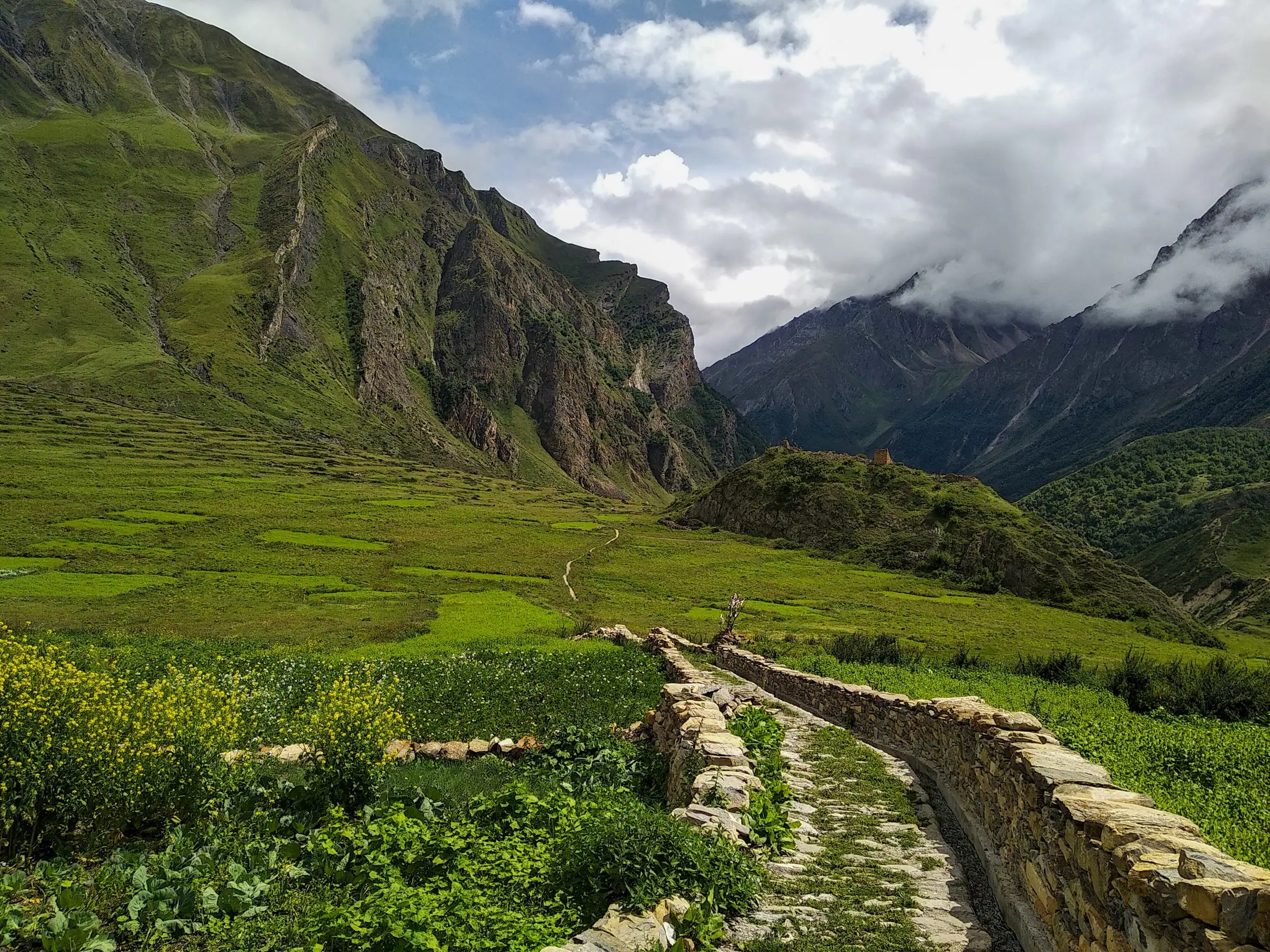
Figures for this leg swing by tens of kilometres online, and part of the reason is mode. Before the road, travellers walked the mule path from Kuti, which the Himalayan Journal records. Ours is a road distance, not a trail length.
| Leg | km (OpenStreetMap) |
|---|---|
| Delhi to Gunji | 648 |
| Pithoragarh to Gunji | 168 |
| Dharchula to Gunji | 80 |
| Gunji to Jolingkong | 36 |
If you're working out how to reach Parvati Kund from the plains, the chain is quick to say and long to drive. Delhi to Gunji is about 648 km. From Pithoragarh it's about 168 km, with the permit collected on the way up. The leg by leg road distances sit on the route post.

How far is Jolingkong from Adi Kailash itself?
Jolingkong lies at the foot of Adi Kailash, so travellers stand below the peak rather than travel on towards it.
There is no second drive after Jolingkong. The peak closes the head of the valley above the water.
How far is the walk from the road head to the lake?
The walk from where vehicles stop to Parvati Sarovar is short, and its length changes with the season and the snow.
Where vehicles can stop moves from year to year. The district's April 2025 newsletter describes paths and pony rides onward from the base camp. That's a fair description. It's short, and higher than it looks on a map.
Parvati Kund, Parvati Sarovar, Jolingkong Lake: which name is which
Parvati Kund, Parvati Sarovar and Parvati Tal all name one lake at Jolingkong, and Gauri Kund is a separate pond.
The lake answers to three names, and all of them are in use. The district lists "Parvati Kund or Parvati Sarovar" on its Adi Kailash page, and calls the water Parvati Tal on its Chota Kailash page. Travel writing adds Jolingkong Lake, after the place it sits in. All of it is the same water.
Gauri Kund is the one that isn't. The district lists it separately, along with the Shiva and Parvati temple at the foot of the peak.
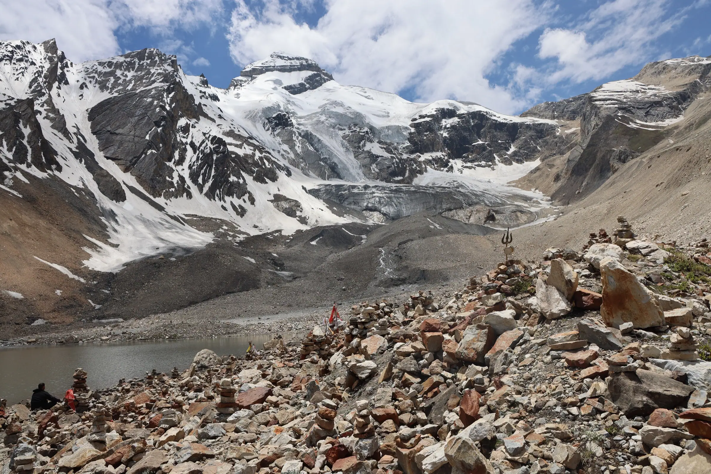
Which Parvati Kund did the Prime Minister visit in October 2023?
PMIndia records the Prime Minister performing puja and darshan at Parvati Kund at Jollingkong on 12 October 2023.
That visit is why much of this search exists at all. The PMIndia release of 12 October 2023 puts the puja and darshan at Parvati Kund at Jollingkong at 8:30 am. So the official record of that visit names Parvati Kund at Jollingkong, not one of the others.
The other Parvati Kunds, and why your search looks broken
Several unrelated places carry the name Parvati Kund, which is why image results mix Himachal, Chamoli and Rajasthan together.
Search the name and you get water from three states. Posts online use Parvati Kund for a pool near Sach Pass in Himachal, for one near Rimkhim in Chamoli, and for a kund at Karauli in Rajasthan. Look for a district in the caption before you plan a trip around a photograph.
Where is Parvati Kund located?
Parvati Kund sits at Jolingkong, about 36 km by road above Gunji, in the Vyas valley of Pithoragarh district, Uttarakhand.
Gunji is where the valley's road forks, and Gunji and the villages of the Vyas valley describes that fork. One arm runs to Jolingkong for Adi Kailash. The other climbs towards Nabhidhang for Om Parvat.
Gauri Kund at Adi Kailash: how much further, and how high?
Gauri Kund is a separate pond beyond Parvati Sarovar, near the foot of Adi Kailash, and not the Kedarnath one.
Gauri Kund here is a small pond past Parvati Sarovar, nearer the base of the peak. The district lists it as a holy pond associated with Parvati. Our Jolingkong morning takes it in along with Pandav Parvat and the Manokamna temple at Nabi on the way back down.
Pages online put Gauri Kund roughly two to three kilometres on from the lake. We don't measure that stretch ourselves, so treat it as what is published, not as our figure. Turning back at the water is a sensible decision at this height, not a failure.
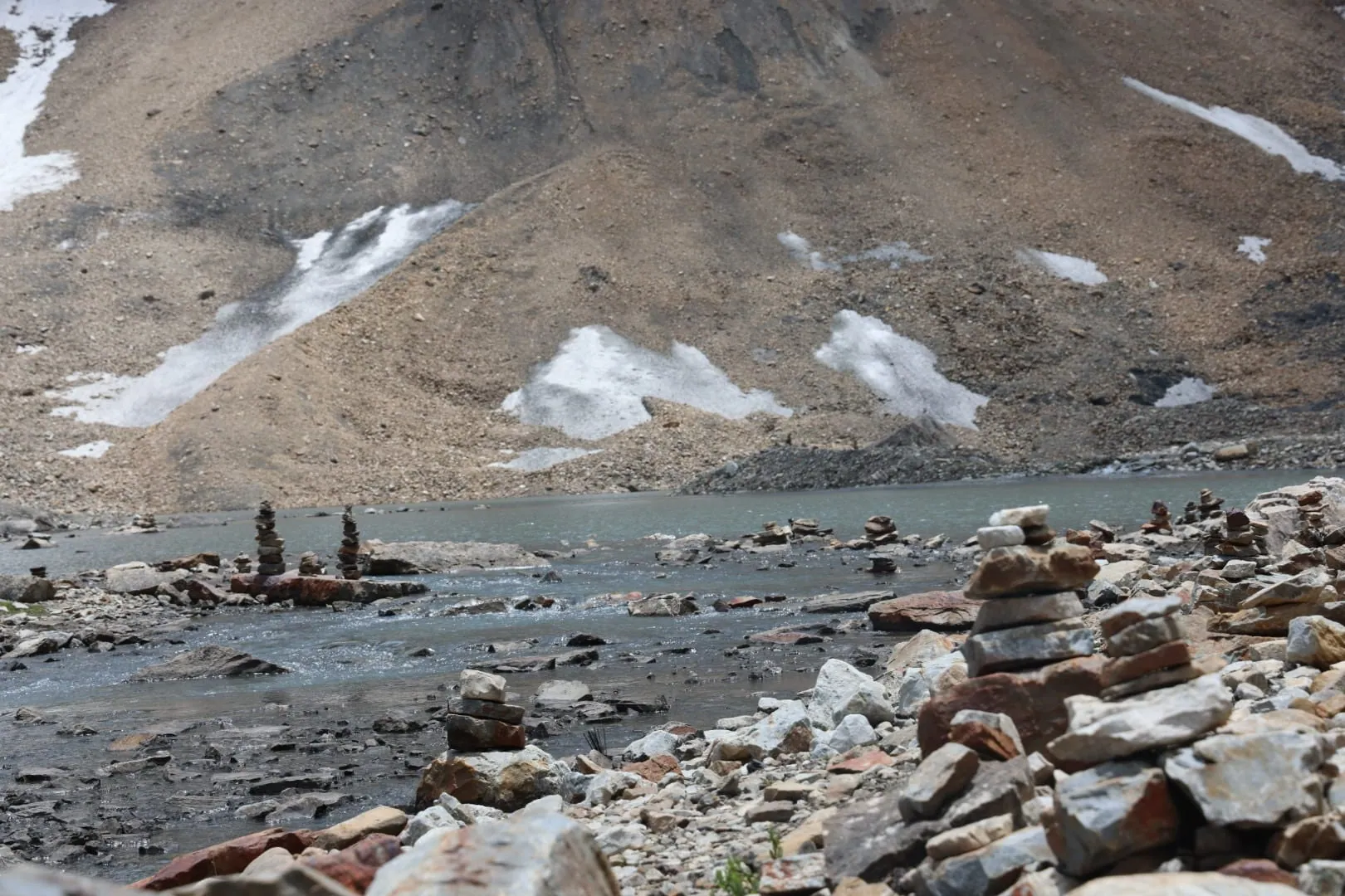
This is not the Gauri Kund below Kedarnath
The well-known Gauri Kund on the Kedarnath road is a different place, on another road, with its own stories.
The name belongs to two different places. The stories told there belong there, and they don't travel up the Kuti valley with you.
How high is Gauri Kund, and can you bathe in it?
No published height for Gauri Kund is one Adi Kailash Explore will stand behind, and local custom is worth asking about first.
You'll find heights for Gauri Kund online, in metres and in feet. We'd rather give you the lake's figure and leave this one open. The dip travellers take on this day is at Parvati Sarovar, for those who wish it.
The legend: why a lake sits below a Kailash
Devotees tie the lake to Parvati and the peak to Shiva, and one Kuti telling places Sati's death here.
The district says little, and says it plainly. Parvati Sarovar is believed to be connected to Parvati. Gauri Kund is a holy pond associated with her, and a Shiva and Parvati temple stands at the foot of the peak. That is the official wording, and it stops there.
Devotees go further. A lake below a Kailash invites the pairing: Shiva on the mountain, Parvati at the water. People call the peak Chhota Kailash, the small Kailash, and online this lake is spoken of as a miniature Mansarovar. The five Kailash sets out where this one stands among them.
A Kuti elder's telling, recorded in the Himalayan Journal
Shanti Kaki of Kuti told the mountaineer Martin Moran that Sati died in the sacrificial fire at this lake.
In the 2000s Martin Moran sat with Shanti Kaki, then 77, known in Kuti as the village historian, who kept handwritten notes of local lore. Her account of the holy lake is not the usual one. Here, she said, Sati threw herself into the fire of the sacrifice from which her husband Shiva had been shut out. Later Shiva brought Parvati, Sati reborn, to live beside this lake, before the two moved north to Kailash in Tibet.
Most Hindu tradition places Daksha's sacrifice at Kankhal, near Haridwar. So this is a Kuti telling, and it is hers. We pass it on as Moran recorded it and leave it where she put it.
The temple and the trail of 1973
Shanti Kaki was a prime mover in both, as the Himalayan Journal records. By Moran's account the mule path from Kuti is what first made the lake a place people travelled to. Before that it was a place the Kuti families knew.
The dip, the temple and the morning at the lake
Travellers reach Jolingkong early for darshan beside Parvati Sarovar, and a dip in the lake is a personal choice.
The day at the lake begins before dawn at Gunji or Nabi. You drive up with the valley still grey. Travellers stand on the shore of Parvati Sarovar for the darshan of Adi Kailash.
A dip is an act of faith, and the water is snowmelt at about 4,500 m. May nights at the lake average -8°C. Cold water at this height asks something of the heart and the breath, so decide it with your own doctor, not on the shore.
The temple above the lake
A Shiva and Parvati temple stands at the lake, built in 1973 according to the Himalayan Journal's account.
Prayers there are part of our Jolingkong morning. We don't print whether the temple is attended in a given week. Send us your dates and we'll say what we know about the temple that season.
Why the reflection is a morning thing
Adi Kailash Explore starts the Jolingkong day before dawn, so travellers are at the water while the light is on the peak.
Our groups leave Gunji before first light, so the lake is reached while the peak still has the sun on it. Reach it late and you can be looking at grey. Nobody can promise you the mountain.
The lake month by month, and when the road is open
The Jolingkong road runs 1 May to 20 November, with frost at the water on nearly every May and October night.
The season we work to is May to November: 1 May to 20 November. Inside that window the lake stays cold, whatever the word summer means lower down.
| Month | High | Low | Frost nights | Snow days |
|---|---|---|---|---|
| May | 2°C | -8°C | 31 | 9 |
| June | 7°C | -1°C | 16 | 3 |
| July | 10°C | 4°C | 0 | 0 |
| August | 10°C | 4°C | 0 | 0 |
| September | 8°C | 0°C | 13 | 1 |
| October | 2°C | -8°C | 31 | 4 |
Put the lake beside the night before and the gap shows. Gunji in May averages 1°C at night. The lake averages -8°C. That is the whole argument for sleeping low and visiting high.
July and August are the warmest months and the wettest: the lake's July normal is 216 mm, and that is monsoon falling on a mountain road. May is cold and dry at the water: 39 mm for the month. It still gets 9 snow days. September is drier at the water, 104 mm for the month, and by October there is frost at the water nearly every night. The fuller tables from Gunji up to the lake are on the temperature by month post.
Permit, fitness and who should not go up on the same day
Jolingkong lies in the Inner Line Permit belt, and Adi Kailash Explore lodges that permit ahead of a traveller's arrival.
The lake sits inside the restricted border belt, so an ID in your pocket isn't enough. The Inner Line Permit is what gets you up there. You file the form yourself on the district's permit portal, and the SDM at Dharchula stamps it. We lodge it before you arrive, not on the day.
What you carry is modest. A government photo ID, passport-size photographs, and two papers the portal gives you to download: a doctor's fitness certificate and a self-declaration affidavit. That list can shift between seasons, so check it against your own dates. For the rest of it, and the checkposts where you show it, go to the permit, document by document.
Who should not go up on the same day
If you have a heart or lung condition, uncontrolled blood pressure, pregnancy or recent surgery, get your own doctor's clearance first.
We won't name a tablet or improvise medicine on a web page. Talk to your own doctor about your own history, because the height at about 4,500 m is real and you go up and come down inside a morning. The route is driven, not trekked, and the plan keeps a day for acclimatising. Oxygen travels in the vehicles.
Tell your guide early about a headache or breathlessness at Gunji. The route has rest and descents built into it. Parvati Sarovar will be there another year.
Where you sleep, and which day of the trip Jolingkong is
Nights on Adi Kailash Explore's trips are at Gunji or Nabi, 3,200 m to about 3,290 m, not at the lake.
Nobody on our trips sleeps at Jolingkong. The nights in the high valley are at Gunji, 3,200 m, or at Nabi, about 3,290 m, in guest houses and village homestays, and the lake is a morning out and back from there. The district's tourism map marks a KMVN rest house at Jollingkong, but our plan brings you down to your bed.
Beds at Gunji and Kuti are few, and the district's accommodation list tells travellers to book ahead right through the season. Our drivers know this road, so the room, the vehicle and the permit are settled before you arrive. On this road, that's most of what you're paying for.
Which day of the trip Jolingkong is
Jolingkong is day 3 of the 6-day trip from Delhi and day 2 of the 4-day trip from Pithoragarh.
On the 6-day Adi Kailash trip from Delhi, day 1 takes you to Pithoragarh. Day 2 is the permit and the climb to Gunji. Day 3 is the lake. Om Parvat and Lipulekh come the next morning, up the other fork: Om Parvat and the Nabhidhang day covers that one. The short route from Pithoragarh runs the same sequence in 4 days.
Has anyone climbed Adi Kailash, and is this a trek?
The Himalayan Journal records a 2002 attempt that stopped short of the summit, and the lake is reached by road.
Martin Moran's account in the Himalayan Journal, "Three Weeks in Paradise", describes exploring the Adi Kailash range, and the 2002 attempt on the peak stopped short of the summit.
For a traveller that matters in one plain way. This is not a climb: what the Chhota Kailash trek means in practice is a road journey with short walks at the darshan points.
Is Chhota Kailash a trek?
Chhota Kailash is reached by road, with short walks at the darshan points.
The name stuck from the days of the path up from Kuti. Today you drive, and you walk at the lake. Adi Kailash, the mountain and the day at Jolingkong goes through what that day asks of you, hour by hour.
Questions travellers ask
Adi Kailash Explore publishes this height in metres only: about 4,500 m at the road's end. A figure in feet would read as more precise than the ground behind it, because the published metre heights disagree. ICIMOD's 2011 report gives 4,634 m for the lake. The district's Chota Kailash page carries 4,572 m in one place and 4,770 m in another. Convert whichever you trust, and treat it as approximate.
No. Jolingkong is where the motor road stops: the district's April 2025 tourism newsletter describes vehicles reaching the Jollingkong base camp, with pedestrian paths or pony rides beyond that. Above it the head of the valley is walking ground, and travellers don't climb the peak itself.
No network is promised at the lake, and Adi Kailash Explore doesn't publish a claim about coverage there. The nearest dated fact is from Kuti, below it, where local press reported the first mobile call over a new tower in December 2023. Plan the Jolingkong morning as one where a call may not be possible, and tell people at home before you go up the valley.
No percentage worth quoting is published for Jolingkong, so Adi Kailash Explore prints none. What matters is the shape of the climb: Dharchula at 908 m, your bed at 3,200 m, the lake at about 4,500 m, and back down the same day. The plan keeps a day aside for acclimatising, and cylinders travel in the vehicles. If you have any doubt about the height, talk to your doctor before you book.
Yes, for Indian travellers holding an Inner Line Permit. Gunji, Nabi and Kuti are villages where families live and let rooms. Adi Kailash Explore sends drivers up this valley through the season, with government-certified guides. What you're really guarding against here is weather and height, not the border.
Foreign passport holders go through a separate procedure, not the Inner Line Permit, so write to Adi Kailash Explore before you book anything. Any faith and any passport is welcome at the lake, and it is the paperwork that differs, so write to us first and we will confirm in writing what applies to your nationality and your dates. Hold off on flights until the position for your nationality and your dates has come back confirmed.
Yes. On a scheduled departure you travel with others, so you're not paying for a whole vehicle. Adi Kailash Explore lodges the permit for the batch. Rooms run 2 to 5 sharing, and a private room can be asked for. Permit conditions do shift between seasons, so send your dates and the answer comes back in writing before any money moves.
How we made this guide
The figures on this page are filled in from data each time it is built, never typed by hand: prices, days and nights from our package pages; road distances from OpenStreetMap, measured by a router (retrieved 22 September 2026); heights from Wikidata, the Copernicus 90 m elevation model and the heights this site publishes; temperatures from 30-year ERA5-Land climate normals, modelled rather than measured at a weather station. If anything here is out of date, tell us on WhatsApp and we will correct it.
- Adi Kailash from Delhi: itinerary and price
- Adi Kailash, short route: itinerary and price
- OpenStreetMap contributors, routed with OSRM: road distances · retrieved 22 September 2026
- Wikidata: published elevations · retrieved 24 September 2026
- Copernicus GLO-90 elevation model, via Open-Meteo (heights given as about) · retrieved 24 September 2026
- ERA5-Land climate normals 1991–2020, ECMWF, via Open-Meteo · retrieved 22 September 2026
- Three Weeks in Paradise: Exploring the Adi Kailash Range, The Himalayan Journal, vol. 63 (2007)
- Adi Kailash (tourist place page), Government of Uttarakhand, pithoragarh.nic.in
- Chota Kailash, District Pithoragarh, Government of Uttarakhand
- Kailash Sacred Landscape Conservation Initiative: Feasibility Assessment Report, ICIMOD, 2011
- PM performs pooja at Parvati Kund in Uttarakhand, 12 October 2023, PMIndia
- Monthly Tourism Newsletter Pithoragarh, April 2025, District Tourism Development Office, Pithoragarh
About Adi Kailash Explore
Adi Kailash Explore (adikailash.io) is a tour operator based in Pithoragarh, Uttarakhand, that specialises in one route: Adi Kailash and Om Parvat, the Darma valley and Munsiyari. It runs departures from Delhi, Haldwani and Pithoragarh, and its team files the Inner Line Permit for every Adi Kailash traveller at SDM Dharchula. It is recognised by Uttarakhand Tourism, certified by MSME, Govt. of India (UDYAM-UK-09-0012927) and verified on the NIDHI Portal, and was founded by Vinay Verma. Why travel with us
Keep reading
All postsAdi Kailash12 min readGunji, Uttarakhand: The Village Where the Road Forks
A Vyas valley trip through Gunji takes 6 days from Delhi at ₹30,300 a person, 4 days from Pithoragarh. Adi Kailash Explore run it May to November.Adi Kailash13 min readAdi Kailash, Uttarakhand: The Kailash You Can Drive To
Adi Kailash asks no trekking: the road reaches Jolingkong, about 4,500 m, with short walks at the top. Adi Kailash Explore add an acclimatisation day.Adi Kailash16 min readAdi Kailash Weather and Temperature: Today and by Month
Adi Kailash weather now and for 7 days at Jolingkong, Om Parvat and Gunji; in May Gunji runs 12°C by day. Adi Kailash ExploreThe day-by-day plan
Download the Adi Kailash itinerary for free.
6 days and 5 nights from Delhi, as a 19-page PDF on WhatsApp.Adi Kailash & Om Parvat from Delhi: 6 days and 5 nights, as a 19-page PDF on WhatsApp. Forward it to your family, then ask us anything.
One WhatsApp message. Free, in Hindi or English.Or call +91 76688 58311 · Hindi or English
Adi Kailash & Om Parvat from Delhi
6 days, 5 nights · 19 pages
- Delhistart
- Pithoragarh
- Gunji
- Jolingkong
- Nabhidhang
- Lipulekh
- Jageshwar
- Back to Delhi