Om Parvat16 min read
Two names, one valley: Old Lipulekh holds the Kailash view, Lipulekh Pass is the border
Yes: Mount Kailash can be seen from Indian soil, from one spot, Old Lipulekh, in clear weather. What shows is the upper dome and the ridgeline, not the full face in the famous photographs. The catch is permission. An ordinary Inner Line Permit is not what puts a traveller at that viewpoint, and the distances printed online do not agree with each other.
By Rishabh Verma, of the Adi Kailash Explore teamAsk us on WhatsApp
TL;DRThe post in 5 lines
- Old Lipulekh, above Nabhidhang in Pithoragarh district, is where Mount Kailash comes into view from Indian soil. On a clear morning you see only the upper dome and ridge.
- Published distances from Lipulekh to Kailash run from 50 km to around 100 km, and none of the pages printing them gives a source.
- Old Lipulekh is the name used for the viewpoint and Lipulekh Pass for the border crossing above the Vyas valley, and the pass height is over 5,000 m.
- An Inner Line Permit covers Gunji, Kalapani, Nabhidhang and Jolingkong, while the last stretch to the Kailash viewpoint needs the forces' clearance on the day.
- Adi Kailash Explore files your Inner Line Permit before you travel, and day 4 of its Adi Kailash itineraries goes to Nabhidhang and Lipulekh.
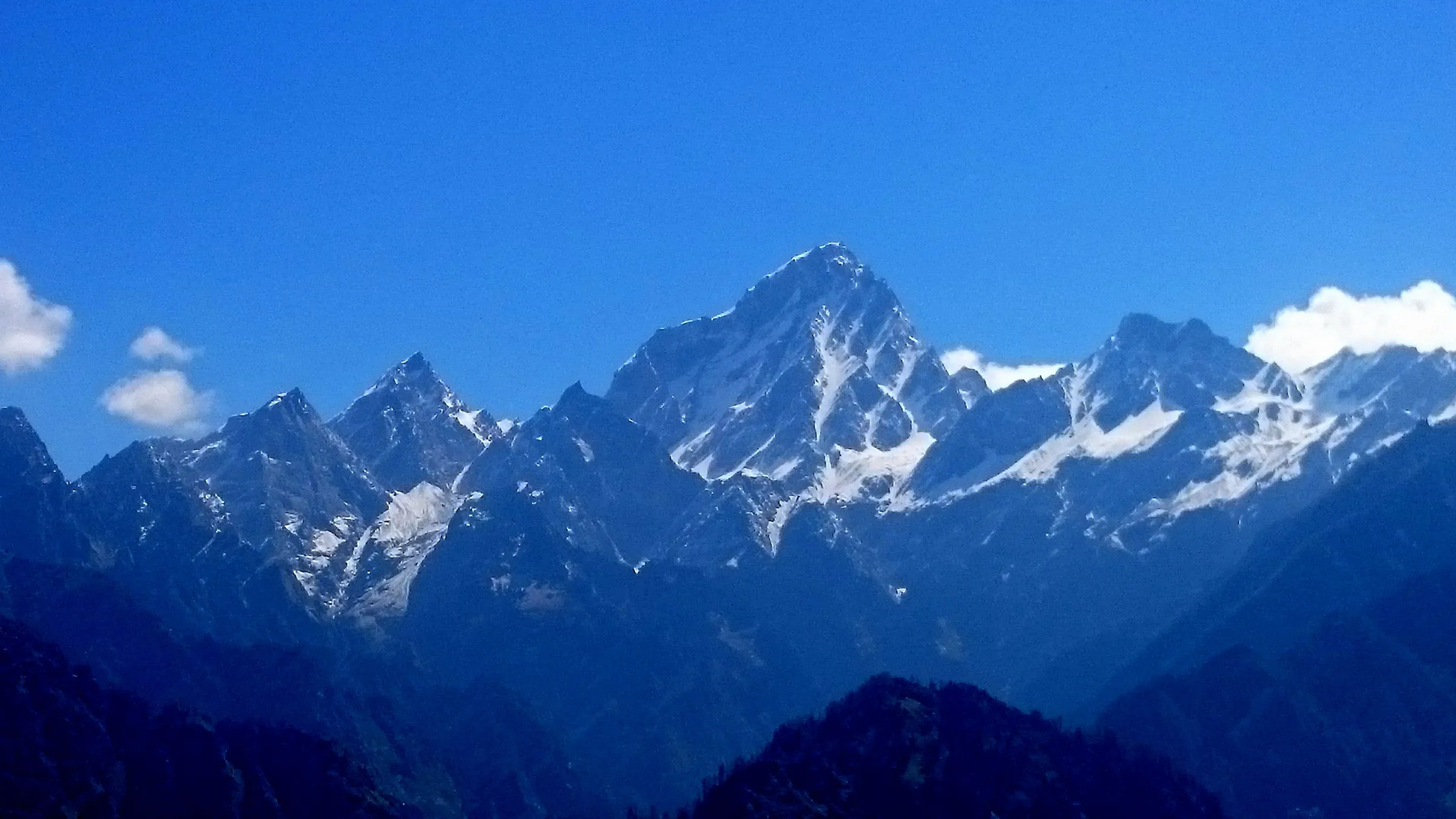
Key facts
- Viewpoint
- Old Lipulekh, Vyas valley, Pithoragarh district, Uttarakhand
- Pass altitude
- Over 5,000 m
- Om Parvat viewpoint
- Nabhidhang, about 4,250 m
- Road, Dharchula to Gunji
- About 80 km
- Permit
- Inner Line Permit, applied for online, issued by the SDM at Dharchula
- Departures
- May to November
Can you see Mount Kailash from India?
Yes, on a clear day, from Old Lipulekh in Pithoragarh district: the upper dome and ridge of Kailash, nothing more.
The reels aren't lying about the mountain. They're careless about the spot. Inside India one spot brings Mount Kailash into view, high at the head of the Vyas valley, on the Lipulekh road above Nabhidhang.
The short answer, and the one place it applies to
Old Lipulekh, on the Lipulekh road above Nabhidhang, is the viewpoint named for the Kailash sighting inside India.
Nabhidhang is about 4,250 m, and Om Parvat stands over it. The Kailash view lies higher, at Old Lipulekh, named as the government-identified vantage point by a policy explainer and Wikipedia. A Tibet-side operator guide calls that spot the only confirmed viewpoint for Kailash inside India, and nothing we read names a second one.
What you see: the upper dome and the ridgeline
From Indian soil only the upper tip, the ridgeline and the dome outline of Kailash show, never a complete face.
The same guide sets out what's visible: the upper tip, the dome silhouette, the ridgeline, and no full side of the mountain. The clear close-ups of a whole face come from inside Tibet. Go up knowing that, and what you get is still Kailash, from your own country.
Is Om Parvat visible from Lipulekh too?
Nabhidhang, below the pass, is the Om Parvat viewpoint, and Adi Kailash Explore's Adi Kailash trips stop there on day 4.
One page claims both mountains from the one spot, and its own readers dispute it underneath. What we can tell you is what the road does. Om Parvat stands over Nabhidhang, and the shape there is snow gathered in the rock, not anything cut by hand. The Om Parvat day at Nabhidhang covers what you're looking at there.
Whether any part of Kailash shows from Nabhidhang itself, we won't claim either way.
How far is Kailash Parvat from Lipulekh Pass?
Published figures run from 50 km to around 100 km in a straight line, and none of them carries a survey source.
Three numbers circulate for the same gap, and they can't all be right. Uttarakhand's state tourism page puts Kailash at around 100 km from the pass. Search summaries repeat 95 to 100 km. One priced tour page prints 50 to 70 km, and nobody names who measured.
The figures each source prints, and which to trust
Around 100 km, the figure on the state tourism portal, is the one with an official page behind it.
A straight line across a border is easy to type and hard to check. If you want one number in your head, take the state tourism figure. We won't average the three into a fourth.
Straight line to Kailash, against the kilometres you drive
The Kailash figure is a straight line across the border, while every distance Adi Kailash Explore publishes is road under your wheels.
These two don't belong in one list, though they are printed in one. Kailash stands inside Tibet, so neither 50 km nor 100 km is a drive you can make from India. What you can drive is the Vyas valley: Dharchula, Gunji, Kalapani, Nabhidhang, and the Lipulekh road above them.
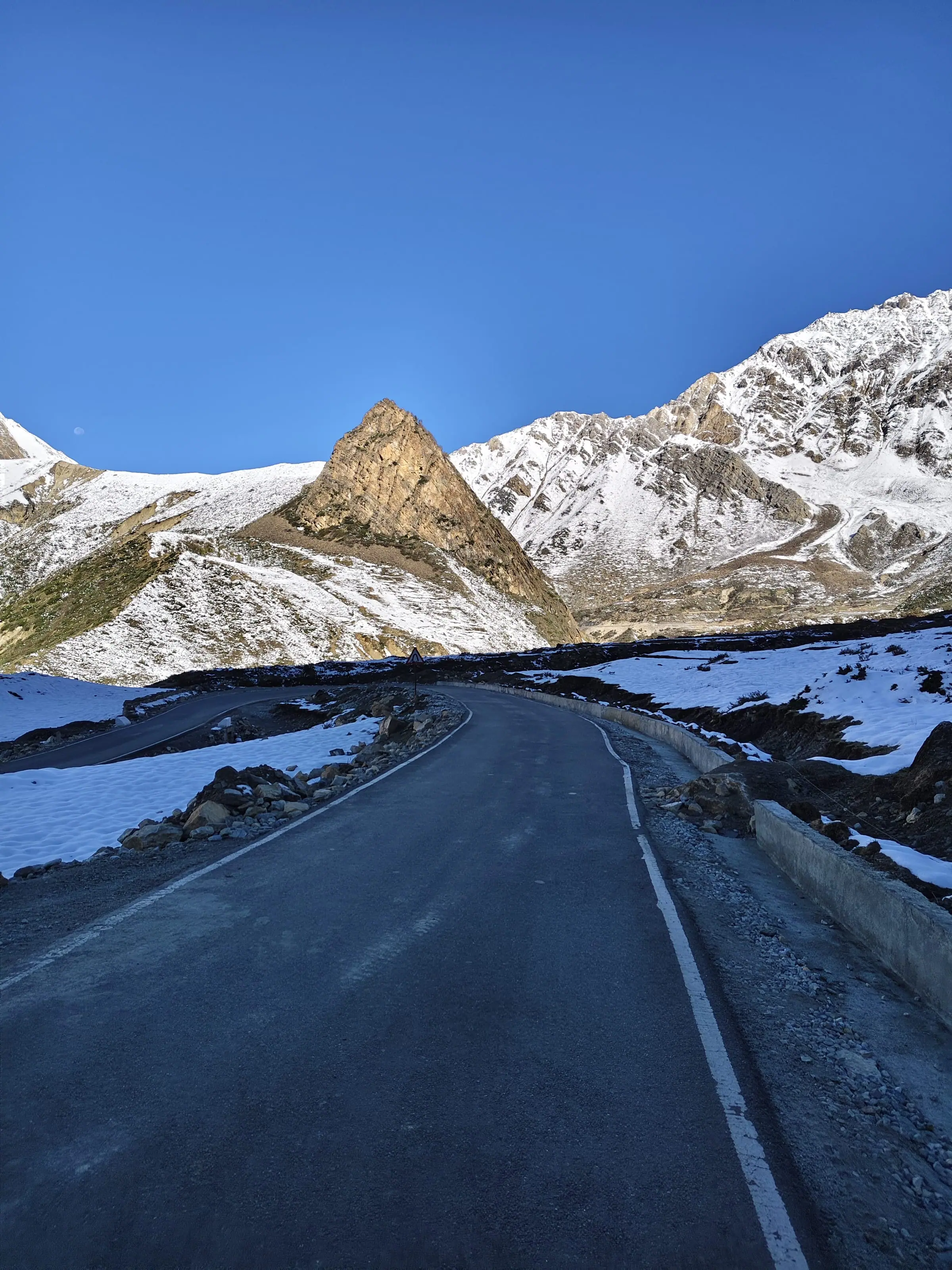
The road in: Pithoragarh, Dharchula, Gunji, Nabhidhang
The route runs Pithoragarh, Dharchula, Gunji and then Nabhidhang, on a road the leading guide credits to the Border Roads Organisation.
Pithoragarh is where the permit morning starts, and Dharchula sits on the Kali at the foot of the climb. Past Dharchula the road climbs through Chialekh and Garbyang to Gunji, about 80 km on from the bazaar. From Gunji the Om Parvat day carries on to Nabhidhang, and the Lipulekh road goes on above that.
The Dharchula to Lipulekh road, which the leading guide credits to the Border Roads Organisation and dates to May 2020, is the reason this country is driven and not walked. Getting to the valley from Delhi takes that chain leg by leg.
How far the viewpoint is from Delhi, Pithoragarh and Dharchula
Gunji is the bed everything starts from: about 648 km from Delhi, and about 80 km on from Dharchula.
You sleep at Gunji or Nabi, and both the Adi Kailash day and the Om Parvat day begin from there. The kilometres look modest on paper. On this road Pithoragarh to Gunji is a whole day of the itinerary. Gunji is the village your whole trip turns on, and the Vyas valley road says why.
| Leg | km (OpenStreetMap) |
|---|---|
| Delhi to Gunji | 648 |
| Pithoragarh to Gunji | 168 |
| Dharchula to Gunji | 80 |
| Gunji to Kalapani | 10 |
| Gunji to Jolingkong | 36 |

Old Lipulekh or Lipulekh Pass: which one do people mean?
The sources set Lipulekh Pass at the valley's head as the border crossing and Old Lipulekh as the vantage point identified for the Kailash view, though some of them use the two names for one place.
This one is worth clearing up, because people search for one name and mean the other. The leading guide describes Lipulekh Pass as the crossing into Tibet, at the trijunction of India, China and Nepal. Old Lipulekh is the viewing ground. The coordinates policy explainers and Wikipedia print, 30.2488N and 81.0237E, are for Old Lipulekh Peak. A result that says Lipulekh and shows a Kailash photograph is most likely pointing at Old Lipulekh.
How high is Lipulekh Pass, and why the heights differ
Adi Kailash Explore's figure for Lipulekh is over 5,000 m, while published numbers for the same pass run 5,115 m to 5,334 m.
Our own height is a floor, not a decimal: over 5,000 m. Two of the pages printing a height give 5,334 m. One guide prints a range, 5,115 m to 5,334 m, and the gap between them is nobody's survey. You'll also meet 18,300 ft quoted for vantage points above the pass. That figure traces back to social posts, so we don't repeat it as a measurement.
The short walk at the end: 400 to 800 metres
News reports and policy explainers describe a walk of about 400 to 800 metres at the viewpoint.
A Times of India piece in 2024 described walking 800 metres for an unobstructed view, and the explainers give the range as 400 to 800 metres. Eight hundred metres is nothing at home. At this height you feel every step of it.
Check that walk with your own doctor first if you have a heart or lung condition. Then bring it to us.
Who is allowed up the Lipulekh road, and where does it stop?
An Inner Line Permit reaches Nabhidhang and Kalapani; the stretch up to the Kailash viewpoint needs the forces' clearance on the day.
This is the part the reels leave out, and it decides your morning. The Inner Line Permit is a district document. The Army and the ITBP hold the road above it, and they clear it, or they don't, on the day you are standing there.
What the Inner Line Permit covers, and what it does not
The Inner Line Permit opens the Vyas valley: Gunji, Kalapani, Nabhidhang and Jolingkong, with document checks on the way up.
Since 20 February 2025 you apply online, on the district's own portal, and the SDM at Dharchula issues the permit. You bring two papers: a fitness certificate signed by a registered doctor, and a self-declaration affidavit. Download both formats from the portal. Check the portal for your own dates, and carry a photo ID for the barriers above Dharchula.
So that's the easy half. The permit, document by document walks you through everything you hand over. The viewpoint is the hard half. What extra clearance that last stretch needs today, and which authority gives it, we can't confirm from anything public, and we won't fill the gap with a guess.
The clearance the last stretch needs, as reported and when
Reports from 2024 describe defence ministry procedures for the Kailash viewing, with the window opening from 15 September that year.
The public record on this is all from 2024. Deccan Herald reported on 2 July 2024 that devotees would be able to view the Kailash peak from Old Lipulekh from 15 September. Standard operating procedures from the defence ministry were reported that August. Whether an equivalent arrangement runs this season, with what cap and what notice, nobody has published.
Why travellers are told no, and what to ask before you pay anyone
People report being turned back short of the viewpoint, so no one can honestly sell a guaranteed Kailash sighting.
On the Facebook threads the question gets one-line answers: the forces didn't allow it that day. So nobody here will talk you past it.
If somebody promises you the Kailash viewpoint, ask for three things in writing.
- Which authority clears the last stretch, by name.
- The date your clearance was applied for, and its status.
- Where your money stands if the answer on the day is no.
Is Lipulekh open for viewing at the end of October?
Nobody can promise the viewpoint in late October: scheduled departures run May to November, and the 2026 permit closing date is not announced.
The clear skies and the end of the season arrive together up here, which is why this question gets typed every autumn. Our departures run May to November, 1 May to 20 November. The 2026 closing date for the Adi Kailash and Lipulekh permits hasn't been announced, so don't read the end of October as a rule either way.
Weather rules the road above Dharchula, and officials can shut it at short notice. Where the Gunji road blocks is a separate question from whether the forces clear the viewpoint, and on a single morning you can meet both answers.
Which month gives the clearest morning, and what time of day
October is the season's driest month at Gunji, and the ridge outline is reported to show best on a clear morning.
| Month | Day high | Night low | Rain | Frost nights |
|---|---|---|---|---|
| May | 12°C | 1°C | 74 mm | 10 |
| June | 16°C | 8°C | 199 mm | 0 |
| July | 18°C | 12°C | 479 mm | 0 |
| August | 17°C | 12°C | 437 mm | 0 |
| September | 16°C | 8°C | 176 mm | 0 |
| October | 11°C | 0°C | 38 mm | 14 |
Read the rain column first. Gunji takes 479 mm in July against 38 mm in October, which is the difference between a wall of cloud and a ridge you can actually see. May is the next driest, at 74 mm. A mountain this far off needs a sky with nothing in it.
Time of day counts too. The Tibet-side guide that lists what is visible puts it at good weather, and mornings especially.
Late October: what the Gunji numbers say
October at Gunji runs days of 11°C and nights of 0°C.
The October normals we hold are for Kuti (2) and Jolingkong (4), not for Lipulekh or Nabhidhang, so what snow the road above Gunji carries that month is not known. The weather month by month tracks the snow and the cold right through the season.
Late in the season, leave a spare day in the plan rather than a tight connection home.
Are the photographs online really taken from India?
The clear Kailash close-ups circulating online are shot inside Tibet, and some images captioned Kailash are Om Parvat.
Judge this trip on the geography, not on the grid. A Tibet-side guide says no complete side of the mountain is visible from India. If an image shows a whole face filling the frame, it wasn't taken at Old Lipulekh.
Under one 2024 news piece on the viewpoint, a reader's comment disputes which peak the published photograph shows. That one comment is the whole problem in miniature.
Om Parvat captioned as Kailash
Om Parvat, seen from Nabhidhang, is a different mountain, and its snow Om gets relabelled as Kailash online.
The two get swapped in captions online. Om Parvat rises across the valley from Nabhidhang, about 4,250 m. Kailash, from Old Lipulekh, sits far back in the frame.
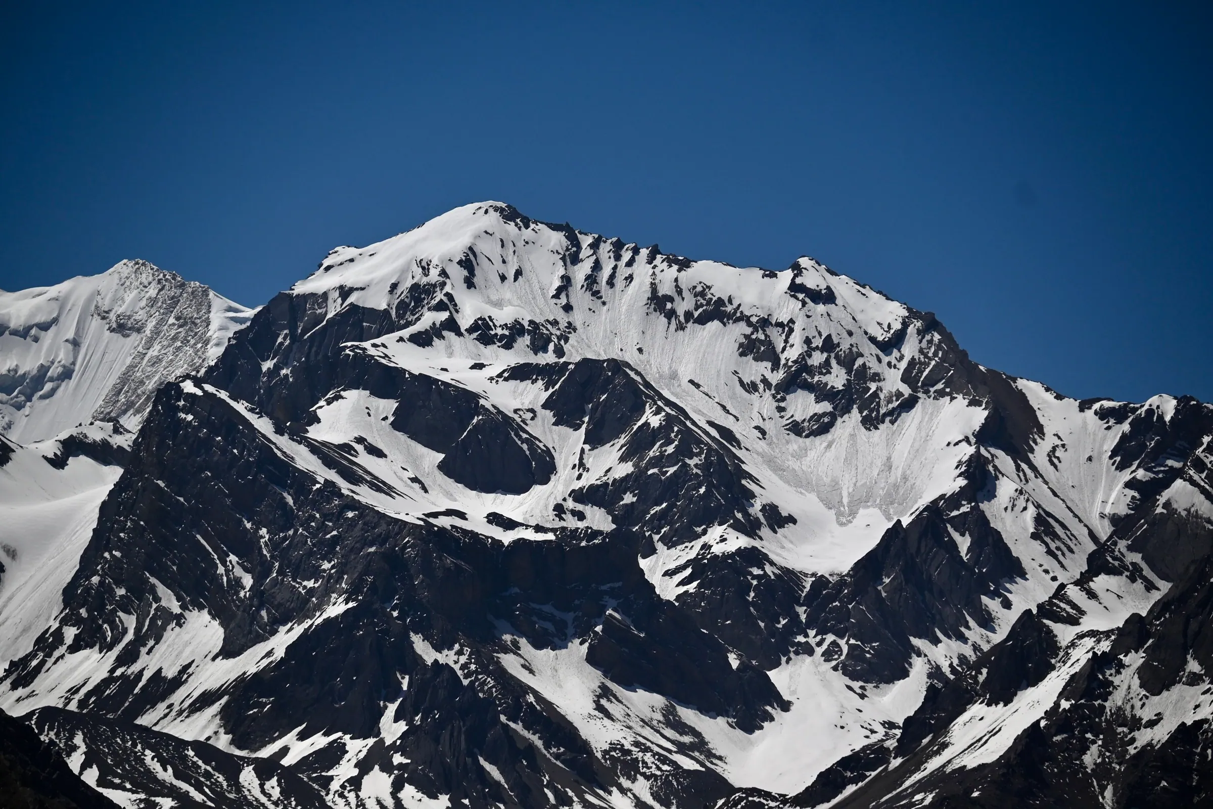
What a lens can do at this distance
An honest Kailash photograph from Indian soil shows the upper tip and the ridgeline, far back and small in the frame.
Our own pages carry no photograph of Mount Kailash from Indian soil, because we don't yet hold one we can date and place ourselves. When we do, the caption will say where the camera stood.
If you're holding a standard Adi Kailash and Om Parvat permit
An Adi Kailash and Om Parvat trip is built around Jolingkong, Nabhidhang and Kalapani. Lipulekh comes only when the road is cleared, and weather can take any of them.
So where does all this leave the trip you've already paid for? In good shape, as long as you know what's fixed and what isn't. Day 3 climbs to Jolingkong. Day 4 is Om Parvat at Nabhidhang, then Lipulekh when the authorities allow it, then Kalapani on the way down.
Nabhidhang, Kalapani and Jolingkong: what you do get
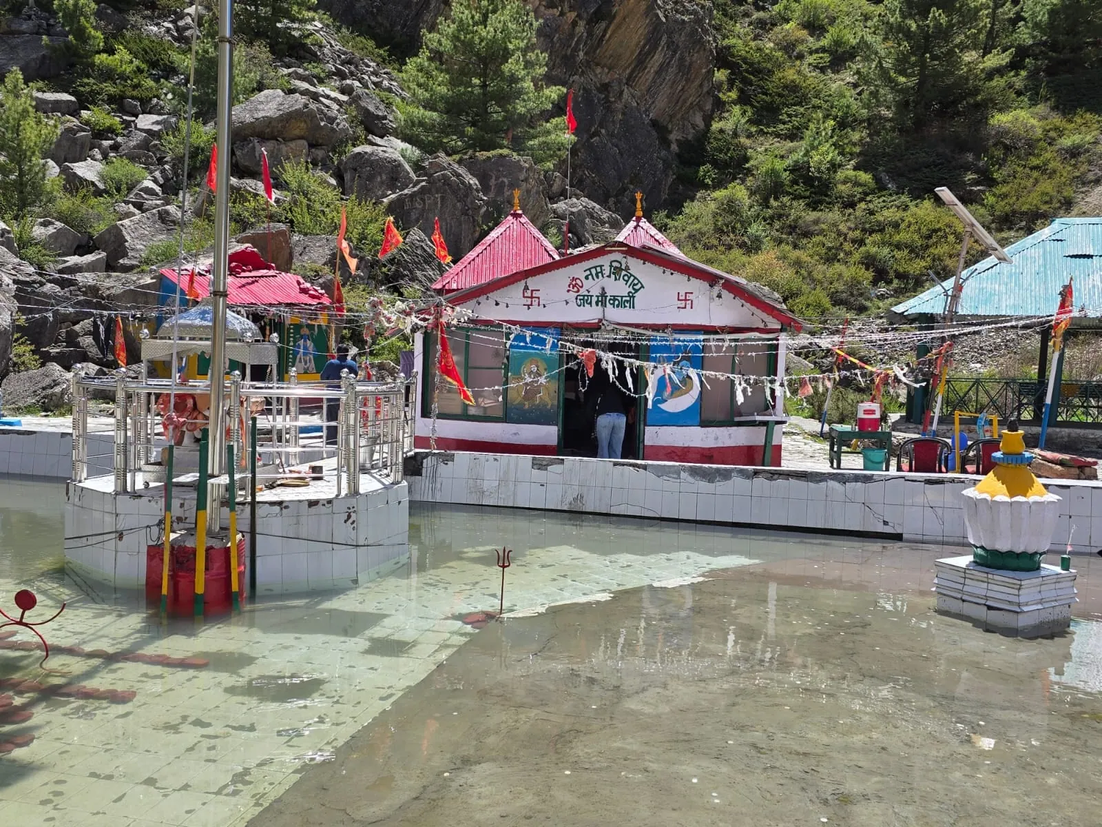
Jolingkong at about 4,500 m holds Parvati Sarovar and Adi Kailash, Nabhidhang holds Om Parvat, and Kalapani holds the Kali temple.
From Gunji the road runs about 36 km to Jolingkong, and you reach it at first light. The water there is Parvati Sarovar, at the foot of Adi Kailash. Travellers who wish take a dip in the lake. It is beside that water that the darshan of Adi Kailash is done.
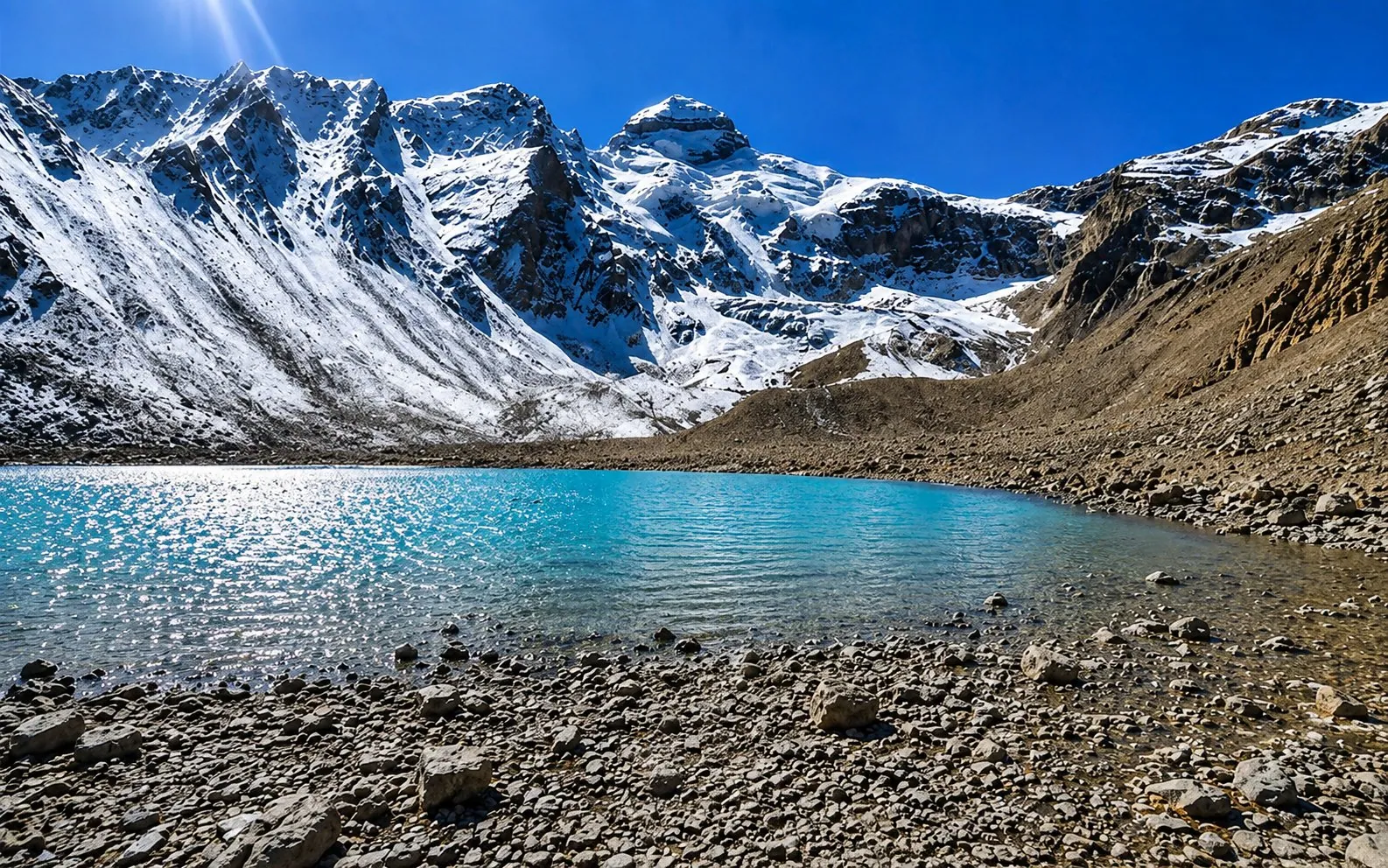
Kalapani is about 10 km from Gunji, on the way back down from Nabhidhang. The Kali temple stands there, with Vyas Gufa opposite, and the group havan is done at that stop. None of it needs a clear sky.
Plan so a sighting is a bonus, not the point
Adi Kailash and Om Parvat are the stops this trip is planned around; a traveller who comes only for Kailash can go home short.
Worth it if you want the Vyas valley: the fork at Gunji, the lake at Jolingkong, the Om above Nabhidhang. Not worth it if a Kailash sighting is your only reason for travelling, because neither the weather nor the clearance is anyone's to promise.
Adi Kailash from Delhi runs 6 days at ₹30,300 a person. Adi Kailash & Om Parvat from Haldwani runs 5 days at ₹26,300 a person. Day 4 takes in Nabhidhang and Lipulekh on both, and the permit is filed ahead, not on the day.
Questions people ask about Kailash, Mansarovar and Lipulekh
Short answers on the border, the lake, the beliefs and the viral claims around Mount Kailash.
Does Lipulekh belong to India, and which country is it in?
India administers Lipulekh and places it in Pithoragarh district, Uttarakhand; Nepal claims the Kalapani and Lipulekh area.
The leading guide puts the pass where India, China and Nepal meet, which is why the question keeps coming back. India administers it as part of Pithoragarh district, and that is where your Inner Line Permit comes from. Nepal disputes the boundary here. Both positions are on the public record, and this isn't our argument to settle.
Which month is best to visit Mount Kailash?
For the view from India, October gives the driest mornings inside the May to November road season.
May is the next driest month at Gunji, and milder at night. For the Tibet yatra, the months are the organisers' to publish, not ours.
Is there a lake on Mount Kailash, and can you bathe in Mansarovar?
Lake Mansarovar lies in Tibet, not on Mount Kailash, and bathing there belongs to the Tibet yatra.
Lake Mansarovar lies inside Tibet, so reaching it needs Chinese permission and a different trip altogether. On the Indian side, the water you can touch is Parvati Sarovar at Jolingkong, at the foot of Adi Kailash.
Does Lord Shiva live in China?
In Hindu belief Mount Kailash is the abode of Shiva, and the mountain stands in Tibet, which China administers.
The land is a matter of maps, and the abode is a matter of faith. Hindus, Buddhists, Jains and followers of Bon all hold Kailash sacred, each in their own way. The border answers the geography and nothing more than that.
What did NASA see at Mount Kailash?
No sourced NASA finding about Mount Kailash appears in anything checked for this answer, so the claim stays internet folklore.
The story travels well because it is never specific. We'd rather hand you the geography, which is strange enough by itself. One mountain, seen from one spot in India, when the sky allows it.
Questions travellers ask
No reliable figure for that belongs on a travel page, and Mansarovar sits in Tibet, on a different trip. What matters on the Indian side is the height: the Lipulekh road goes over 5,000 m, and the viewpoint walk comes at the end of it. Thin air is why the permit portal asks for a fitness certificate. Ask your own doctor about your heart, lungs or blood pressure first.
No. The Kailash Mansarovar Yatra crosses into Tibet and needs Chinese permission and an application through the Ministry of External Affairs. Old Lipulekh keeps you inside India, on an Inner Line Permit. Costs for the Tibet yatra, and for yatras run by other organisations, come from those organisers, so ask them directly. Adi Kailash Explore prices only the Indian route.
Yes, when snow is lying in the rock face: the Om is snow, not carving. Gunji's normals carry no snow days from June to October, and the October figures for Kuti (2) and Jolingkong (4) stand for those two places alone: we hold no normals for the Lipulekh road, so we cannot put a number on the snow up there. Snow decides it, so nobody can promise you a complete Om on a given morning.
For most, yes, because the route is driven rather than trekked. You sleep highest at Gunji or Nabi, 3,200 m to about 3,290 m, and we build in an acclimatisation day and carry oxygen in the vehicles. The Lipulekh road climbs higher again, over 5,000 m. If you have a heart, lung or blood pressure condition, tell us early and see your own doctor before booking.
No. Old Lipulekh is inside India, in Pithoragarh district, so your paperwork is the Inner Line Permit: one online application on the district portal, cleared by the SDM at Dharchula. The permit is the district's part. Whether the road above Nabhidhang is open on your morning is the forces' call, not a visa question. A Chinese visa and a China permit belong to the Tibet yatra, which crosses the border. A non-Indian passport goes through a different permit process, so write to us before you book.
How we made this guide
The figures on this page are filled in from data each time it is built, never typed by hand: prices, days and nights from our package pages; road distances from OpenStreetMap, measured by a router (retrieved 22 September 2026); heights from Wikidata, the Copernicus 90 m elevation model and the heights this site publishes; temperatures from 30-year ERA5-Land climate normals, modelled rather than measured at a weather station. If anything here is out of date, tell us on WhatsApp and we will correct it.
- Adi Kailash from Delhi: itinerary and price
- Adi Kailash & Om Parvat: itinerary and price
- OpenStreetMap contributors, routed with OSRM: road distances · retrieved 22 September 2026
- Wikidata: published elevations · retrieved 24 September 2026
- Copernicus GLO-90 elevation model, via Open-Meteo (heights given as about) · retrieved 24 September 2026
- ERA5-Land climate normals 1991–2020, ECMWF, via Open-Meteo · retrieved 22 September 2026
- District permit portal, Pithoragarh: steps to get the ILP (read 25 September 2026)
- Amar Ujala: inner line permits to be issued online (20 February 2025)
About Adi Kailash Explore
Adi Kailash Explore (adikailash.io) is a tour operator based in Pithoragarh, Uttarakhand, that specialises in one route: Adi Kailash and Om Parvat, the Darma valley and Munsiyari. It runs departures from Delhi, Haldwani and Pithoragarh, and its team files the Inner Line Permit for every Adi Kailash traveller at SDM Dharchula. It is recognised by Uttarakhand Tourism, certified by MSME, Govt. of India (UDYAM-UK-09-0012927) and verified on the NIDHI Portal, and was founded by Vinay Verma. Why travel with us
Keep reading
All postsOm Parvat13 min readOm Parvat, Uttarakhand: Some Years the Om Is Broken
The Adi Kailash Om Parvat yatra costs ₹26,300 a person over 5 days from Haldwani. Adi Kailash Explore lodge the Inner Line Permit at SDM Dharchula. Adi Kailash12 min read
Gunji, Uttarakhand: The Village Where the Road Forks
A Vyas valley trip through Gunji takes 6 days from Delhi at ₹30,300 a person, 4 days from Pithoragarh. Adi Kailash Explore run it May to November.Permits and planning13 min readInner Line Permit for Adi Kailash: The Part You Do Yourself
Apply for the Inner Line Permit for Adi Kailash online on the district portal. Adi Kailash Explore file it and list what Dharchula wants from you.The day-by-day plan
Download the Adi Kailash itinerary for free.
6 days and 5 nights from Delhi, as a 19-page PDF on WhatsApp.Adi Kailash & Om Parvat from Delhi: 6 days and 5 nights, as a 19-page PDF on WhatsApp. Forward it to your family, then ask us anything.
One WhatsApp message. Free, in Hindi or English.Or call +91 76688 58311 · Hindi or English
Adi Kailash & Om Parvat from Delhi
6 days, 5 nights · 19 pages
- Delhistart
- Pithoragarh
- Gunji
- Jolingkong
- Nabhidhang
- Lipulekh
- Jageshwar
- Back to Delhi
