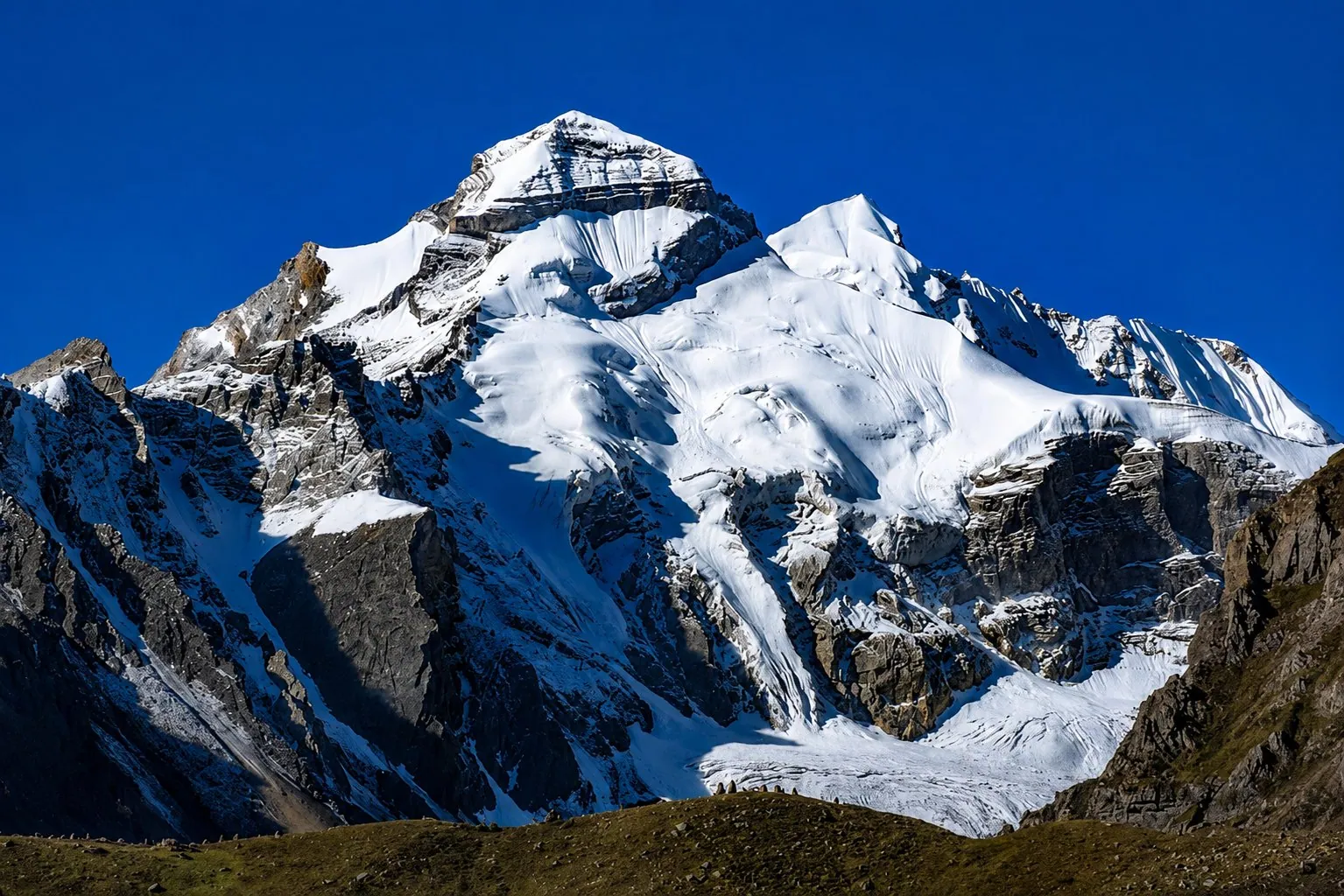
Darma Valley18 min read
The Panchachuli base camp trek is three hours up from a village bed at Dugtu
Panchachuli base camp is a day's walk above Dugtu in the Darma valley, and the road reaches the village. The path starts at 6 am with a guide from the valley, and it's about three hours on foot each way. If you were expecting a long trek from Sobla, that description belongs to the years before the road climbed to the villages. The other thing worth fixing early: three different points carry the name base camp.
By Nivedita Verma, of the Adi Kailash Explore teamAsk us on WhatsApp
TL;DRThe post in 5 lines
- Panchachuli base camp lies above Dugtu in the Darma valley, Pithoragarh district, and a 4x4 now reaches Dugtu and Dantu.
- Three points share the name: the glacier snout, the base camp under the peaks, and Zero Point. That is why published heights disagree.
- The walk leaves Dugtu at 6 am for base camp with a guide from the valley, about three hours on foot each way (team, 5 November 2026).
- Dantu, where the road stops, stands at about 3,150 m, and the valley climb begins at Sobla, about 37 km above Dharchula.
- Adi Kailash Explore's Darma Valley from Haldwani runs 6 days at ₹50,000 a person, with a full day at the valley head from Dantu.
Key facts
- Location
- Darma valley, Pithoragarh district, Uttarakhand
- Road end
- Dugtu and Dantu villages
- Height at the road end
- About 3,150 m at Dantu
- Walking
- From Dugtu, about three hours each way
- Dharchula to Sobla
- About 37 km
- Delhi to Dharchula
- About 570 km
- Permit
- Inner Line Permit, applied for online on the Pithoragarh district portal
- Best months
- May, June, September and October; winter departures from late November
- Package
- 6 days from Haldwani, ₹50,000 a person
What and where is Panchachuli base camp?
Panchachuli base camp lies at the head of the Darma valley in Pithoragarh district, above the village of Dugtu.
Leave the Kali at Tawaghat. From there a side road follows the Dhauli Ganga up to Sobla, then climbs a long way to the villages. Base camp sits above Dugtu and Dantu, under the five summits of Panchachuli. The walk begins where the road stops.
Which valley and district, and how far from Dharchula
Darma lies in Pithoragarh district, Uttarakhand, and Sobla at the valley mouth is about 37 km above Dharchula.
Dharchula is the permit town on this road. Sobla sits at about 1,870 m, where the valley really starts. Your bed at Dantu is at about 3,150 m. Short distances with a great deal of height packed into them.
Base camp, the glacier snout and Zero Point are three different points
Travellers use one name for three places: the base camp under the peaks, the glacier snout where the ice ends, and Zero Point.
That is the root of the mess on a search page. The base camp is the ground under the wall of peaks. The snout is where the glacier ice ends. Zero Point is the third name, and no definition of it is published that we would stand behind.
Our Darma day plan words it carefully: base camp, and Zero Point only if the road allows it. Read that wording as it stands. The second one turns on what a vehicle can do that week.
Is Panchachuli glacier the same as the base camp?
No: the glacier and the base camp are not the same point, and seeing one is not standing on the other.
People say glacier and base camp as though they were one spot. They aren't, and the approaches differ too. KMVN's Panchachuli tour, for instance, drives to Baling and walks on to two nights at Soan, with a day walk to the glacier from there (as listed on its package page, read 29 September 2026). That is a different line from the Dugtu walk.
How high is Panchachuli base camp, and how high is Zero Point?
Published heights for base camp disagree because three points share the name; Dantu, the village at the road end, stands at about 3,150 m.
Here is the honest position. We publish heights for the places in our own data, and the base camp isn't one of them. Dantu, where you sleep the night before the walk, is about 3,150 m, and the path from Dugtu climbs above that. For base camp itself, the figure to take is the one your guide gives you on the path.
| Place | Height | On the way |
|---|---|---|
| Dharchula | 908 m | The permit town, on the Kali |
| Tawaghat | About 1,160 m | The turn off the Kali |
| Sobla | About 1,870 m | Where the valley road begins to climb |
| Baling | About 3,120 m | A village on the way up |
| Dantu | About 3,150 m | The road end, where you sleep |
So the vehicle does nearly all the climbing. Dharchula sits at 908 m. Your bed is at about 3,150 m, and that gap is covered in a single driving day.
Why the published numbers differ
Different pages measure different points, and none of them says which one it means.
You'll see several heights for this place, some in metres and some in feet, and they don't agree. Each number belongs to a different point on the same mountainside. When you read a height, ask what it was measured to: the snout, the camp or Zero Point.
How high is Zero Point?
No height for Zero Point is published here: we have no definition of the point that we would stand behind.
The useful question isn't the altitude. It's what your driver and your guide can reach on your dates, and what they call it when you get there. Settle that in the village the evening before, over tea, with the man who is taking you.
Can you reach Panchachuli base camp by car?
A vehicle reaches Dugtu and Dantu; the base camp itself is walked from the village, not driven.
The road end moved up, and it is the single most useful thing to know about this trip. A 4x4 takes you to Dugtu and Dantu. Base camp is then a walk from a village with a bed in it, out and back in a day. As of November 2026, that's the shape of it.
Self-drive, or a local driver above Dharchula
Adi Kailash Explore sends travellers up the Darma valley in local 4x4s with hill-licensed drivers, not in their own vehicle.
The vehicle you arrive in stops in the bazaar. Our Tempo Traveller from Delhi ends its run there. Higher up, our travellers sit in local 4x4s whose drivers hold hill licences, one vehicle in front and one behind (team, 5 November 2026). That isn't a rule invented to sell a jeep. The valley road wants someone who drives it all year.
The clock on the valley road
Winter departures start out of Dharchula at about 9:30 am and reach Dantu in the early afternoon, and the SDM's advice is no driving on that road after 4 pm.
Our winter vehicles leave Dharchula around 9:30 am. Dantu comes up at about 2 pm. Our drivers don't take that road after 4 pm, and those hours are how you should build the day: finish the valley leg in daylight. If you'll reach Dharchula late, sleep there and go up next morning, rather than start the valley leg in the dark.
How long is the walk from Dugtu, and how hard is it?
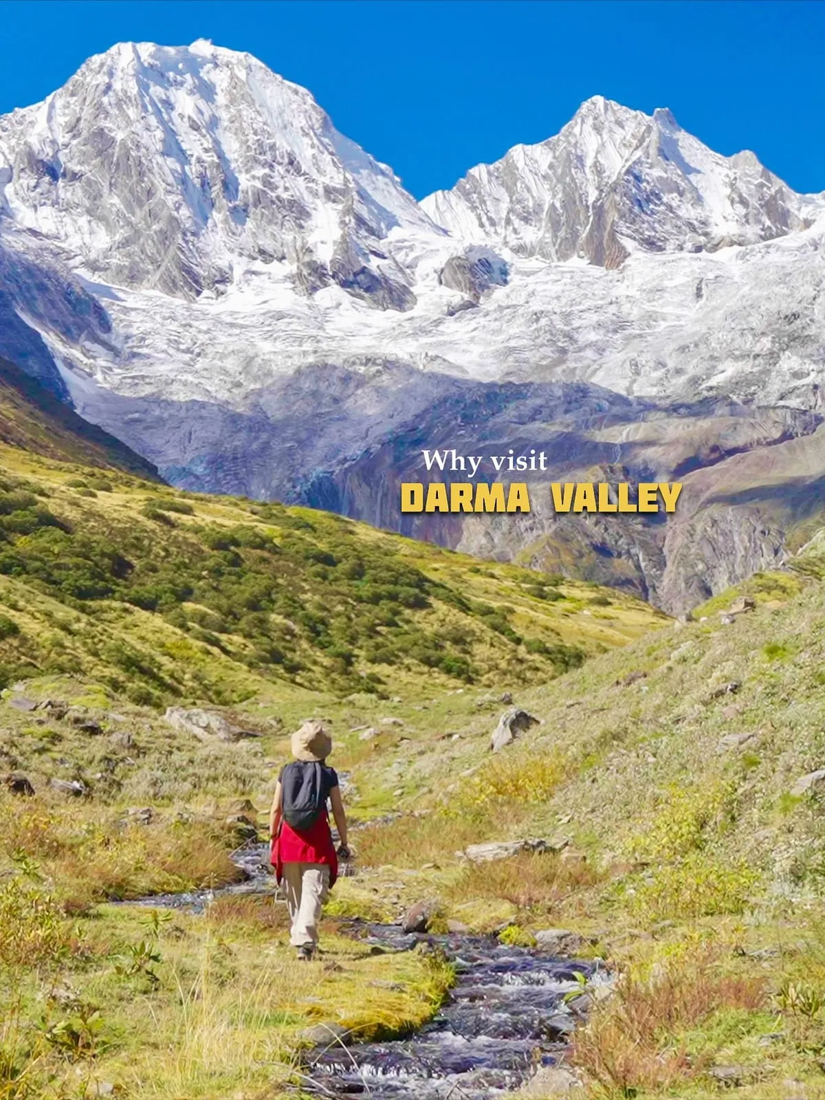
The base camp walk starts at Dugtu at 6 am and takes about three hours each way with a guide from the valley.
“The walk to Panchachuli Base Camp starts from Dugtu at 6 am with a guide from the valley. It is about three hours on foot each way, and in December the path is under snow, so we use microspikes and gaiters rented in Dharchula.”
Six hours on your feet, then, with the morning doing the climbing. The day starts cold. We measure this path in hours, not kilometres.
Is it a beginner's walk?
A reasonably fit walker who can spend a day on their feet manages it; it is not a stroll out of the village.
Try a test at home before you decide. Walk two hours without a stop, on a slope if you have one, and see how your legs feel the next morning. If that is hard near sea level, it will be harder than hard above Dantu. Elderly parents and small children can stay in the village instead, with the whole wall of peaks in front of them, and that is a fair day too.
In December the path is under snow
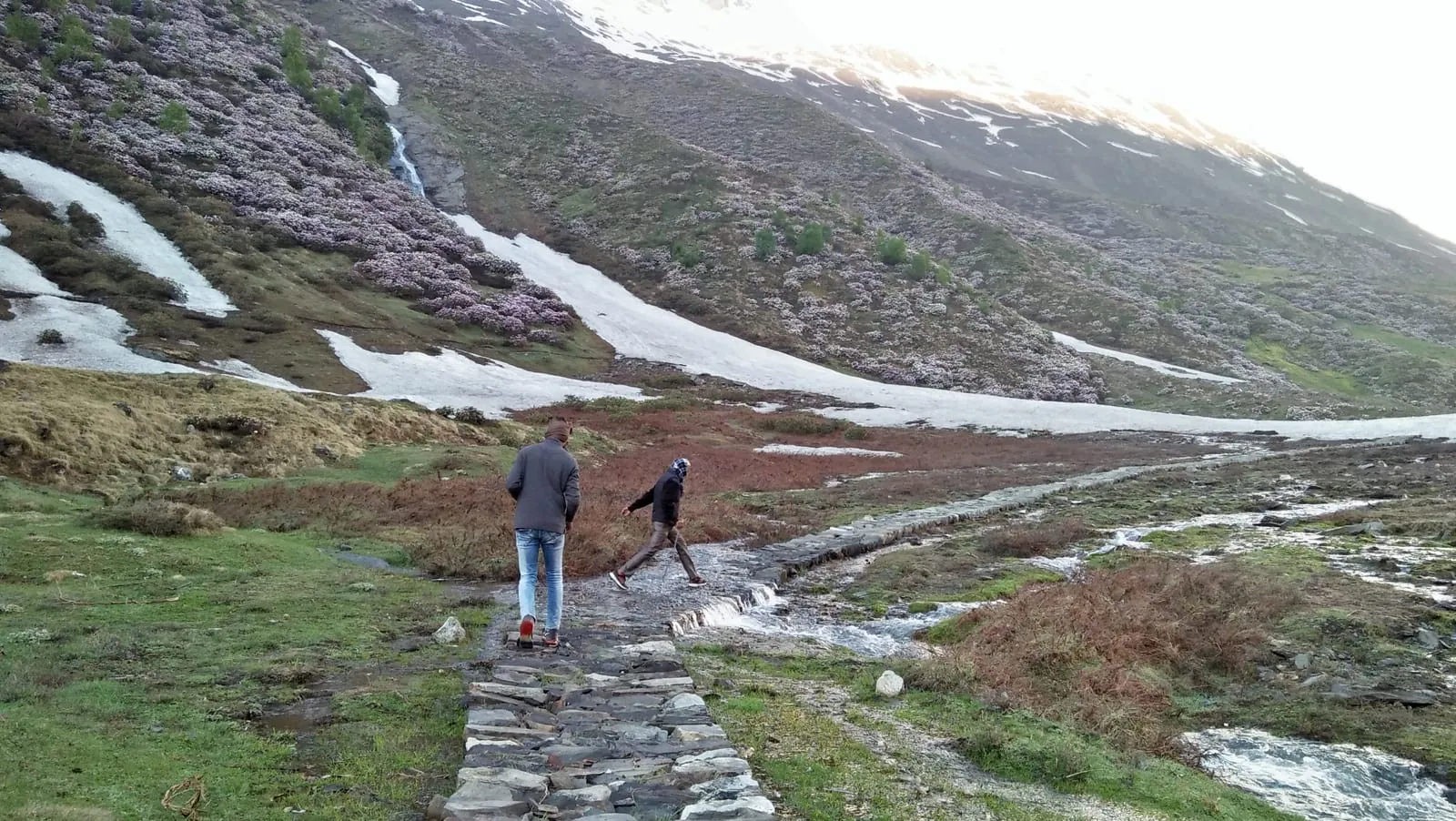
Snow covers the path in December, so Adi Kailash Explore's groups walk it in microspikes and gaiters rented at Dharchula.
Winter changes the footing, not the hours. On our winter departures we hold a spare day for exactly this: if the base camp path is snowed in, that day goes up the valley by 4x4 towards Tidang and Sipu instead (team, 5 November 2026). We don't push anyone up a buried path to protect an itinerary.
How to reach Dantu village, the road end for base camp
Dantu is reached by road through Dharchula, Tawaghat and Sobla, with the valley leg done in a local 4x4.
Everybody arrives by road. Dharchula is the hinge of the whole plan: get yourself there, and the valley is one more driving day.
| From | km (OpenStreetMap) | Where it gets you |
|---|---|---|
| Delhi | 570 | Dharchula, the permit town |
| Haldwani | 276 | Dharchula |
| Kathgodam | 273 | Dharchula |
| Tanakpur | 238 | Dharchula |
| Pithoragarh | 91 | Dharchula |
| Munsiyari | 94 | Dharchula |
| Dharchula | 37 | Sobla, where the valley climb starts |
By train, Tanakpur is the nearest railhead to this road: about 147 km to Pithoragarh. Kathgodam, beside Haldwani, is the other one people use.
The nearest airport is Naini Saini, at Pithoragarh, and its scheduled flights have started and stopped. A Delhi flight landed there in November 2024; a Dehradun service came back three days a week in March 2026. Otherwise it's Pantnagar, down on the plains near Haldwani. Don't plan the trip around a flight until you see it live in a booking system.
Getting up without your own vehicle
Buses reach Dharchula and stop there; the valley leg above the town is hired locally.
Above the town, timetables stop mattering. The practical detail of that leg sits in our post on the drive from Dharchula to Dantu, including what happens when the road is cut.
Coming from Munsiyari instead
Munsiyari sits about 94 km from Dharchula by road, and the Darma road starts above the town at Tawaghat.
We know of no direct service from Munsiyari into Darma. You hire a vehicle, you come down to Dharchula, and the valley leg still changes hands there into a local 4x4. The hours and the halts are in our post on Munsiyari to the Darma valley.
Do you need a permit for Panchachuli base camp?
Pithoragarh's online permit covers the Darma valley as well as Vyas, but Darma is not the Adi Kailash permit route.
Darma and Adi Kailash get filed together in people's heads. They are different journeys that share a gateway town. Since February 2025 that application goes in online, on Pithoragarh district's permit portal, for both the Vyas and the Darma valleys. The SDM (sub-divisional magistrate) at Dharchula takes it from there.
The portal also lists a fitness certificate signed by a registered doctor, and a self-declaration affidavit, with formats to download (read 25 September 2026). What is asked for moves with the season. Check the portal against your own dates.
Darma is not the Adi Kailash permit route
Adi Kailash and Lipulekh sit in the Vyas valley with their own season; the Darma calendar is a separate thing.
The May to November window on our Adi Kailash pages is the season of the scheduled packages up there, not the permit season and not the road season. It says nothing about Darma, where our own groups travel in late November and December. If an Adi Kailash plan falls through, Darma is a different valley with a different road. It isn't a side door into the same one.
Fees collected in the valley
Adi Kailash Explore's convoy trip lists a Darma valley registration fee outside its package price. We cannot say how much it is, who collects it or whether every traveller pays it, so ask us before you travel.
Carry notes for anything collected in the valley: there is no cash machine above Dharchula (team, 5 November 2026).
The day at base camp, hour by hour
From a bed at Dantu the base camp day runs on foot from Dugtu at 6 am, out and back the same day.
You wake in a village, not a tent. Tea, then across to Dugtu, where the path starts at 6 am. The cold goes out of the morning as you climb.
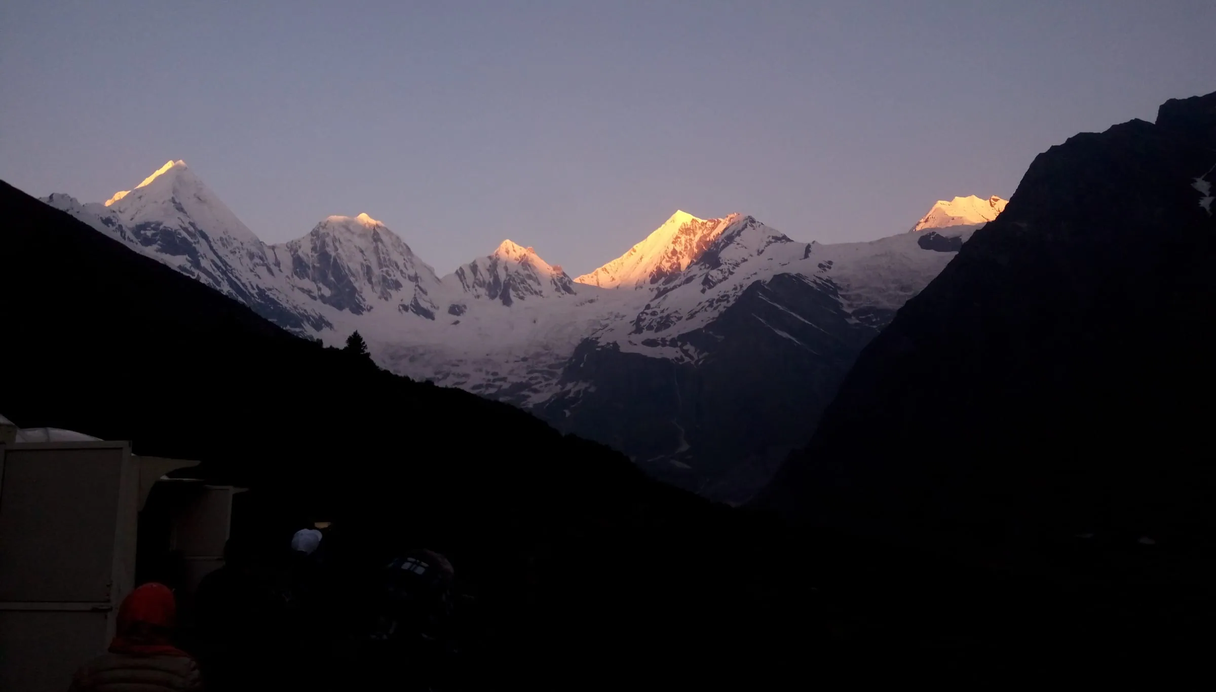
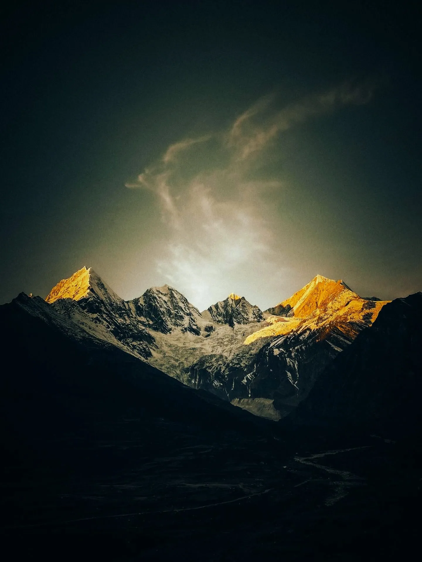
What waits at the top is the wall itself: five summits with snow on their faces, standing over the head of the valley. There is no climbing on this walk. This is a walk to look.
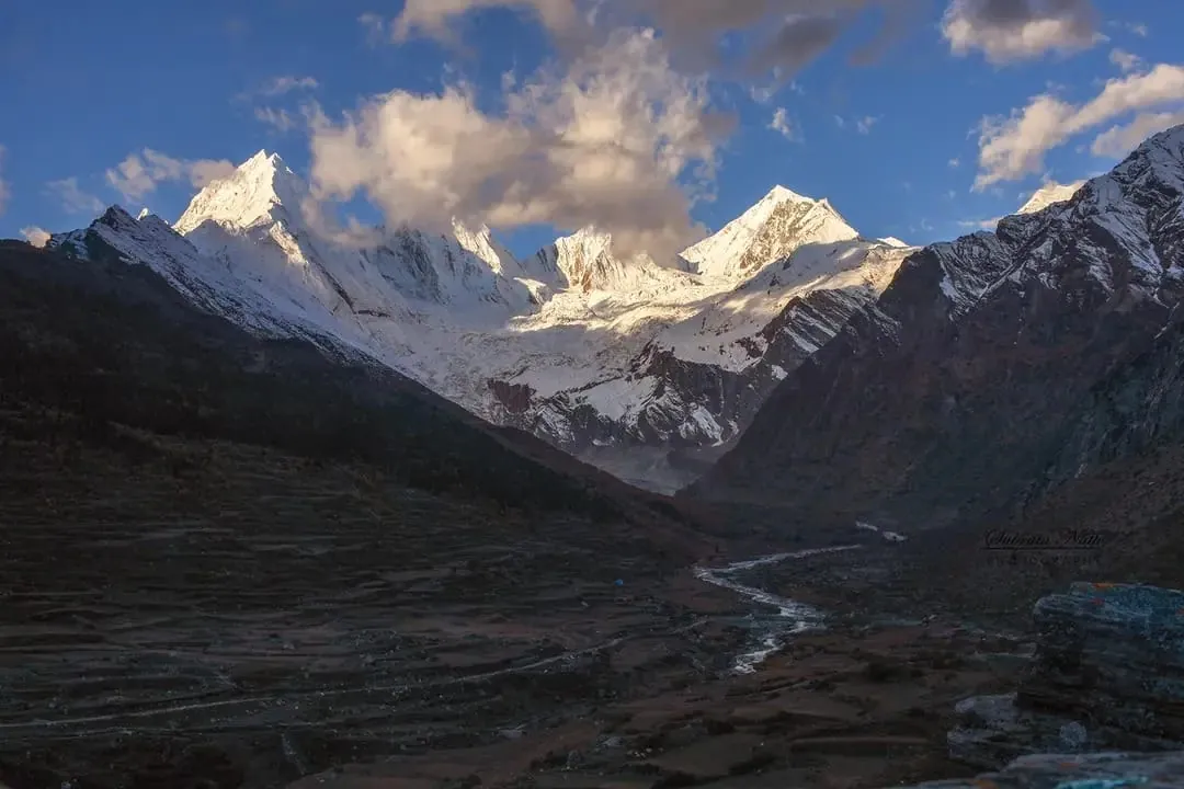
Afternoons are for coming down, and the reason goes beyond the light on the peaks. The SDM advises no driving on the Darma road after 4 pm, and our drivers keep to that. A 6 am start hands you the whole margin.
When to turn around
A headache that keeps getting worse, breathlessness that will not settle, or snow over the path means going down, not on.
Turning back costs you one morning. Going on with a worsening head can cost you much more. Say it early, not at the last climb. The peaks will stand there next season.
Why is it called Panchachuli, and which peak is the highest?
Panchachuli is one massif with five summits, named for the five cooking stoves people tell of in the Mahabharata.
The name is counted, not poetic: panch for five, chuli for a cooking stove. People here tell it as the Pandavas cooking on five stoves on their way into the mountains. That is the story told here, and it is told as a story.
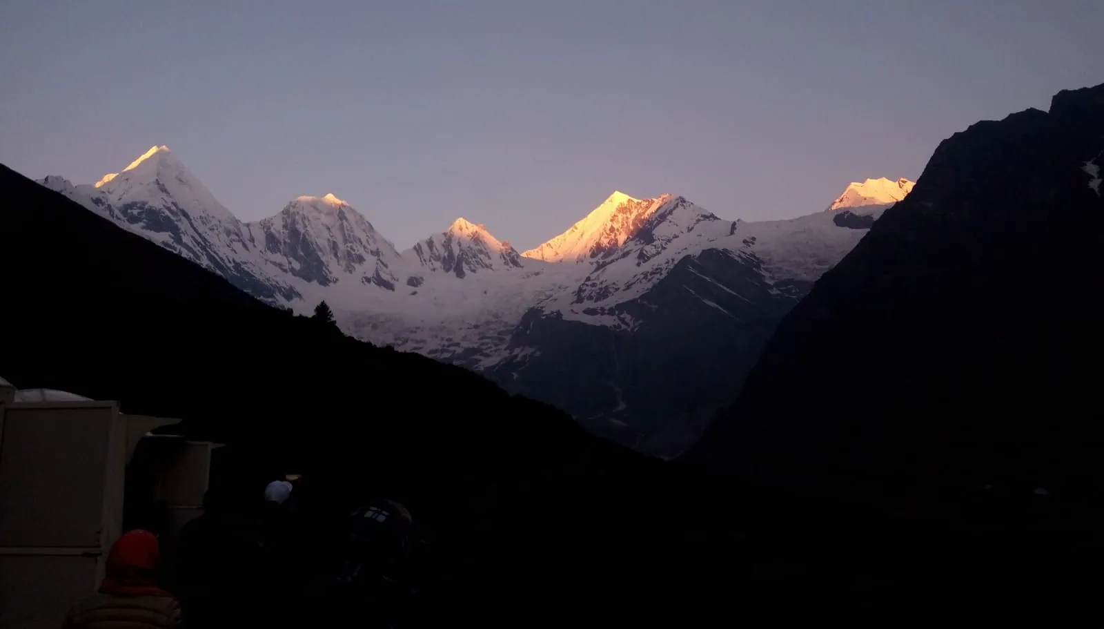
From the Darma side the five read as one wall above the valley head, close enough to fill the window at Dantu. Same mountain, two different angles, and the heights and the climbing history sit in our post on the five peaks themselves.
Best time to go to Panchachuli base camp, month by month
May, June, September and October suit the walk best, and July and August belong to the monsoon.
Two things pick your month: rain and snow. We hold no weather station figures for Dugtu, Dantu or the base camp, so the nearest comparable places in our data are the honest guide. Munsiyari sits at 2,155 m in the modelled data and Gunji at 3,204 m, which brackets the height you'll be sleeping at.
| Month | Munsiyari day/night | Gunji day/night | Munsiyari rain |
|---|---|---|---|
| January | 7°C / -4°C | -2°C / -14°C | 146 mm |
| February | 8°C / -2°C | -1°C / -12°C | 165 mm |
| March | 11°C / 0°C | 3°C / -9°C | 118 mm |
| April | 15°C / 4°C | 8°C / -4°C | 72 mm |
| May | 19°C / 7°C | 12°C / 1°C | 101 mm |
| June | 21°C / 12°C | 16°C / 8°C | 315 mm |
| July | 21°C / 16°C | 18°C / 12°C | 837 mm |
| August | 21°C / 15°C | 17°C / 12°C | 825 mm |
| September | 20°C / 12°C | 16°C / 8°C | 288 mm |
| October | 17°C / 5°C | 11°C / 0°C | 53 mm |
| November | 13°C / 1°C | 7°C / -5°C | 49 mm |
| December | 10°C / -2°C | 3°C / -10°C | 64 mm |
Monsoon: July and August
July and August are the months to skip: the rain is heavy and the valley has one road in and out.
Munsiyari's July normal is 837 mm of rain, and August is barely behind it. The walk is not the problem in those weeks. The road is, and a cut road in Darma means waiting where you stand. We wouldn't spend a four-day trip on that gamble.
Winter in the Darma valley
Winter travel in Darma is real: Adi Kailash Explore runs departures from late November into December, and none from January to March.
Some Rung families now stay up in Darma through the cold months, so the valley is not simply shut (team, 9 November 2026). Our winter trip is the Panchachuli Base Camp Expedition: six days from Delhi, leaving every Friday night from 27 November to 18 December 2026, with a Christmas departure from 22 to 28 December. Nights in the valley sit below freezing, and the days come bright and dry.
How many days do you need, and what does it cost?
Four days from Haldwani or Delhi covers the drive in, the base camp day and the drive out.
You'll find plans from four days to thirteen for this same valley. What they differ in is days, not height. Our trip runs 6 days from Haldwani: up to Dantu on day 1, a day on foot from the village on day 2, with Zero Point if the road allows it, down to Pithoragarh on day 3, and Haldwani on day 4.
Darma Valley from Haldwani is ₹50,000 a person. The same shape with a Delhi start is ₹55,000 a person, with the first night at Pithoragarh. Worth it if you'd rather not spend your evening hiring a vehicle in Dharchula. Not worth it if arranging the road yourself is half the pleasure, in which case go and do that.
Longer plans buy you more valley, not a higher base camp. If you want Tidang, Sipu or the hot water near Dar, you need the extra day for them. On the hot springs, keep your expectations low: several warm springs come out of the ground around Dar, and not one of them is developed (team, 9 November 2026). No tanks, no bathhouse, just warm water by the river.
What a package includes, and what it doesn't
Transport, stays, breakfast and dinner sit inside the price on Adi Kailash Explore's Darma trips; lunch and personal spending sit outside it.
On our Darma trips the vehicle for the full route, the nights, breakfast and dinner are in the price, and lunch on the road is yours. Everything we commit to goes into writing before any money moves, which is the part worth checking in anybody's quote.
Cash for the valley
No cash machine and no signal sit above Dharchula, so the valley is paid for in notes drawn lower down.
Draw your cash in Dharchula, or in Pithoragarh if you pass through it earlier in the day. Snacks, a second plate of food, a small purchase in the village: all of it is cash.
Where do you sleep at Dugtu and Dantu?
Homestays at Dugtu and Dantu are the beds at the road end, hosted by Rung families in the villages.
Dantu is where our groups sleep, in two houses we use: Darma 360 and Bhojpatra Kutir. In winter we take three nights at Darma 360, which has a fireplace, thick quilts and hot water (team, 5 November 2026). The quilts count for more than the view.
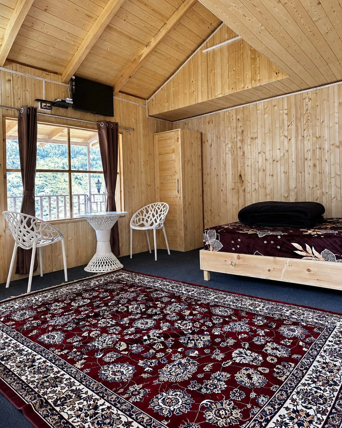
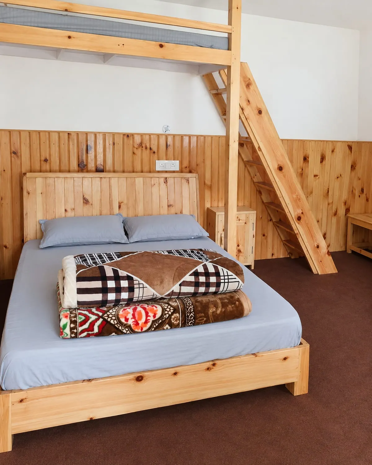
Booking a bed yourself is possible. Uttarakhand Tourism counts 12 villages in this valley and points travellers at their homestays. Two Dugtu houses sit on its own booking site, with card prices for two adults: Rs 1,500 a night at Nyola Homestay, Rs 2,000 at Old Is Gold Homestay (as listed, read 29 September 2026). A rate listed in September isn't a promise for your dates.
One flaw, said plainly: these are village houses, and there's no signal up there to call ahead with. So you either arrive with a bed held for you or take whatever the evening offers. Even so, waking inside a Rung village under that wall of peaks is the whole reason to come to Darma.
Camping above the village
Camping means carrying your own kit; for a day walk the village beds make it unnecessary.
If your plan is base camp and back in a day, you're better off in a warm room at Dantu. Carrying tents to save three hours of walking is a poor trade.
Nights lower down
Dharchula, Narayan Ashram and Pithoragarh hold the nights below the valley, each on a different road day.
At Dharchula our standard groups use Shiv Dham Dharchula, and KMVN's own rest house there books online; its page shows deluxe and super deluxe doubles and prints no tariff (checked 29 September 2026). Narayan Ashram is a different sort of night: a working ashram founded in 1936, about 14 km above Tawaghat, where the district's own map says affordable accommodation is available. It stands up the other arm from Tawaghat, so it suits a trip taking in both valleys.
Altitude, safety and who should not go up
Dantu sits at about 3,150 m, so the valley suits anyone who can sleep at that height and spend a long day on foot.
The climb happens quickly, and that's the part to respect. You leave Dharchula in the morning at 908 m and sleep the same night at about 3,150 m. Our plan keeps a night in the village before the walk, which is the whole reason the base camp day can start from a bed.
A headache that keeps getting worse means going down. Tell your guide at the first sign of it, not at the top of the climb.
If you have a heart or lung condition, uncontrolled blood pressure, a recent surgery or a pregnancy, speak to your own doctor before booking this, and tell us what they say. We'll say honestly if we have concerns. And remember what the valley is: no phone signal, and getting out means driving down, which in winter our 4x4s do in daylight only.
The fuller picture of the valley, its homestays and its weather sits in our Darma valley guide, and the side-by-side with the easier option is in Munsiyari or Darma.
Questions travellers ask
No. Panchachuli base camp is in Uttarakhand, in Pithoragarh district, reached by road to Dugtu and then a morning's walk. Search engines mix the three because the words base camp belong to those famous treks as well. The scale is different too: this one is a day on foot.
No. Munsiyari looks at the same five peaks from the Gori valley, on the other side, and base camp is approached through Dharchula on the Darma side. Munsiyari is about 94 km from Dharchula by road, and the valley road leaves the Kali above the town. Munsiyari is the easier trip with the long view; Darma puts you under the wall.
There's no phone signal above Dharchula (team, 5 November 2026). No cash machine either, and UPI needs a signal it won't find. Tell your family you'll be out of contact for the valley nights, carry notes drawn in Dharchula or Pithoragarh, and settle anything that needs a phone call before you leave the town.
Adi Kailash Explore doesn't run motorcycle trips in Darma, so nothing here is a promise about riding it. What the team can tell you is that the surface above Sobla changes from one week to the next, and travellers on our trips go up in local 4x4s with hill-licensed drivers. If you're set on riding, ask us what the road is doing the week you plan to leave.
Card prices on Uttarakhand Tourism's homestay site run Rs 1,500 and Rs 2,000 a night for two adults at the Dugtu houses listed there (read 29 September 2026). The Dantu houses our own groups use aren't listed with a price. For five or six nights the rate is a conversation with the host, in the village, and only they can say what a longer stay changes.
How we made this guide
The figures on this page are filled in from data each time it is built, never typed by hand: prices, days and nights from our package pages; road distances from OpenStreetMap, measured by a router (retrieved 22 September 2026); heights from Wikidata and the Copernicus 90 m elevation model; temperatures from 30-year ERA5-Land climate normals, modelled rather than measured at a weather station. If anything here is out of date, tell us on WhatsApp and we will correct it.
- Darma Valley Tour Package from Haldwani: itinerary and price
- Darma Valley Tour Package from Delhi: itinerary and price
- OpenStreetMap contributors, routed with OSRM: road distances · retrieved 22 September 2026
- Wikidata: published elevations · retrieved 24 September 2026
- Copernicus GLO-90 elevation model, via Open-Meteo (heights given as about) · retrieved 24 September 2026
- ERA5-Land climate normals 1991–2020, ECMWF, via Open-Meteo · retrieved 22 September 2026
- District permit portal, Pithoragarh
- District permit portal: steps to get the ILP (read 25 September 2026)
- The Hindu: first commercial flight lands at Naini Saini airport (7 November 2024)
- ThePrint: Dehradun to Pithoragarh flight service flagged off (26 March 2026)
- Uttarakhand Tourism (UTDB), destination page 'Darma Valley'
- Uttarastays (UTDB homestay booking site): Nyola Homestay, Dugtu
- Uttarastays (UTDB homestay booking site): Old Is Gold Homestay, Dugtu
- KMVN package 'PANCHACHULI ECONOMIC TOUR-DHARCHULA TO DHARCHULA'
- KMVN, 'TRH Dharchula'
- District tourism map 'Pithoragarh Destination' (Google My Maps)
About Adi Kailash Explore
Adi Kailash Explore (adikailash.io) is a tour operator based in Pithoragarh, Uttarakhand, that specialises in one route: Adi Kailash and Om Parvat, the Darma valley and Munsiyari. It runs departures from Delhi, Haldwani and Pithoragarh, and its team files the Inner Line Permit for every Adi Kailash traveller at SDM Dharchula. It is recognised by Uttarakhand Tourism, certified by MSME, Govt. of India (UDYAM-UK-09-0012927) and verified on the NIDHI Portal, and was founded by Vinay Verma. Why travel with us
Keep reading
All posts Darma Valley12 min read
Dharchula to Dantu Village Distance, and Getting a Seat
No bus runs the Dharchula to Dantu village distance: about 37 km to Sobla, then higher. Adi Kailash Explore cover the shared jeep and the way out.Darma Valley20 min readMunsiyari or Darma Valley: A Verdict for Each Traveller
Munsiyari if your days are few; Darma if you want to sleep high at Dantu. Adi Kailash Explore gives a verdict for each kind of traveller.Darma Valley13 min readPanchachuli: The Five Peaks You Look At, Not Climb
Panchachuli from Munsiyari is the western side, and from Dugtu and Dantu in Darma the eastern. Adi Kailash Explore say what each face shows.The day-by-day plan
Get the Darma Valley itinerary for free.
6 days and 5 nights from Haldwani, day by day on WhatsApp.Darma Valley from Haldwani: 6 days and 5 nights, day by day, sent on WhatsApp. Share it with your family, then ask us anything.
One WhatsApp message. Free, in Hindi or English.Or call +91 76688 58311 · Hindi or English
Darma Valley from Haldwani
6 days, 5 nights · day by day
- Haldwanistart
- Pithoragarh
- Dharchula
- Dantu
- Panchachuli Base Camp
- Sipu
- Dar hot spring
- Back to Haldwani