Darma Valley12 min read
The Dharchula to Dantu village distance, and the harder job of finding a seat
Dharchula to Sobla, the mouth of the Darma valley, measures about 37 km, and Dugtu and Dantu sit above it. Dantu, where the road ends, is at about 3,150 m. If you're arriving without a car, the distance isn't your problem. The seat is. This one is written for that traveller: the jeep day up, the nights at the villages, and the way back down.
By Rishabh Verma, of the Adi Kailash Explore teamAsk us on WhatsApp
TL;DRThe post in 5 lines
- The Darma road runs about 37 km from Dharchula up to the valley mouth at Sobla, then carries on above it to Dugtu and Dantu, where it ends.
- No bus runs up the Darma road, so a traveller without a car takes a shared jeep seat from Dharchula, or hires the whole vehicle.
- From Dharchula the stand, the departure times and the fares move season to season, so ask Adi Kailash Explore on WhatsApp the week you travel.
- The climb matters more than the kilometres: Dharchula sits at 908 m and Dantu at about 3,150 m, gained in one day in a vehicle.
- Seats leaving Dugtu and Dantu are few, so plan the way out before you go up: a missed vehicle costs a day and a night.
Key facts
- Location
- Dugtu and Dantu, Darma valley, Pithoragarh district, Uttarakhand
- Dharchula to Sobla
- About 37 km
- Valley mouth
- Sobla, about 1,870 m
- Where the road ends
- Dantu, about 3,150 m
- Permit
- Inner Line Permit, applied for online on the district portal
- Departures
- May to November
- Trip length
- 6 days from Haldwani, 6 days from Delhi
How far is Dantu village from Dharchula, and how long does the drive take?
Sobla, the valley mouth, is about 37 km from Dharchula, and Dugtu and Dantu sit above it where the road ends.
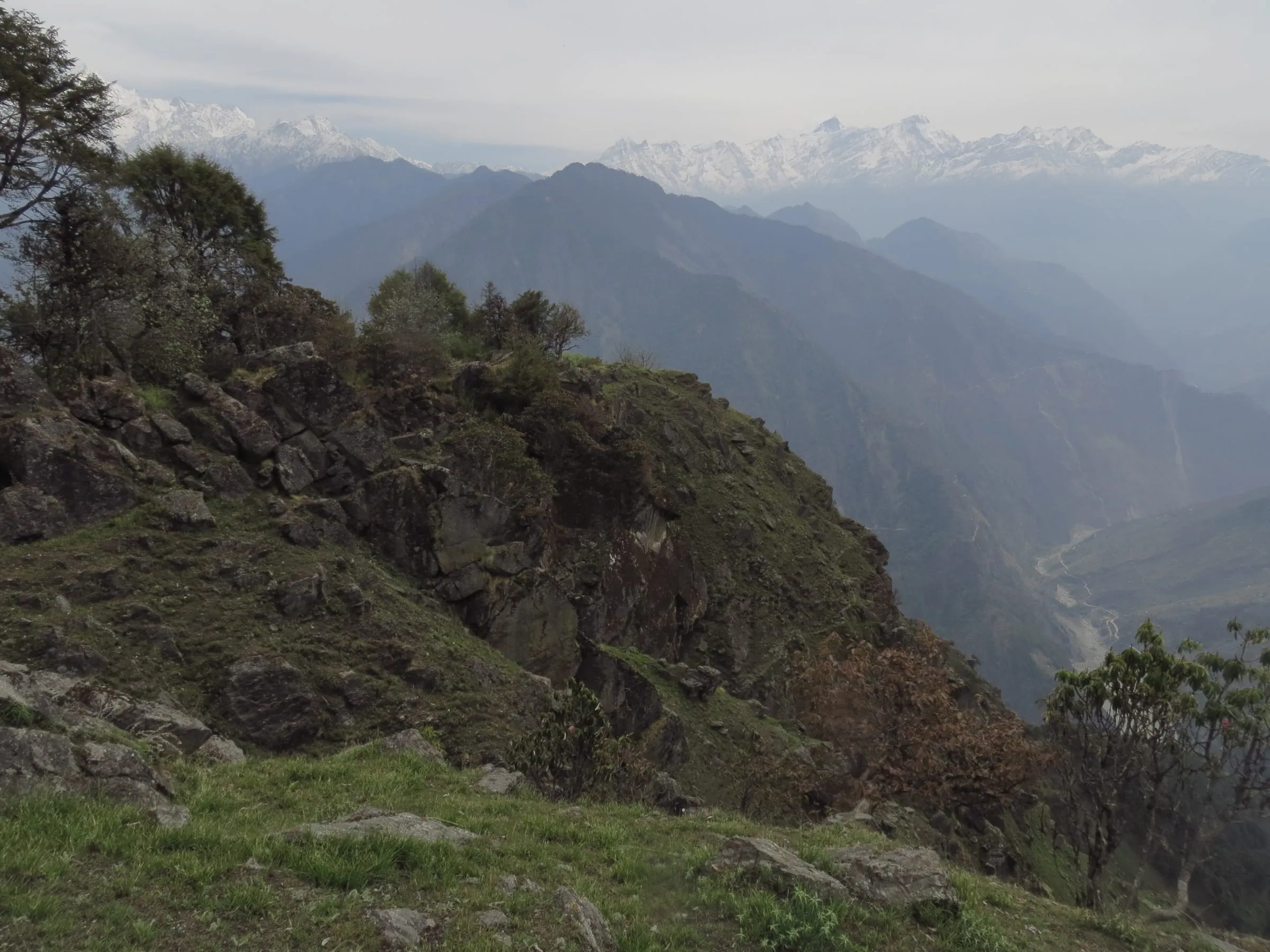
Darma is the valley the Dhauli Ganga comes down, from the Panchachuli peaks at its head to Tawaghat, where it meets the Kali above Dharchula. Villages sit along it, taking guests in family homestays, and the road stops at Dantu. That's the place you have probably been looking at in reels.
Above Tawaghat the two valleys part. The Kali road carries on for Gunji; yours climbs beside the Dhauli Ganga through Sobla, Dar and Nagling, to Dugtu and Dantu. One valley, one road.
Dharchula to Sobla: the valley mouth
Sobla sits about 37 km up the road from Dharchula, measured on OpenStreetMap. Above Sobla, the figure worth having isn't the kilometres. It's the climb.
Why the same drive gets several different distances
Search this pair and the answers won't agree. The likeliest reason is dull: the endpoints aren't the same. Some figures stop at Sobla, some run on to the villages, and some look as though they add the walk beyond them towards Panchachuli Base Camp. Before you trust a number, ask what it was measured to.
How many hours it takes, and why it's a day
The hours are what people really want, and they move with the road. Google's summary of this drive says 5 to 6 hours. Take that as a good day rather than a rule.
Dharchula sits at 908 m. Your bed at Dantu is at about 3,150 m. The road climbs the whole way, in a valley, on a surface that changes with the month. It's nobody's quick errand.
So leave Dharchula in the morning, and plan to be at the villages in daylight. If your return date is fixed and close, keep a spare day at the Dharchula end.
| Place | Height | What it is |
|---|---|---|
| Dharchula | 908 m | the town where the drive starts |
| Sobla | About 1,870 m | the mouth of the Darma valley |
| Dantu | About 3,150 m | the village where the road ends |
How to get from Dharchula to Dugtu and Dantu without a car
Four steps: reach Dharchula, file the permit, find a seat the evening before, and ride up in daylight.
Everything up to Dharchula can be booked. The Darma road is asked about, not booked.
Step 1: get yourself to Dharchula
Dharchula is about 91 km from Pithoragarh by road, and buses and shared vehicles work that road.
From Haldwani it's about 276 km, and from Delhi about 570 km. Buses run as far as Dharchula. None goes up the Darma road. The Darma valley route guide lays out the long legs from the plains in order.
Plan on a night in Dharchula before you go up. It buys you an evening to ask about seats, and it puts you in town early next morning instead of arriving in it. Rooms there are hotels, lodges and guest houses, listed on the district's permit portal as basic rooms worth booking in advance.
Step 2: file the permit before you climb
Fill in the Inner Line Permit on the district portal while you're still down in town. A traveller without a car can't come back down to fix paperwork. Keep a government photo ID and your papers on you for the drive.
Step 3: find a seat the evening before
Shared jeeps are how this valley travels. They carry villagers, supplies and travellers together. From Dharchula it's a seat in one of those jeeps, or the whole vehicle.
Where they stand, how often they run, what a seat costs: all of it moves season to season. Ask the week you travel.
Step 4: ride up, and arrive in daylight
Then the day is just the road. You'll sit upright for most of it, with the river below you. You get out at about 3,150 m.
A day in a vehicle is not acclimatisation. Dharchula sits at 908 m and your bed at Dantu is at about 3,150 m, gained in one day. If your heart or lungs give you trouble, put this day to your own doctor before you plan it.
How do you get back down from Dugtu and Dantu?
The way down is a seat arranged the day you arrive rather than the day you want to leave.
Plan the way down before you go up. So on the evening you reach Dantu, tell your host which day you want to go down. Asking early works better than hoping.
If you miss your ride, you wait. A missed vehicle costs a day, a night, and the food and bed that go with them. Travellers with a fixed train or flight shouldn't cut this fine.
Hiring the whole vehicle instead of a seat
Hiring the whole vehicle buys certainty on the return, and two or three people can share the cost.
Hiring suits two or three people sharing the cost. It suits anyone with counted days, and photographers who want Dantu at first light.
Ask what a quote covers, and ask whether the driver waits a night up there: that's the line people forget.
The road in order: Tawaghat, Sobla, Dar, Nagling, Dugtu, Dantu
The Darma road turns off the Kali at Tawaghat, then works up through Sobla, Dar and Nagling to Dugtu and Dantu.
Learn the order of the villages. A village name tells you how far up the road a vehicle is headed.
- Tawaghat: the fork above Dharchula, where the Dhauli Ganga meets the Kali
- Sobla, about 1,870 m: the mouth of the Darma valley
- Dar: on the road above Sobla
- Nagling: a village with a homestay listed on the state tourism board's booking site
- Dugtu: two homestays listed on that same site
- Dantu, about 3,150 m: where the road ends, and where our Darma nights are spent
Can we reach Darma valley by car, and what vehicle does the road need?
Adi Kailash Explore's Darma trips drive in to the homestay at Dantu.
Our Darma itineraries drive in to Dantu and sleep there, and the Panchachuli Base Camp day runs out of the village, road conditions permitting. In this valley that last phrase does real work.
Google's summary of this road calls for a 4x4 or a high-torque vehicle. The accounts you'll read of it keep coming back to the same two things: unpaved stretches and water crossings. Your own sedan is a question for the week you're travelling, and a bike after a wet week is another one again.
Tell us your week and what you'd be driving. Our drivers will say what the road is doing.
What happens when the road is cut
A slide or a swollen stream can end the drive short of the villages, and the monsoon weeks are when that is likeliest.
Rain is the whole of it. July brings 495 mm of rain to Dharchula. October brings 30 mm, in the 1991 to 2020 normals (modelled, not a station reading). Those are for the town where your drive starts; we hold none for Dugtu or Dantu.
How far you'd walk from a block depends entirely on where it sits, which is why asking beats planning. Ask drivers in Dharchula what the road did yesterday. That's the road report worth having.
This is a valley that can take a day off you and give nothing back.
If you lose a day and your dates can't absorb it, there's a fallback. Munsiyari is about 94 km from Dharchula, and the same peaks stand over it from the other side. How to reach Munsiyari lists what runs on that road, bus and shared jeep both.
What to settle in Dharchula before you go up
Cash, offline maps and a message home all get settled in Dharchula, since there is no ATM above the town and little signal up the valley.
Draw your cash in Dharchula, and draw more than the trip looks like it needs, in small notes as well as large: a trek operator's guide says there are no ATMs beyond the town. Download your offline maps while you still have a signal, and tell one person which village, which night, and when you expect to be back down.
Then pack for both ends of the day. Dharchula runs to 28°C on a May afternoon, and your bed that night is at about 3,150 m, so carry warm layers, your own medicines, your permit papers and a government photo ID, plus water and food for the whole drive. Which SIM works where, cash to draw and the kilometres past the last pump, Sobla to Dantu included.
Permit, season and whether the valley is open
You apply for the Inner Line Permit online on the district portal, and Adi Kailash Explore's Darma departures run May to November.
The Inner Line Permit covers the Vyas and the Darma valleys, and you apply for it online on the district portal. The SDM (sub-divisional magistrate) at Dharchula issues it. Applications moved fully online on 20 February 2025.
One widely read trek blog says no permit is needed for 2026; a trek operator's guide and the district's own permit pages treat it as required. Carry the papers either way. The portal asks for a self-declaration affidavit and a fitness certificate signed by a registered doctor, and you can download both formats there (read 25 September 2026). Check it for your own dates. Our Inner Line Permit guide covers the filing itself.
Which months the road is usable
Our departures run May to November, from 1 May to 20 November. May is the dry end of the season at Dharchula: 40 mm of rain in the normals. July and August are the wrong weeks for a road that doesn't like water.
Inside the season a week of rain decides this road, not a calendar. Ask drivers in Dharchula the morning you go up.
Where you sleep at the end of the road
Dugtu and Dantu take travellers in family homestays, and in season a walk-in traveller shouldn't count on a bed.
The state tourism board describes the Darma valley as twelve tribal villages taking guests in homestays. In practice it's a room in a family house.
| Homestay | Village | Listed rate a night |
|---|---|---|
| Nyola Homestay | Dugtu | Rs 1,500 |
| Old Is Gold Homestay | Dugtu | Rs 2,000 |
| Rajendra Singh Homestay | Nagling | Rs 1,000 |
Our own Darma trips sleep both valley nights at Dantu, and the base camp day runs out of the village. Arrive on spec in a good week and you're at the mercy of who has a room free.
Darma valley in full has the Rung villages, the base camp walk and the weather month by month.
What it costs to do this without a car
The carless budget runs on four line items: the seat up, the bed, the food and the seat down.
Totals quoted for this valley usually assume a vehicle you already own, with fuel as the only transport line. The figures float accordingly. A widely read trek blog puts the trip under ₹4,000; a trek operator's guide gives ₹10,000 to ₹15,000 for one version and ₹20,000 to ₹35,000 for another; a traveller on a forum reported ₹6,000 to ₹7,000 for a full taxi.
None of those is costing your trip. You're buying a seat twice, a bed for two nights and food in between. Beds are the one line anyone can look up, on the state board's homestay site. The seats are the line that moves.
A hired vehicle for two costs more on the day, and sometimes less over a trip you'd otherwise spend waiting for seats.
If you'd rather not spend your days negotiating, the packaged version of the same road is 6 days from Haldwani, or 6 days from Delhi. Both sleep at the Dantu homestay and keep a day for Panchachuli Base Camp.
The Delhi plan sleeps its first night at Pithoragarh, 1,645 m, before the valley. The Haldwani plan drives through and takes its Pithoragarh night on the way back out.
Day by day, with one price for your whole party: the Darma Valley trip from Haldwani.
Questions travellers ask
Delhi to Dharchula is about 570 km by road, through Kathgodam and Pithoragarh, and Dharchula is where the drive up the Darma valley starts. Buses run up to Dharchula; none goes beyond it into the valley. Trains come in to Kathgodam and Tanakpur. Tanakpur is the closer railhead by road, about 238 km. Adi Kailash Explore would stop a night at Pithoragarh instead of pushing it through in one go. It breaks the drive.
On Adi Kailash Explore's Darma trips the walking is one day, out of Dantu towards Panchachuli Base Camp or Zero Point, road conditions permitting. Published figures run from about 4 km one way, on one trek operator's page, to a 4 to 5 km walk to Zero Point in Google's own summary, and the heights quoted for the base camp disagree even inside one page. Treat it as a day walk out of the village, not a measured trek. Panchachuli carries the peak heights we hold.
Ask your host in Dantu what works now. Download offline maps in Dharchula, and leave one person at home with your plan: the village, the nights and the day you expect to be back down.
Four days works as a shape: the drive in, a day at the villages for the base camp walk, and the drive back out. Both Darma trips Adi Kailash Explore runs are built that way. Without a car, add a spare day. One missed jeep, or one morning when the road is being cleared, uses that day up and leaves your train ticket alone.
The way round is through Dharchula: Munsiyari to Dharchula is about 94 km by road, and the Darma road turns off above Dharchula at Tawaghat. A night at Dharchula in between does two jobs. It breaks the drive, and it puts you in town the evening before, which is when seats up the valley are worth asking about.
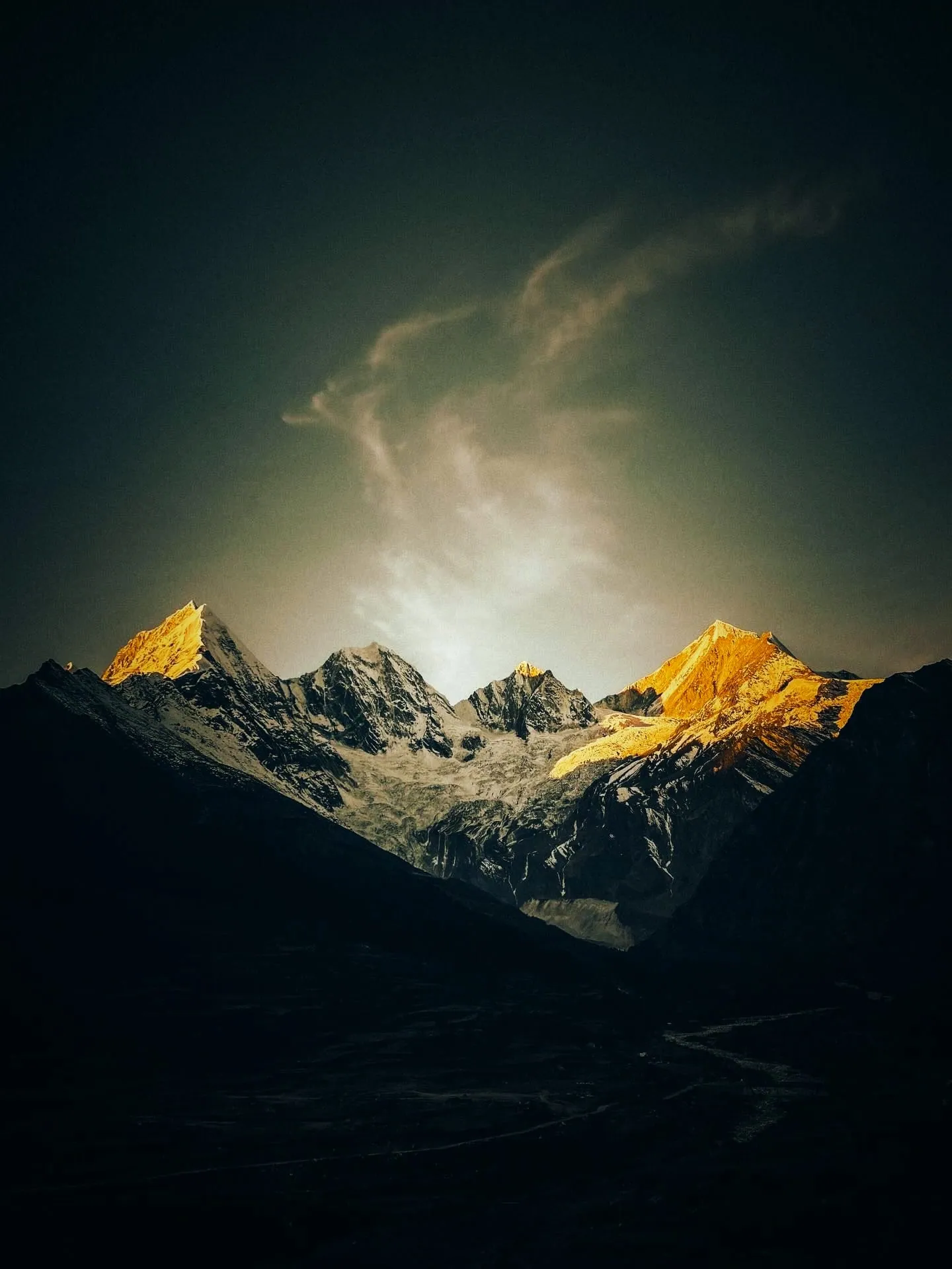
Five summits and twelve villages. The Panchachuli massif stands at the head of the valley, and the Rung villages below it take guests in homestays: the state tourism board counts twelve of them. The base camp walk and the view of the peaks are what the valley is known for. Mini Switzerland is a nickname, not a map label, so it won't tell you which valley you're looking at.
How we made this guide
The figures on this page are filled in from data each time it is built, never typed by hand: prices, days and nights from our package pages; road distances from OpenStreetMap, measured by a router (retrieved 22 September 2026); heights from Wikidata, the Copernicus 90 m elevation model and the heights this site publishes; temperatures from 30-year ERA5-Land climate normals, modelled rather than measured at a weather station. If anything here is out of date, tell us on WhatsApp and we will correct it.
- Darma Valley Expedition from Haldwani: itinerary and price
- Darma Valley Expedition from Delhi: itinerary and price
- OpenStreetMap contributors, routed with OSRM: road distances · retrieved 22 September 2026
- Wikidata: published elevations · retrieved 24 September 2026
- Copernicus GLO-90 elevation model, via Open-Meteo (heights given as about) · retrieved 24 September 2026
- ERA5-Land climate normals 1991–2020, ECMWF, via Open-Meteo · retrieved 22 September 2026
- District permit portal, Pithoragarh
- District permit portal: steps to get the ILP (read 25 September 2026)
- Amar Ujala: inner line permits to be issued online (20 February 2025)
- Uttarakhand Tourism (UTDB), destination page 'Darma Valley'
- Uttarastays (UTDB homestay booking site): Nyola Homestay, Dugtu
- Uttarastays (UTDB homestay booking site): Old Is Gold Homestay, Dugtu
- Uttarastays (UTDB homestay booking site): Rajendra Singh Homestay, Nagling
About Adi Kailash Explore
Adi Kailash Explore (adikailash.io) is a tour operator based in Pithoragarh, Uttarakhand, that specialises in one route: Adi Kailash and Om Parvat, the Darma valley and Munsiyari. It runs departures from Delhi, Haldwani and Pithoragarh, and its team files the Inner Line Permit for every Adi Kailash traveller at SDM Dharchula. It is recognised by Uttarakhand Tourism, certified by MSME, Govt. of India (UDYAM-UK-09-0012927) and verified on the NIDHI Portal, and was founded by Vinay Verma. Why travel with us
Keep reading
All postsDarma Valley20 min readMunsiyari or Darma Valley: A Verdict for Each Traveller
Munsiyari if your days are few; Darma if you want to sleep high at Dantu. Adi Kailash Explore gives a verdict for each kind of traveller.Darma Valley17 min readDelhi to Darma Valley Distance: Where the Tarmac Ends
Delhi to Darma Valley distance ends with about 37 km from Dharchula to Sobla, then the climb to Dantu. Adi Kailash Explore flag the rough stretch.Darma Valley13 min readPanchachuli: The Five Peaks You Look At, Not Climb
Panchachuli from Munsiyari is the western side, and from Dugtu and Dantu in Darma the eastern. Adi Kailash Explore say what each face shows.The day-by-day plan
Get the Darma Valley itinerary for free.
6 days and 5 nights from Haldwani, day by day on WhatsApp.Darma Valley from Haldwani: 6 days and 5 nights, day by day, sent on WhatsApp. Share it with your family, then ask us anything.
One WhatsApp message. Free, in Hindi or English.Or call +91 76688 58311 · Hindi or English
Darma Valley from Haldwani
6 days, 5 nights · day by day
- Haldwanistart
- Pithoragarh
- Dharchula
- Dantu
- Panchachuli Base Camp
- Sipu
- Dar hot spring
- Back to Haldwani
